Trail Mountain bike Guebwiller - Espace VTT - FFC Région de Guebwiller - n°04 - Circuit de Judenhut  - Photo

Espace VTT - FFC Région de Guebwiller - n°04 - Circuit de Judenhut

 tracegps
tracegps

User

© OpenStreetMap contributors
Length
Length
29 km
Max alt
Max alt
973 m
Uphill gradient
Uphill gradient
1113 m
Km-Effort
Km-Effort  
44 km
Min alt
Min alt
361 m
Downhill gradient
Downhill gradient
1109 m
Boucle
Boucle
Yes
Creation date :
2014-12-10 00:00:00.0
Updated on :
2014-12-10 00:00:00.0

(0 Reviews)

Mountain bike
Mountain bike
2h30
Difficulty : Very difficult

Scan this QR Code to open this trail in the SityTrail application

FREE GPS app for hiking

Logo SityTrail SityTrail

IGN / Geographical institutes

Download SityTrail from the App Store Download SityTrail from Google Play

Logo SityTrail SityTrail World

The world is yours!

Download SityTrail from the App Store Download SityTrail from Google Play Download SityTrail on Huawei AppGallery

About

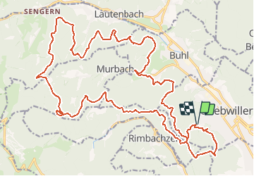
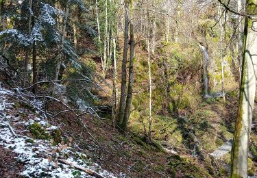
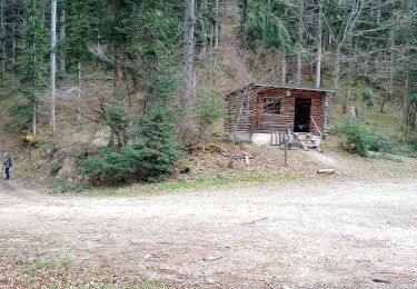
Trail Mountain bike of 29 km to be discovered at Grand Est, Haut-Rhin, Guebwiller. This trail is proposed by tracegps.

Description

Espace VTT - FFC Région de Guebwiller - n°04 - Circuit de Judenhut Circuit officiel labellisé par la Fédération Française de Cyclisme. Magnifique circuit noir, celui-ci vous conduira à proximité de Lautenbach-Zell, au Judenhut (973 m) après avoir admiré le vallon de Murbach depuis le Lieserwasen. Le rocher du Waldeck, l’abri du Munsteraeckerle (lieu-dit appartenant à l’abbaye de Murbach), le col de Peternit et l’oratoire du Bildstoecklé vous attendent au retour. Judenhut, traduction littérale « bonnet de juif », ce qui n’est pas sans rappeler les armoiries de Guebwiller. Selon l’abbé Braun, Judenhut signifie « protection de Wotan » ou mieux encore « chapeau de Wotan » étant donné l’importance que la mythologie confère à ce couvre-chef. L’abri se situant au Judenhut est propriété du Club Vosgien de Guebwiller. Lautenbach-Zell : même si une église Saint-Pierre est citée dès 1257, la commune n’apparaît qu’au XIVème siècle. Tout d’abord constitué d’une petite communauté de paysans, vivant de l’élevage et de la transhumance, un château fort est construit, le Husenbourg, inféodé à la famille Hus, d’où son nom. Vers 1550, Lautenbach-Zell compte une centaine d’habitants. Dépeuplé comme beaucoup de villages lors de la guerre de Trente Ans, le village est reconstruit par des immigrants suisses. Au XIXème siècle, des industries pour le tissage et la filature provoquent une nette croissance de la population atteignant 2073 habitants en 1871. Elle retombera à 1074 en 1921. Topo guide VTT en vente à l’Office du Tourisme de Guebwiller-Soultz et les Pays du Florival - Antenne de Guebwiller - 71 Rue de la République - 68500 – Guebwiller Tel. : 03 89 76 10 63 - Fax :03 89 76 52 72 Crédit photos ; ©Pays d’Art et d’Histoire de la Région de Guebwiller

Elevation profile

Photos

Positioning

Country:
France
Region :
Grand Est
Department/Province :
Haut-Rhin
Municipality :
Guebwiller
Location:
Unknown
Start:(UTM)
365294 ; 5307329 (32T) N.

Trails nearby

Trail Walking Soultz-Haut-Rhin - Rando Marcheurs..04/04_2025 - Photo
Walking
boubou68

Walking

Very difficult
Soultz-Haut-Rhin, Grand Est, Haut-Rhin, France
21 km | 35 km-effort
4h 42min
Yes
Trail Walking Jungholtz - Rando Retrouvailles...01/03/2024.par Jean Marc - Photo
Walking
boubou68

Walking

Very difficult
Jungholtz, Grand Est, Haut-Rhin, France
11.3 km | 19.2 km-effort
1h 35min
Yes
Trail Walking Murbach - La
Walking
boubou68

Walking

Very difficult
Murbach, Grand Est, Haut-Rhin, France
14.7 km | 28 km-effort
4h 3min
Yes
Trail Walking Murbach - Murbach - Photo
Walking
oscar1

Walking

Difficult
Murbach, Grand Est, Haut-Rhin, France
15.4 km | 25 km-effort
4h 25min
Yes
Trail Walking Soultz-Haut-Rhin - Rando avec 0mar et Mouloud..18/02/2023 - Photo
Walking
boubou68

Walking

Very difficult
Soultz-Haut-Rhin, Grand Est, Haut-Rhin, France
12 km | 20 km-effort
3h 9min
Yes
Trail Walking Orschwihr - Boucle pour Soultzmatt - Photo
Walking
GuyVachet

Walking

Medium
Orschwihr, Grand Est, Haut-Rhin, France
12.4 km | 16.5 km-effort
4h 4min
Yes
Trail Walking Soultz-Haut-Rhin - Wuenheim -  Kohlschlag  (18/03/2021) - Photo
Walking
Richard68500

Walking

Medium
Soultz-Haut-Rhin, Grand Est, Haut-Rhin, France
15.9 km | 26 km-effort
4h 8min
Yes
Trail Walking Buhl - Wolfsgrube (4/3/2021) - Photo
Walking
Richard68500

Walking

Medium
Buhl, Grand Est, Haut-Rhin, France
12 km | 19 km-effort
3h 39min
Yes
Trail Walking Guebwiller - Col du Dreibannstein (25/02/2021) - Photo
Walking
Richard68500

Walking

Medium
Guebwiller, Grand Est, Haut-Rhin, France
12 km | 17.5 km-effort
3h 42min
Yes


Close
My subscriptions