Trail Mountain bike Soultzmatt - Espace VTT - FFC Région de Guebwiller - n°10 - Circuit du Strohberg  - Photo

Espace VTT - FFC Région de Guebwiller - n°10 - Circuit du Strohberg

 tracegps
tracegps

User

© OpenStreetMap contributors
Length
Length
46 km
Max alt
Max alt
1154 m
Uphill gradient
Uphill gradient
1702 m
Km-Effort
Km-Effort  
69 km
Min alt
Min alt
412 m
Downhill gradient
Downhill gradient
1707 m
Boucle
Boucle
Yes
Creation date :
2014-12-10 00:00:00.0
Updated on :
2014-12-10 00:00:00.0

(0 Reviews)

Mountain bike
Mountain bike
4h30
Difficulty : Very difficult

Scan this QR Code to open this trail in the SityTrail application

FREE GPS app for hiking

Logo SityTrail SityTrail

IGN / Geographical institutes

Download SityTrail from the App Store Download SityTrail from Google Play

Logo SityTrail SityTrail World

The world is yours!

Download SityTrail from the App Store Download SityTrail from Google Play Download SityTrail on Huawei AppGallery

About

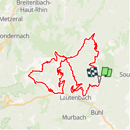
Trail Mountain bike of 46 km to be discovered at Grand Est, Haut-Rhin, Soultzmatt. This trail is proposed by tracegps.

Description

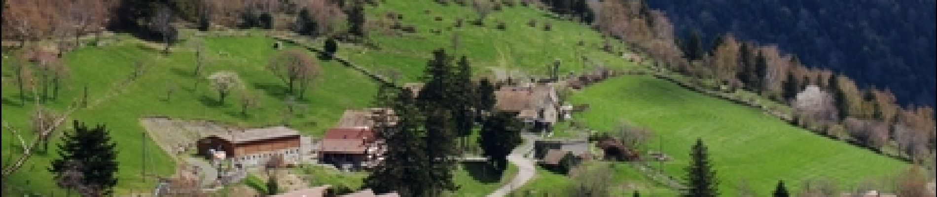
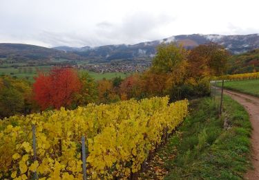
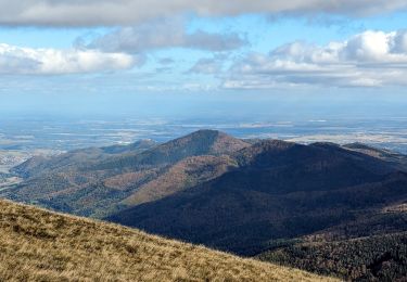
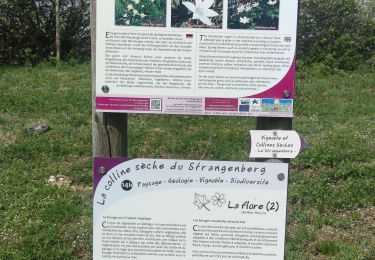
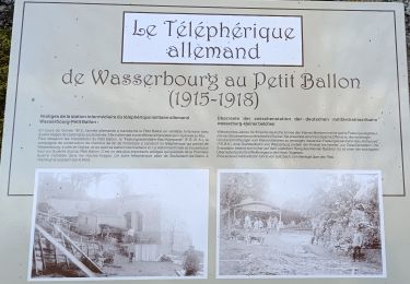
Espace VTT - FFC Région de Guebwiller - n°10 - Circuit du Strohberg Circuit officiel labellisé par la Fédération Française de Cyclisme. Départ : Col de Bannstein. Après l’effort, le réconfort. Après avoir gravi les cols de Bannstein, de Firstplan et de Boenlesgrab, vous pourrez admirer le paysage en vous désaltérant à la ferme auberge du Strohberg. De celle-ci, à travers chaumes et bois, vous arriverez à Linthal, charmant village du fond de vallée, pour remonter au col de Boenlesgrab et rejoindre votre point de départ. Au cœur du Parc Naturel Régional des Ballons des Vosges, Linthal, village montagnard de 589 habitants s’étend entre 420 et 1339 mètres d’altitude dans un vallon étroit, dont la faune et la flore environnantes en font un site au patrimoine naturel exceptionnel, à protéger et à valoriser. Relevant du chapitre de Lautenbach, Linthal est à l’origine une petite communauté de paysans. Après la guerre de Trente Ans, d’importants défrichements dans la montagne sont dus à la reconstruction et à l’immigration suisse. Linthal devient commune indépendante en 1797. L’abondance de l’eau et de forêts font qu’au XIXème siècle, de nombreuses industries s’implantent, entraînant une forte hausse de la population. Celle-ci déclinera au début du XXème siècle, les conditions de vie étant rudes en montagne. Pendant la grande guerre, et notamment au Hilsenfirst en juin 1915, de violents combats se dérouleront et des hameaux seront détruits. Une partie des évacués ne regagnera pas le village et la population déclinera petit à petit pour reprendre son essor plus tard. Topo guide VTT en vente à l’Office du Tourisme de Guebwiller-Soultz et les Pays du Florival - Antenne de Guebwiller - 71 Rue de la République - 68500 – Guebwiller Tel. : 03 89 76 10 63 - Fax :03 89 76 52 72 Crédit photos ; ©Pays d’Art et d’Histoire de la Région de Guebwiller

Elevation profile

Photos

Positioning

Country:
France
Region :
Grand Est
Department/Province :
Haut-Rhin
Municipality :
Soultzmatt
Location:
Unknown
Start:(UTM)
365016 ; 5312768 (32T) N.

Trails nearby

Trail Walking Lautenbach - Tour du Petit Ballon - Photo
Walking
VacheKiri67

Walking

Medium
(1)
Lautenbach, Grand Est, Haut-Rhin, France
12.7 km | 20 km-effort
4h 46min
Yes
Trail Walking Osenbach - Osenbach - Sentier des Sols - Photo
Walking
gscheven

Walking

Easy
(1)
Osenbach, Grand Est, Haut-Rhin, France
4.7 km | 6.6 km-effort
3h 0min
Yes
Trail Walking Rouffach - suuntoapp-Hiking-2023-10-22T08-43-15Z - Photo
Walking
GUIDE
holtzv

Walking

Medium
Rouffach, Grand Est, Haut-Rhin, France
19 km | 33 km-effort
7h 34min
Yes
Trail On foot Wasserbourg - Boenlesgrab - Drei Schöpf - Bannwald - Chalet St Hubert - Brunnemaëttlé - Wassmatt - Hansen et retour - Photo
On foot
patrickbeyrath

On foot

Medium
(1)
Wasserbourg, Grand Est, Haut-Rhin, France
10.2 km | 14.2 km-effort
Unknown
Yes
Trail Walking Wasserbourg - SityTrail - Boenlesgrab- Strohberg - Photo
Walking

Walking

Difficult
(1)
Wasserbourg, Grand Est, Haut-Rhin, France
9.6 km | 15.1 km-effort
3h 0min
Yes
Trail Mountain bike Westhalten - Westhalten - Le tour de la vallée Noble - Photo
Mountain bike
sit68000

Mountain bike

Difficult
(1)
Westhalten, Grand Est, Haut-Rhin, France
24 km | 33 km-effort
2h 30min
Yes
Trail Walking Westhalten - WESTHALTEN ZINKOEPHLE - Photo
Walking
MarcOBRECHT

Walking

Medium
Westhalten, Grand Est, Haut-Rhin, France
10.6 km | 15.3 km-effort
2h 56min
Yes
Trail Walking Rouffach - Boenlesgrab - Ried (14.03.2024) - Photo
Walking
Richard68500

Walking

Medium
Rouffach, Grand Est, Haut-Rhin, France
10.2 km | 15.3 km-effort
3h 28min
Yes
Trail Walking Murbach - La
Walking
boubou68

Walking

Very difficult
Murbach, Grand Est, Haut-Rhin, France
14.7 km | 28 km-effort
4h 3min
Yes


Close
My subscriptions