Trail Other activity Écromagny - Circuit les Epoissets - Photo
 margotte
margotte

User

© OpenStreetMap contributors
Length
Length
7.8 km
Max alt
Max alt
464 m
Uphill gradient
Uphill gradient
148 m
Km-Effort
Km-Effort  
9.9 km
Min alt
Min alt
360 m
Downhill gradient
Downhill gradient
170 m
Boucle
Boucle
No
Creation date :
2019-06-11 14:15:20.276
Updated on :
2020-04-26 15:25:56.928

(0 Reviews)

Other activity
Other activity
--
Difficulty : Unknown

Scan this QR Code to open this trail in the SityTrail application

FREE GPS app for hiking

Logo SityTrail SityTrail

IGN / Geographical institutes

Download SityTrail from the App Store Download SityTrail from Google Play

Logo SityTrail SityTrail World

The world is yours!

Download SityTrail from the App Store Download SityTrail from Google Play Download SityTrail on Huawei AppGallery

About

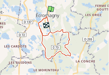
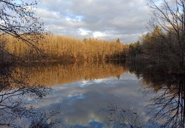
Trail Other activity of 7.8 km to be discovered at Bourgogne-Franche-Comté, Haute-Saône, Écromagny. This trail is proposed by margotte.

Description

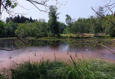
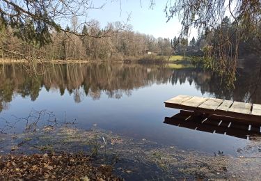
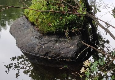
Au cœur du plateau des 1000 Étangs, ce circuit familial vous emmène à la découverte de ces paysages de landes et de tourbières si caractéristique de ce milieu. Au départ du village, observez la tourbière des Viaux, véritable arche de Noé végétale puis, laissez-vous guider par les panneaux d'information disposés sur le parcours.

Elevation profile

Points of interest

Point of interest Écromagny - Point de départ - Photo
margotte
ÉCROMAGNY 
Point of interest Écromagny - Etape n°2 - Photo
margotte
ÉCROMAGNY 
Point of interest Écromagny - Etape n°3 - Photo
margotte
ÉCROMAGNY 
Point of interest Mélisey - Etape n°4 - Photo
margotte
MÉLISEY 
Point of interest Mélisey - Etape n°5 - Photo
margotte
MÉLISEY 
Point of interest Écromagny - Etape n°6 - Photo
margotte
ÉCROMAGNY 

Positioning

Country:
France
Region :
Bourgogne-Franche-Comté
Department/Province :
Haute-Saône
Municipality :
Écromagny
Location:
Unknown
Start:(Dec)
Start:(UTM)
317501 ; 5296205 (32T) N.

Trails nearby

Trail Walking Écromagny - Milles Étangs 18.06.2020 - Photo
Walking
klopbill

Walking

Medium
(2)
Écromagny, Bourgogne-Franche-Comté, Haute-Saône, France
18.7 km | 23 km-effort
6h 26min
Yes
Trail Walking Faucogney-et-la-Mer - 08-02-20 La mer, étang de Pierre Plate et retour. - Photo
Walking
annefrance70

Walking

Very easy
(1)
Faucogney-et-la-Mer, Bourgogne-Franche-Comté, Haute-Saône, France
9.9 km | 12.3 km-effort
2h 4min
Yes
Trail Mountain bike Mélisey - 1000 2tangs 54km 935ml - Photo
Mountain bike
qlqin

Mountain bike

Difficult
(1)
Mélisey, Bourgogne-Franche-Comté, Haute-Saône, France
53 km | 68 km-effort
4h 20min
Yes
Trail Walking Écromagny - Étang de plate pierre - Photo
Walking
Sugg

Walking

Medium
Écromagny, Bourgogne-Franche-Comté, Haute-Saône, France
9.2 km | 11.3 km-effort
3h 59min
Yes
Trail Walking Écromagny - Ecromagny Rando réelle  - Photo
Walking
Sugg

Walking

Medium
Écromagny, Bourgogne-Franche-Comté, Haute-Saône, France
7.6 km | 9.5 km-effort
4h 17min
Yes
Trail Walking Belmont - 4-03-22 circuit du bois des hauts, Belmont - Photo
Walking
annefrance70

Walking

Easy
Belmont, Bourgogne-Franche-Comté, Haute-Saône, France
11.9 km | 14.8 km-effort
2h 48min
Yes
Trail Walking Mélisey - melissey - Photo
Walking
tessy74

Walking

Medium
Mélisey, Bourgogne-Franche-Comté, Haute-Saône, France
9.4 km | 11.7 km-effort
3h 52min
Yes
Trail Walking Faucogney-et-la-Mer - la mzr - Photo
Walking
tessy74

Walking

Very difficult
Faucogney-et-la-Mer, Bourgogne-Franche-Comté, Haute-Saône, France
18.7 km | 24 km-effort
6h 17min
Yes
Trail Walking Faucogney-et-la-Mer - 23-02-22 marche Oroz, étangs...  - Photo
Walking
annefrance70

Walking

Medium
Faucogney-et-la-Mer, Bourgogne-Franche-Comté, Haute-Saône, France
11.9 km | 15.6 km-effort
2h 49min
Yes


Close
My subscriptions