


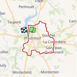

21 km | 25 km-effort


User


FREE GPS app for hiking
 SityTrail
IGN / Geographical institutes
SityTrail World
The world is yours!
Trail Mountain bike of 22 km to be discovered at Brittany, Morbihan, Ploërmel. This trail is proposed by tracegps.
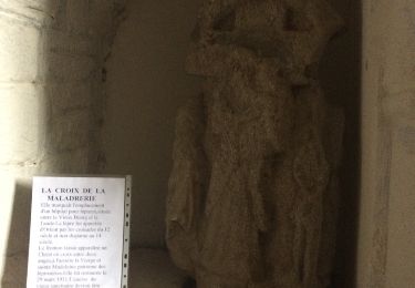
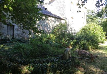
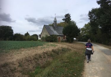
A voir en chemin: 1. Le clos Hazel (propriété privée du 16ème siècle) : le manoir conserve de larges vestiges du 16ème siècle. Portes et fenêtres aux ornements et écussons sculptés rappellent la grandeur des seigneurs des lieux. 2. La chapelle Saint Maur : restaurée en 1924, la chapelle conserve quelques vestiges du 14ème siècle, en particulier son bénitier de granit qui se trouve auprès de la porte sud, classée monument historique 3. Gourhel : comme en témoigne son nom celtique, l’origine de la commune est très lointaine. Jusqu’en 1789, elle est rattachée à Loyat avant de devenir une paroisse indépendante. L’église tombée en ruine est démolie en 1902. A défaut d’édifice religieux, Gourhel possède un ancien calvaire (16ème siècle) doté de personnages 4. Bezon : le moulin de Bezon (meunerie mixte : eau et électricité) est aujourd’hui encore producteur de farines. Un peu plus loin vous trouverez les croix Guyot qui s’élèvent curieusement l’une contre l’autre. Contact: Office de tourisme de Ploërmel « Terres de légendes » - 02 97 74 02 70 Email: accueil(at)tourisme-ploermel.com
Walking
Walking
Walking
Other activity

Nordic walking
Walking

Nordic walking