Trail Walking Annoisin-Chatelans - De Chatelans à Larina - Photo
 tracegps
tracegps

User

© OpenStreetMap contributors
Length
Length
6.9 km
Max alt
Max alt
420 m
Uphill gradient
Uphill gradient
214 m
Km-Effort
Km-Effort  
9.8 km
Min alt
Min alt
317 m
Downhill gradient
Downhill gradient
213 m
Boucle
Boucle
Yes
Creation date :
2014-12-10 00:00:00.0
Updated on :
2014-12-10 00:00:00.0

(0 Reviews)

Walking
Walking
2h00
Difficulty : Medium

Scan this QR Code to open this trail in the SityTrail application

FREE GPS app for hiking

Logo SityTrail SityTrail

IGN / Geographical institutes

Download SityTrail from the App Store Download SityTrail from Google Play

Logo SityTrail SityTrail World

The world is yours!

Download SityTrail from the App Store Download SityTrail from Google Play Download SityTrail on Huawei AppGallery

About

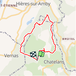
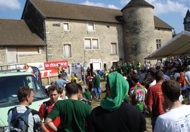
Trail Walking of 6.9 km to be discovered at Auvergne-Rhône-Alpes, Isère, Annoisin-Chatelans. This trail is proposed by tracegps.

Description

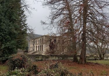
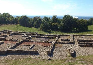
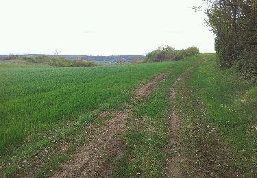
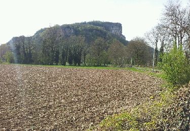
Chatelans dans le Nord Isère. Belle balade en boucle facile d'une durée de 2h environ. Beaucoup de sous bois donc super par grosse chaleur. Possibilité de s'arrêter pour visiter les ruines de Larinas, village du 5eme siècle. Beau panorama sur le Rhône avec la centrale du Bugey au premier plan... mais bon c'est sympa quand même. Bonne randonnée !

Elevation profile

Photos

Positioning

Country:
France
Region :
Auvergne-Rhône-Alpes
Department/Province :
Isère
Municipality :
Annoisin-Chatelans
Location:
Unknown
Start:(UTM)
678527 ; 5071532 (31T) N.

Trails nearby

Trail Walking Siccieu-Saint-Julien-et-Carisieu - Etang-de-Ry Siccieu 10km 245m - Photo
Walking
pzvictor

Walking

Easy
(1)
Siccieu-Saint-Julien-et-Carisieu, Auvergne-Rhône-Alpes, Isère, France
9.8 km | 13.1 km-effort
3h 0min
Yes
Trail Walking Charette - Cascade de la Roche - Photo
Walking
Marchopier

Walking

Easy
Charette, Auvergne-Rhône-Alpes, Isère, France
9 km | 10.4 km-effort
2h 8min
Yes
Trail Walking Saint-Baudille-de-la-Tour - Et Baudille de la tour - Photo
Walking
jpbo

Walking

Easy
Saint-Baudille-de-la-Tour, Auvergne-Rhône-Alpes, Isère, France
12 km | 14 km-effort
3h 11min
Yes
Trail Walking Hières-sur-Amby - Hieres sur Amby - Photo
Walking
elcanario

Walking

Medium
(1)
Hières-sur-Amby, Auvergne-Rhône-Alpes, Isère, France
14.4 km | 19.5 km-effort
4h 27min
Yes
Trail Mountain bike Hières-sur-Amby - hyeres sur amby optevoz  - Photo
Mountain bike
marc6262

Mountain bike

Medium
Hières-sur-Amby, Auvergne-Rhône-Alpes, Isère, France
19.4 km | 25 km-effort
2h 26min
Yes
Trail Mountain bike La Balme-les-Grottes - Joli tour cascade de la roche - Photo
Mountain bike
marc6262

Mountain bike

Medium
La Balme-les-Grottes, Auvergne-Rhône-Alpes, Isère, France
23 km | 28 km-effort
1h 59min
Yes
Trail Walking Charette - La Craz St Baudille - Photo
Walking
Marchopier

Walking

Easy
Charette, Auvergne-Rhône-Alpes, Isère, France
9 km | 11.5 km-effort
2h 39min
Yes
Trail Walking Optevoz - rando cascade de la roche - Photo
Walking
tyax93

Walking

Easy
Optevoz, Auvergne-Rhône-Alpes, Isère, France
16.2 km | 19.2 km-effort
4h 36min
Yes
Trail Mountain bike Saint-Baudille-de-la-Tour - Rando VTT Nord Isère 45 km - Photo
Mountain bike
tracegps

Mountain bike

Very difficult
Saint-Baudille-de-la-Tour, Auvergne-Rhône-Alpes, Isère, France
46 km | 60 km-effort
3h 30min
Yes


Close
My subscriptions