Trail Mountain bike Quimper - Le Corniguel - Quimper - Photo

Le Corniguel - Quimper

 tracegps
tracegps

User

© OpenStreetMap contributors
Length
Length
15 km
Max alt
Max alt
37 m
Uphill gradient
Uphill gradient
196 m
Km-Effort
Km-Effort  
17.6 km
Min alt
Min alt
-2 m
Downhill gradient
Downhill gradient
197 m
Boucle
Boucle
Yes
Creation date :
2014-12-10 00:00:00.0
Updated on :
2014-12-10 00:00:00.0

(0 Reviews)

Mountain bike
Mountain bike
1h00
Difficulty : Medium

Scan this QR Code to open this trail in the SityTrail application

FREE GPS app for hiking

Logo SityTrail SityTrail

IGN / Geographical institutes

Download SityTrail from the App Store Download SityTrail from Google Play

Logo SityTrail SityTrail World

The world is yours!

Download SityTrail from the App Store Download SityTrail from Google Play Download SityTrail on Huawei AppGallery

About

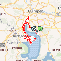
Trail Mountain bike of 15 km to be discovered at Brittany, Finistère, Quimper. This trail is proposed by tracegps.

Description

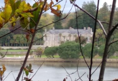
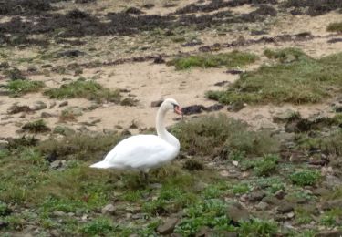
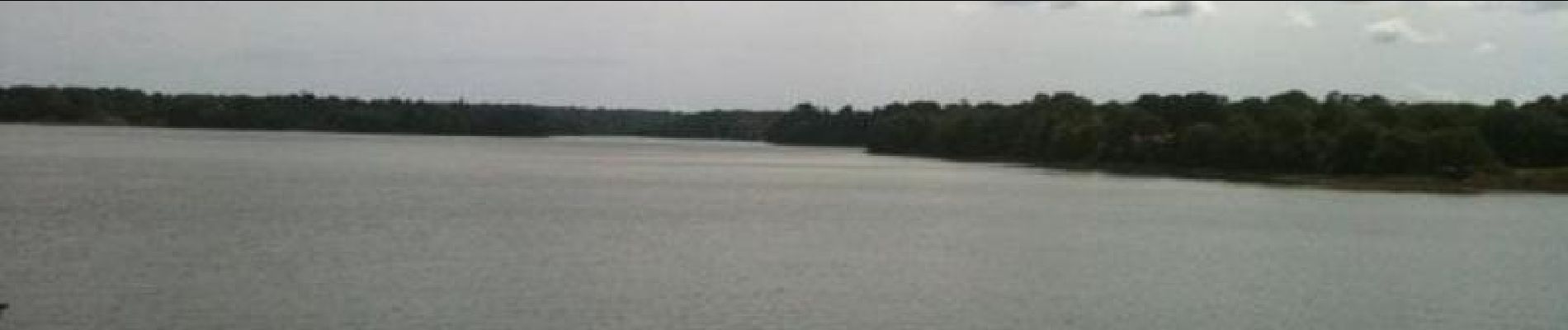
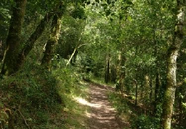
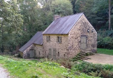
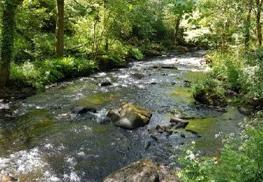
C’est un parcours très facile pour toute la famille. En cheminant sur ces rives, Il vous permettra de commencer à découvrir la partie la plus large de la rivière Odet. Vous partez vers le Château de Lanniron, passez sur le pont de Poulguinan, empruntez les petites routes parallèles en contrebas du chemin de halage, pour vous retrouver sur les rives de l’Odet, que vous suivez jusqu’au Port du Corniguel. Un petit bois, un passage technique et vous retrouvez le halage jusqu'au Pont du Cap Horn, l’ancien quartier de Locmaria et les faïenceries Henriot. Vous rentrez à nouveau par Lanniron vers la zone de loisirs de Creac’h Gwen.

Elevation profile

Photos

Positioning

Country:
France
Region :
Brittany
Department/Province :
Finistère
Municipality :
Quimper
Location:
Unknown
Start:(UTM)
417910 ; 5313968 (30T) N.

Trails nearby

Trail Walking Quimper - vallée du stangala - Photo
Walking
hervef13300

Walking

Easy
(1)
Quimper, Brittany, Finistère, France
10.8 km | 13.3 km-effort
3h 33min
No
Trail Walking Plomelin - Rando Bretagne 2022 - J7 - Plomelin - Photo
Walking
RonanDAGORN

Walking

Medium
(1)
Plomelin, Brittany, Finistère, France
20 km | 24 km-effort
5h 26min
Yes
Trail Walking Quimper - TREK RCY GR34 2022 Quimper en touristes - Photo
Walking
chessyca

Walking

Easy
Quimper, Brittany, Finistère, France
4.4 km | 4.8 km-effort
49min
Yes
Trail Walking Plomelin - PLOMELIN  - Photo
Walking
RonanDAGORN

Walking

Medium
Plomelin, Brittany, Finistère, France
25 km | 30 km-effort
6h 41min
Yes
Trail Walking Quimper - QUIMPER  - Photo
Walking
RonanDAGORN

Walking

Medium
Quimper, Brittany, Finistère, France
23 km | 29 km-effort
6h 6min
Yes
Trail Walking Quimper - Stangala - Photo
Walking
Brusa

Walking

Easy
Quimper, Brittany, Finistère, France
9.5 km | 11.8 km-effort
2h 43min
Yes
Trail Walking Quimper - kercavadec - Photo
Walking
siboutchou

Walking

Very easy
Quimper, Brittany, Finistère, France
5.4 km | 6.8 km-effort
Unknown
Yes
Trail Walking Quimper - Quimper - Photo
Walking
RonanDAGORN

Walking

Very easy
Quimper, Brittany, Finistère, France
5.1 km | 6.1 km-effort
1h 24min
Yes
Trail Walking Quimper - QUIMPER - Photo
Walking
RonanDAGORN

Walking

Easy
Quimper, Brittany, Finistère, France
11.6 km | 14.2 km-effort
2h 38min
Yes


Close
My subscriptions