


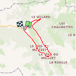

13.4 km | 26 km-effort

User


FREE GPS app for hiking
 SityTrail
IGN / Geographical institutes
SityTrail World
The world is yours!
Trail Mountain bike of 11.2 km to be discovered at Provence-Alpes-Côte d'Azur, Hautes-Alpes, Ceillac. This trail is proposed by tracegps.
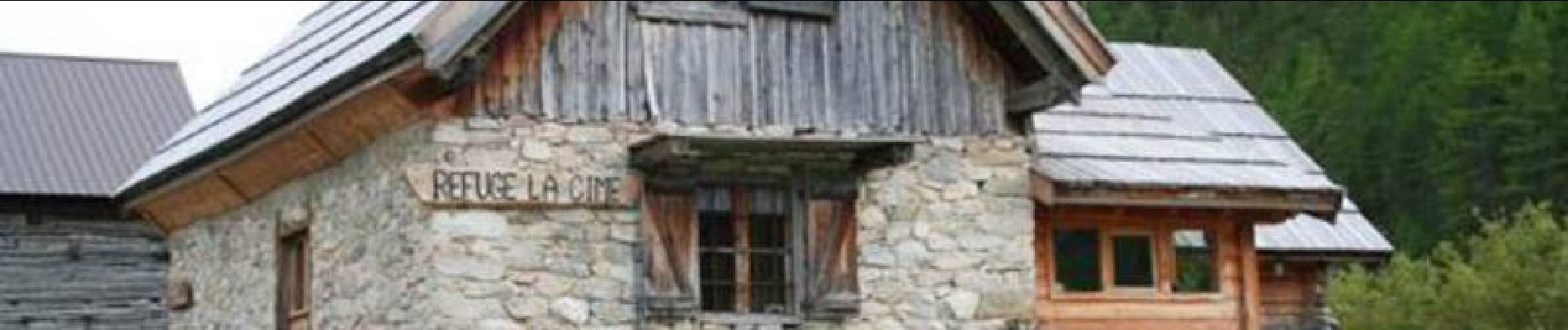
Site VTT FFC Queyras - Circuit n° 13 - Le Bois de Jalavez. Circuit officiel labellisé par la Fédération Française de Cyclisme. Un circuit familial sur piste forestière. Un itinéraire en montée régulière qui domine le village et offre une magnifique vue sur la cascade de la pisse. On rejoint alors, le refuge de la cime par une descente tout terrain. On revient ensuite en contre bas en alternant piste et sentier, légèrement descendant avec un passage sur gravats (descente du vélo recommandée). *L’Office de tourisme du Queyras décline toute responsabilité en cas de modification des tracés sur le terrain et en cas d’aléas dus à des conditions naturelles imprévisibles. Pour les itinéraires non décrits sur ce document, se reporter au topo guides existants et aux cartes du secteur. Office de tourisme du Queyras 05470 Aiguilles tél 33 (0) 4 92 46 76 18 - info(at)queyras-montagne.com


Walking

Walking
Walking

Walking

Walking

Walking
Walking
Walking
Walking