


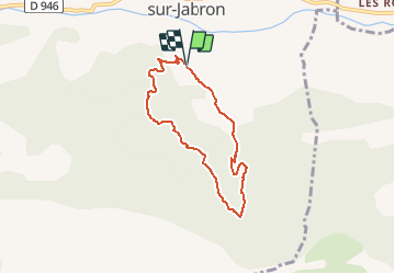

16 km | 24 km-effort


User


FREE GPS app for hiking
 SityTrail
IGN / Geographical institutes
SityTrail World
The world is yours!
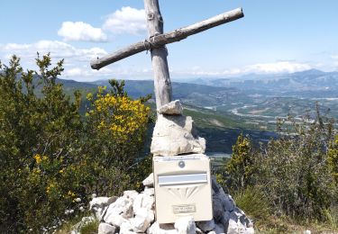
Trail Running of 6.3 km to be discovered at Provence-Alpes-Côte d'Azur, Alpes-de-Haute-Provence, Noyers-sur-Jabron. This trail is proposed by tracegps.
Départ du bassin en dessus de l'Allégrance. Prendre le PR (jaune) direction Le Pas de Porte. A la jonction avec la piste forestière suivre cette dernière (plus facile que le PR) jusqu'au sommet. Reprendre le PR jusqu'à une fourche où à gauche part le PR et à droite un chemin descend. Prendre ce chemin; le suivre jusqu'au 2ème embranchement à droite. Prendre ce sentier qui redescend sur Périvoye.
On foot

Walking
Walking
Walking

Walking
Walking
Walking

Walking
Walking