Trail Walking Trouville-la-Haule - Randonnée à Trouville la Haule - Photo

Randonnée à Trouville la Haule

 tracegps
tracegps

User

© OpenStreetMap contributors
Length
Length
14.6 km
Max alt
Max alt
132 m
Uphill gradient
Uphill gradient
295 m
Km-Effort
Km-Effort  
18.6 km
Min alt
Min alt
7 m
Downhill gradient
Downhill gradient
294 m
Boucle
Boucle
Yes
Creation date :
2014-12-10 00:00:00.0
Updated on :
2014-12-10 00:00:00.0

(1 Reviews)

Walking
Walking
3h19
Difficulty : Medium

Scan this QR Code to open this trail in the SityTrail application

FREE GPS app for hiking

Logo SityTrail SityTrail

IGN / Geographical institutes

Download SityTrail from the App Store Download SityTrail from Google Play

Logo SityTrail SityTrail World

The world is yours!

Download SityTrail from the App Store Download SityTrail from Google Play Download SityTrail on Huawei AppGallery

About

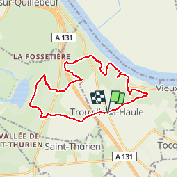
Trail Walking of 14.6 km to be discovered at Normandy, Eure, Trouville-la-Haule. This trail is proposed by tracegps.

Description

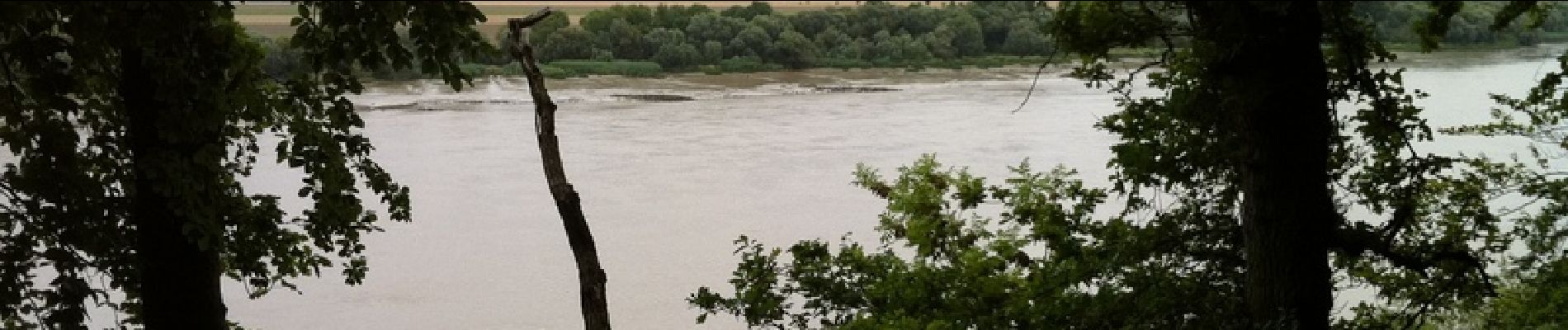
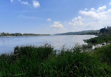
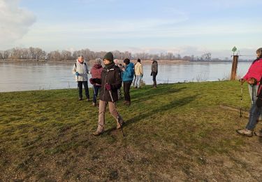
Une promenade nous conduit dans le bois de Vieux-Port le long du GR23 en bord de Seine, puis le long de la réserve Cynégétique de St Opportune-la-Mare. C'est à St Opportune que l'on peut visiter la Maison de la Pomme et le musée de la Forge. Toutes les photos sur baladesennormandie.fr.

Elevation profile

Photos

Positioning

Country:
France
Region :
Normandy
Department/Province :
Eure
Municipality :
Trouville-la-Haule
Location:
Unknown
Start:(UTM)
324009 ; 5476774 (31U) N.

Comments

Please log in to post a review or rate the element


parcours intéressant mais très sportif


Trails nearby

Trail On foot Sainte-Opportune-la-Mare - Chemin pédestre de l'Allée des Granges - Photo
On foot
PRO

On foot

Easy
Sainte-Opportune-la-Mare, Normandy, Eure, France
6.4 km | 8.1 km-effort
1h 49min
Yes
Trail Walking Aizier - Aizier vers Vieux Port (100) - Photo
Walking
randovivi

Walking

Easy
(2)
Aizier, Normandy, Eure, France
12.2 km | 14.9 km-effort
3h 15min
Yes
Trail Walking Aizier - Chemin des sources bleues - Photo
Walking
Fky78

Walking

Medium
Aizier, Normandy, Eure, France
7.3 km | 9.6 km-effort
2h 11min
Yes
Trail Walking Aizier - Vieux-Port, de la forêt aux rives de la Seine - Photo
Walking
jeannine grandjean

Walking

Medium
Aizier, Normandy, Eure, France
4.8 km | 6.5 km-effort
1h 37min
Yes
Trail Walking Trouville-la-Haule - Trouville la Haule . Chemin du Courval - Photo
Walking
MichelRando7656

Walking

Difficult
Trouville-la-Haule, Normandy, Eure, France
11.8 km | 14.5 km-effort
3h 3min
Yes
Trail Walking Bourneville-Sainte-Croix - Bourneville-sainte-Croix- Le petit Brotonne  - Photo
Walking
MichelRando7656

Walking

Difficult
Bourneville-Sainte-Croix, Normandy, Eure, France
14.1 km | 16.2 km-effort
3h 23min
Yes
Trail Walking Le Perrey - chemin des Têtards - Photo
Walking
dominiquelouis

Walking

Medium
Le Perrey, Normandy, Eure, France
7.8 km | 9.2 km-effort
2h 21min
Yes
Trail Walking Aizier - brotonne 2 - Photo
Walking
darnanville

Walking

Very easy
(3)
Aizier, Normandy, Eure, France
14.3 km | 18.8 km-effort
4h 2min
Yes
Trail Walking Bourneville-Sainte-Croix - les sources bleues - Photo
Walking
serisier

Walking

Very easy
(1)
Bourneville-Sainte-Croix, Normandy, Eure, France
6.3 km | 8.4 km-effort
1h 45min
Yes


Close
My subscriptions