Trail Mountain bike Mérens-les-Vals - Chemin des Bonhommes - Merens Porta - Photo

Chemin des Bonhommes - Merens Porta

 tracegps
tracegps

User

© OpenStreetMap contributors
Length
Length
22 km
Max alt
Max alt
2053 m
Uphill gradient
Uphill gradient
1029 m
Km-Effort
Km-Effort  
34 km
Min alt
Min alt
1082 m
Downhill gradient
Downhill gradient
595 m
Boucle
Boucle
No
Creation date :
2014-12-10 00:00:00.0
Updated on :
2014-12-10 00:00:00.0

(0 Reviews)

Mountain bike
Mountain bike
3h30
Difficulty : Very difficult

Scan this QR Code to open this trail in the SityTrail application

FREE GPS app for hiking

Logo SityTrail SityTrail

IGN / Geographical institutes

Download SityTrail from the App Store Download SityTrail from Google Play

Logo SityTrail SityTrail World

The world is yours!

Download SityTrail from the App Store Download SityTrail from Google Play Download SityTrail on Huawei AppGallery

About

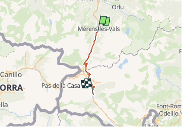
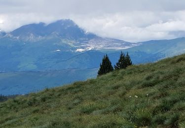
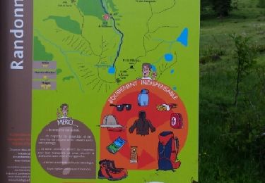
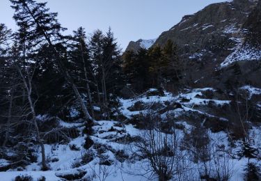
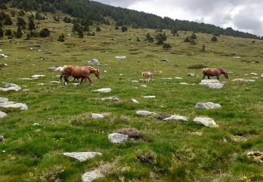
Trail Mountain bike of 22 km to be discovered at Occitania, Ariège, Mérens-les-Vals. This trail is proposed by tracegps.

Description

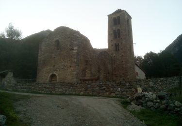
Cinquième étape du Chemin des Bonhommes. Réalisée par le Bureau des Guides Équestres Transpyrénéens, cette trace fait partie des Sentiers Transfrontaliers Pyrénéens.

Elevation profile

Photos

Positioning

Country:
France
Region :
Occitania
Department/Province :
Ariège
Municipality :
Mérens-les-Vals
Location:
Unknown
Start:(UTM)
404440 ; 4722768 (31T) N.

Trails nearby

Trail Walking Orgeix - aiguelongue - Photo
Walking
c.chehere

Walking

Easy
(1)
Orgeix, Occitania, Ariège, France
9 km | 17.9 km-effort
3h 37min
Yes
Trail Walking Mérens-les-Vals - Etang de Comte - Merens les Vals - Photo
Walking
tracegps

Walking

Medium
(1)
Mérens-les-Vals, Occitania, Ariège, France
6.8 km | 10.7 km-effort
2h 15min
Yes
Trail Walking Mérens-les-Vals - Pic de canals en boucle - Photo
Walking
chrisgps

Walking

Medium
Mérens-les-Vals, Occitania, Ariège, France
10.7 km | 23 km-effort
6h 20min
Yes
Trail Walking Mérens-les-Vals - Pic de Canals - Photo
Walking
c.chehere

Walking

Difficult
Mérens-les-Vals, Occitania, Ariège, France
16.7 km | 31 km-effort
8h 27min
Yes
Trail Walking Orgeix - Pic de l'homme  par les crêtes - Photo
Walking
j2c11

Walking

Difficult
Orgeix, Occitania, Ariège, France
11.5 km | 27 km-effort
5h 12min
Yes
Trail Walking Mérens-les-Vals - le lac Couart - Photo
Walking
MarieFrancoise

Walking

Difficult
Mérens-les-Vals, Occitania, Ariège, France
15 km | 26 km-effort
7h 33min
Yes
Trail Walking Orgeix - Lac d ' Aiguelongue - Photo
Walking
MarieFrancoise

Walking

Medium
Orgeix, Occitania, Ariège, France
9.2 km | 18.1 km-effort
4h 10min
Yes
Trail Walking Mérens-les-Vals - cécé Gégé lac de comte - Photo
Walking
pedromartin

Walking

Very difficult
Mérens-les-Vals, Occitania, Ariège, France
13.3 km | 23 km-effort
6h 24min
Yes
Trail Walking Mérens-les-Vals - Mèrens les Vals Haut Porta GR 107 Le chemin Des Bonshommes - Photo
Walking
tercla

Walking

Very difficult
Mérens-les-Vals, Occitania, Ariège, France
22 km | 35 km-effort
5h 59min
No


Close
My subscriptions