Trail Walking Saint-Simon - Le point Y - Photo
 tracegps
tracegps

User

© OpenStreetMap contributors
Length
Length
6 km
Max alt
Max alt
70 m
Uphill gradient
Uphill gradient
29 m
Km-Effort
Km-Effort  
6.4 km
Min alt
Min alt
60 m
Downhill gradient
Downhill gradient
28 m
Boucle
Boucle
Yes
Creation date :
2014-12-10 00:00:00.0
Updated on :
2014-12-10 00:00:00.0

(0 Reviews)

Walking
Walking
1h45
Difficulty : Easy

Scan this QR Code to open this trail in the SityTrail application

FREE GPS app for hiking

Logo SityTrail SityTrail

IGN / Geographical institutes

Download SityTrail from the App Store Download SityTrail from Google Play

Logo SityTrail SityTrail World

The world is yours!

Download SityTrail from the App Store Download SityTrail from Google Play Download SityTrail on Huawei AppGallery

About

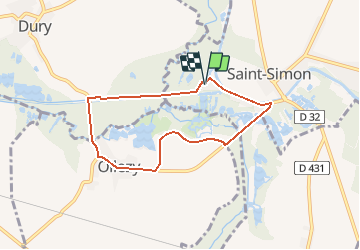
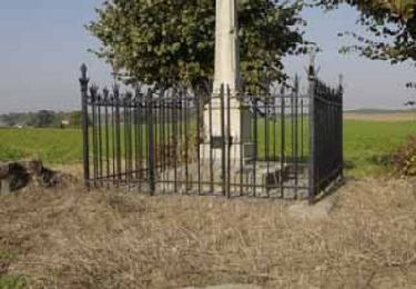
Trail Walking of 6 km to be discovered at Hauts-de-France, Aisne, Saint-Simon. This trail is proposed by tracegps.

Description

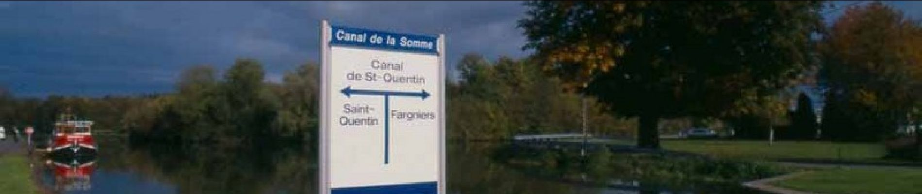
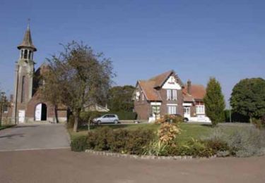
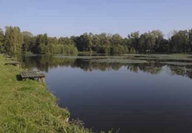
Marais bordés de peupleraies, étangs et canaux, fleuve de la Somme et son petit affluent la Sommette : l'eau accompagne sous de multiples formes cette promenade très facile (pas de dénivelée) et agréable, au départ de l'écluse de Saint-Simon. La vingt-cinquième lettre de l'alphabet désigne mystérieusement la jonction triangulaire du canal de Saint-Quentin et de celui latéral à la Somme. Toutes les infos sont ICI

Elevation profile

Photos

Positioning

Country:
France
Region :
Hauts-de-France
Department/Province :
Aisne
Municipality :
Saint-Simon
Location:
Unknown
Start:(UTM)
511541 ; 5510101 (31U) N.

Trails nearby

Trail Walking Saint-Simon - Le point y - Photo
Walking

Walking

Very easy
Saint-Simon, Hauts-de-France, Aisne, France
6 km | 6.4 km-effort
Unknown
Yes
Trail Walking Seraucourt-le-Grand - Fontaine - Photo
Walking
tracegps

Walking

Medium
Seraucourt-le-Grand, Hauts-de-France, Aisne, France
9.1 km | 9.9 km-effort
2h 30min
Yes
Trail Walking Annois - Les peupleraies du val de Somme - Photo
Walking
tracegps

Walking

Very difficult
Annois, Hauts-de-France, Aisne, France
17.1 km | 18.4 km-effort
4h 30min
Yes
Trail Walking Tugny-et-Pont - La-pierre-à-Bénie - Photo
Walking
tracegps

Walking

Very difficult
Tugny-et-Pont, Hauts-de-France, Aisne, France
13.6 km | 14.8 km-effort
3h 45min
Yes
Trail Walking Cugny - cugny - Photo
Walking
José800

Walking

Easy
Cugny, Hauts-de-France, Aisne, France
10.5 km | 12 km-effort
2h 22min
Yes
Trail Walking Artemps - Artemps 02  - Photo
Walking
José800

Walking

Medium
Artemps, Hauts-de-France, Aisne, France
8.8 km | 9.7 km-effort
2h 13min
Yes
Trail Walking Seraucourt-le-Grand - Saurancourt le grand vendeuil - Photo
Walking
MERMOZ33

Walking

Easy
Seraucourt-le-Grand, Hauts-de-France, Aisne, France
18.5 km | 21 km-effort
4h 25min
No


Close
My subscriptions