


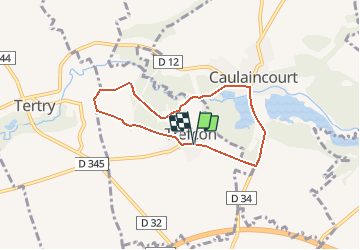

5.7 km | 6.4 km-effort


User


FREE GPS app for hiking
 SityTrail
IGN / Geographical institutes
SityTrail World
The world is yours!
Trail Walking of 5.7 km to be discovered at Hauts-de-France, Aisne, Trefcon. This trail is proposed by tracegps.
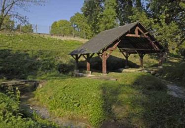
L'Omignon musarde entre Trefcon et Caulaincourt, avec son cortège d'étangs et de bois. Après les ruines de l'église Saint-Martin-des-Prés (voir les pierres tombales dans le cimetière), ce circuit tranquille et ombragé rejoint l'étang de Caulaincourt. Toutes les infos sont ICI


Walking

Walking

Mountain bike

Walking
Walking

Walking

Walking