Trail Walking Neuville-sur-Ailette - Le tour du Lac de l'Ailette - Photo

Le tour du Lac de l'Ailette

 tracegps
tracegps

User

© OpenStreetMap contributors
Length
Length
9.2 km
Max alt
Max alt
139 m
Uphill gradient
Uphill gradient
139 m
Km-Effort
Km-Effort  
11.1 km
Min alt
Min alt
79 m
Downhill gradient
Downhill gradient
143 m
Boucle
Boucle
Yes
Creation date :
2014-12-10 00:00:00.0
Updated on :
2014-12-10 00:00:00.0

(1 Reviews)

Walking
Walking
2h45
Difficulty : Very difficult

Scan this QR Code to open this trail in the SityTrail application

FREE GPS app for hiking

Logo SityTrail SityTrail

IGN / Geographical institutes

Download SityTrail from the App Store Download SityTrail from Google Play

Logo SityTrail SityTrail World

The world is yours!

Download SityTrail from the App Store Download SityTrail from Google Play Download SityTrail on Huawei AppGallery

About

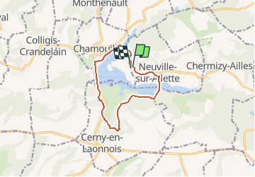
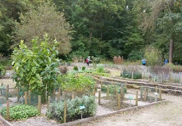
Trail Walking of 9.2 km to be discovered at Hauts-de-France, Aisne, Neuville-sur-Ailette. This trail is proposed by tracegps.

Description

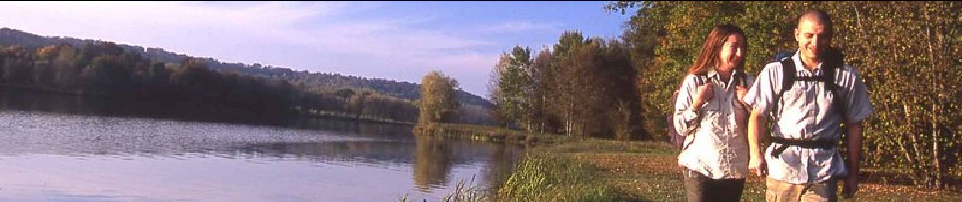
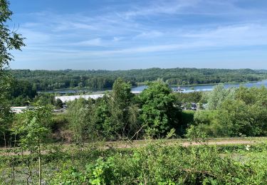
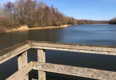
Le circuit évolue entre le Chemin des Dames et le plan d'eau de l'Ailette. Le plaisir que procure ce lac tient à la diversité de ses berges : aménagées en plage, ou herbeuses et ombragées pour un pique-nique… De partout, cette étendue apaise par la sérénité qu'elle dégage. Toutes les infos sont ICI

Elevation profile

Photos

Positioning

Country:
France
Region :
Hauts-de-France
Department/Province :
Aisne
Municipality :
Neuville-sur-Ailette
Location:
Unknown
Start:(UTM)
549528 ; 5479699 (31U) N.

Comments

Please log in to post a review or rate the element


Belle rando ensoleillée


Trails nearby

Trail Walking Bouconville-Vauclair - Saint-Victor - Photo
Walking
tracegps

Walking

Very difficult
(1)
Bouconville-Vauclair, Hauts-de-France, Aisne, France
10.8 km | 13.4 km-effort
3h 0min
Yes
Trail Walking Ployart-et-Vaurseine - autour de Vaurseine - Photo
Walking
alainwald

Walking

Very easy
Ployart-et-Vaurseine, Hauts-de-France, Aisne, France
7.7 km | 9.2 km-effort
1h 50min
Yes
Trail Walking Chamouille - Le monument d’Aille - Photo
Walking
gaudea

Walking

Difficult
Chamouille, Hauts-de-France, Aisne, France
18.3 km | 0 m-effort
4h 57min
Yes
Trail Walking Neuville-sur-Ailette - Le tour du lac de l'Ailette - Photo
Walking

Walking

Very easy
Neuville-sur-Ailette, Hauts-de-France, Aisne, France
9.2 km | 11.1 km-effort
Unknown
Yes
Trail Walking Bouconville-Vauclair - émouvant Chemin des Dames - Photo
Walking
Marc Launay

Walking

Difficult
Bouconville-Vauclair, Hauts-de-France, Aisne, France
14.4 km | 17.7 km-effort
5h 29min
Yes
Trail Walking Neuville-sur-Ailette - Tour de l’Ailette - Photo
Walking
ggguerin

Walking

(1)
Neuville-sur-Ailette, Hauts-de-France, Aisne, France
9.5 km | 11.3 km-effort
2h 7min
No
Trail Nordic walking Chamouille - Chamouille à abbaye de Vauclaire - Photo
Nordic walking
pierre_mack

Nordic walking

Easy
Chamouille, Hauts-de-France, Aisne, France
15 km | 17.3 km-effort
3h 5min
No
Trail Mountain bike Chamouille - Chamouille - Voie Verte de l'Ailette - Photo
Mountain bike
tracegps

Mountain bike

Easy
Chamouille, Hauts-de-France, Aisne, France
5.6 km | 6.2 km-effort
30min
No
Trail Walking Chamouille - Chamouille - Voie Verte de l'Ailette - Photo
Walking
tracegps

Walking

Easy
Chamouille, Hauts-de-France, Aisne, France
5.6 km | 6.2 km-effort
1h 30min
No


Close
My subscriptions