Trail Walking Pernant - Le roc de Pernant - Photo

Le roc de Pernant

 tracegps
tracegps

User

© OpenStreetMap contributors
Length
Length
7.2 km
Max alt
Max alt
136 m
Uphill gradient
Uphill gradient
189 m
Km-Effort
Km-Effort  
9.7 km
Min alt
Min alt
53 m
Downhill gradient
Downhill gradient
189 m
Boucle
Boucle
Yes
Creation date :
2014-12-10 00:00:00.0
Updated on :
2014-12-10 00:00:00.0

(0 Reviews)

Walking
Walking
2h00
Difficulty : Very difficult

Scan this QR Code to open this trail in the SityTrail application

FREE GPS app for hiking

Logo SityTrail SityTrail

IGN / Geographical institutes

Download SityTrail from the App Store Download SityTrail from Google Play

Logo SityTrail SityTrail World

The world is yours!

Download SityTrail from the App Store Download SityTrail from Google Play Download SityTrail on Huawei AppGallery

About

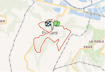
Trail Walking of 7.2 km to be discovered at Hauts-de-France, Aisne, Pernant. This trail is proposed by tracegps.

Description

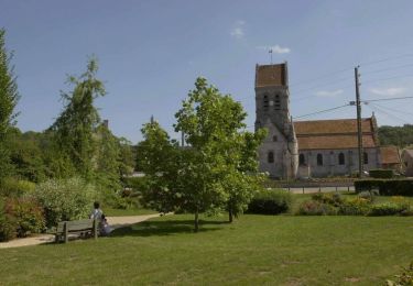
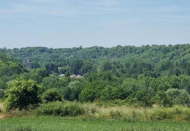
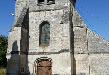
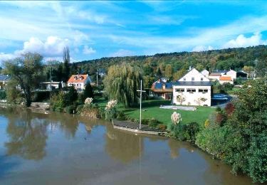
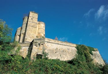
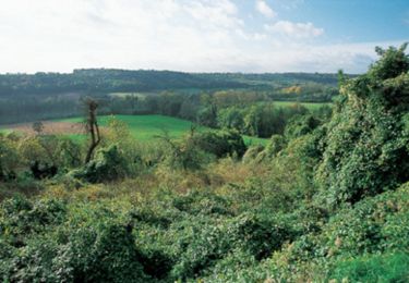
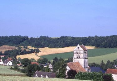
Le vallon encaissé du ru de Pernant, affluent de l'Aisne, est un site attirant, dont cet itinéraire explore les sinuosités. Le panorama du roc Pottier, à l'arrivée, justifie le détour pour embrasser d'un seul regard la vallée de l'Aisne et le château médiéval de Pernant, transformé en ferme. Toutes les infos sont ICI

Elevation profile

Photos

Positioning

Country:
France
Region :
Hauts-de-France
Department/Province :
Aisne
Municipality :
Pernant
Location:
Unknown
Start:(UTM)
517110 ; 5469456 (31U) N.

Trails nearby

Trail Walking Ambleny - Les pas Saint-Martin - Photo
Walking
tracegps

Walking

Very difficult
(2)
Ambleny, Hauts-de-France, Aisne, France
12.2 km | 16 km-effort
3h 0min
Yes
Trail Walking Osly-Courtil - La balade de Saint-Médard - Photo
Walking
tracegps

Walking

Medium
(1)
Osly-Courtil, Hauts-de-France, Aisne, France
12.2 km | 14.2 km-effort
3h 45min
Yes
Trail Walking Ambleny - Ambleny circuit St Martin  - Photo
Walking
José800

Walking

Difficult
Ambleny, Hauts-de-France, Aisne, France
13.3 km | 17 km-effort
3h 32min
Yes
Trail Walking Vauxbuin - 14 la fontaine du coucou - Photo
Walking
fitz2014

Walking

Easy
Vauxbuin, Hauts-de-France, Aisne, France
8.5 km | 10.7 km-effort
2h 20min
Yes
Trail Walking Fontenoy - Châteaux et coteaux - Photo
Walking
tracegps

Walking

Medium
Fontenoy, Hauts-de-France, Aisne, France
9.8 km | 11.6 km-effort
2h 0min
Yes
Trail Mountain bike Mercin-et-Vaux - Circuit Clovis - Photo
Mountain bike
tracegps

Mountain bike

Very difficult
Mercin-et-Vaux, Hauts-de-France, Aisne, France
24 km | 29 km-effort
3h 30min
Yes
Trail Mountain bike Pommiers - Le ru de Juvigny - Photo
Mountain bike
tracegps

Mountain bike

Medium
Pommiers, Hauts-de-France, Aisne, France
22 km | 25 km-effort
2h 30min
Yes
Trail Walking Laversine - La promenade de Gabrielle - Photo
Walking
tracegps

Walking

Medium
Laversine, Hauts-de-France, Aisne, France
7.9 km | 10 km-effort
2h 15min
Yes
Trail Walking Saconin-et-Breuil - Le vallon de la mémoire - Photo
Walking
tracegps

Walking

Medium
Saconin-et-Breuil, Hauts-de-France, Aisne, France
5.7 km | 7.6 km-effort
1h 30min
Yes


Close
My subscriptions