Trail Walking Montigny-Lengrain - Les hameaux de Montigny - variante - Photo

Les hameaux de Montigny - variante

 tracegps
tracegps

User

© OpenStreetMap contributors
Length
Length
7.3 km
Max alt
Max alt
135 m
Uphill gradient
Uphill gradient
103 m
Km-Effort
Km-Effort  
8.7 km
Min alt
Min alt
55 m
Downhill gradient
Downhill gradient
106 m
Boucle
Boucle
Yes
Creation date :
2014-12-10 00:00:00.0
Updated on :
2014-12-10 00:00:00.0

(0 Reviews)

Walking
Walking
1h30
Difficulty : Medium

Scan this QR Code to open this trail in the SityTrail application

FREE GPS app for hiking

Logo SityTrail SityTrail

IGN / Geographical institutes

Download SityTrail from the App Store Download SityTrail from Google Play

Logo SityTrail SityTrail World

The world is yours!

Download SityTrail from the App Store Download SityTrail from Google Play Download SityTrail on Huawei AppGallery

About

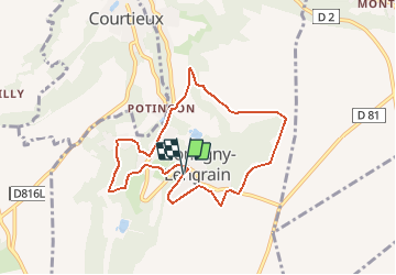
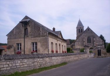
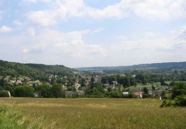
Trail Walking of 7.3 km to be discovered at Hauts-de-France, Aisne, Montigny-Lengrain. This trail is proposed by tracegps.

Description

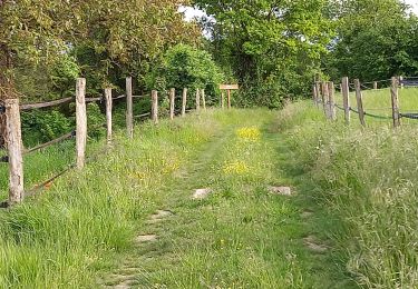
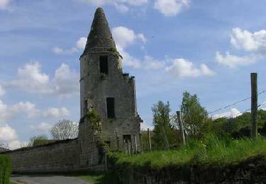
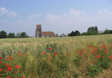
Un circuit pour découvrir les hameaux au sud de l'Aisne, par des chemins en bord de plateau, en sous-bois ou en fond de vallon, que ponctuent des fermes isolées. Observez les pinacles : la forme d'étoiles à huit branches, obtenue en taillant un cube suivant les diagonales, était fréquente dans les villages de Montigny (à voir sur la coupole d'un puits). Une maison près de l'église est dotée d'une toiture en mitre d'évêque. Toutes les infos sont ICI

Elevation profile

Positioning

Country:
France
Region :
Hauts-de-France
Department/Province :
Aisne
Municipality :
Montigny-Lengrain
Location:
Unknown
Start:(UTM)
507115 ; 5468737 (31U) N.

Trails nearby

Trail On foot Montigny-Lengrain - Les-hameaux-de-Montigny - Photo
On foot
TURLUPIN2010

On foot

Easy
Montigny-Lengrain, Hauts-de-France, Aisne, France
9.3 km | 11.4 km-effort
2h 35min
Yes
Trail Walking Chelles - De Chelles à Saint Etienne Roilaye - Photo
Walking
tracegps

Walking

Easy
(1)
Chelles, Hauts-de-France, Oise, France
3.8 km | 5.1 km-effort
1h 0min
Yes
Trail Walking Croutoy - Circuit des 2 côtes - Croutoy - Photo
Walking
tracegps

Walking

Easy
(1)
Croutoy, Hauts-de-France, Oise, France
3.1 km | 4.2 km-effort
45min
Yes
Trail Walking Chelles - Découverte de Chelles - Photo
Walking
tracegps

Walking

Easy
Chelles, Hauts-de-France, Oise, France
5.2 km | 6.5 km-effort
1h 19min
Yes
Trail Walking Vic-sur-Aisne - vic sur aisne - Photo
Walking
bohynm

Walking

Medium
(1)
Vic-sur-Aisne, Hauts-de-France, Aisne, France
13.7 km | 16.5 km-effort
3h 12min
Yes
Trail Walking Jaulzy - Promenade à Jaulzy - Photo
Walking
tracegps

Walking

Easy
Jaulzy, Hauts-de-France, Oise, France
3.1 km | 4.3 km-effort
45min
Yes
Trail Walking Hautefontaine - Hautefontaine - Photo
Walking
tracegps

Walking

Easy
Hautefontaine, Hauts-de-France, Oise, France
4.5 km | 5.6 km-effort
1h 10min
Yes
Trail Walking Attichy - Promenade dans Attichy - Photo
Walking
tracegps

Walking

Easy
Attichy, Hauts-de-France, Oise, France
2.6 km | 3.4 km-effort
45min
Yes
Trail Walking Montigny-Lengrain - Les hameaux de Montigny - Photo
Walking
tracegps

Walking

Very difficult
(1)
Montigny-Lengrain, Hauts-de-France, Aisne, France
9.5 km | 11.5 km-effort
2h 45min
Yes


Close
My subscriptions