Trail Walking Saint-Claude - Autour de St Claude - Photo
 tracegps
tracegps

User

© OpenStreetMap contributors
Length
Length
16 km
Max alt
Max alt
1039 m
Uphill gradient
Uphill gradient
899 m
Km-Effort
Km-Effort  
28 km
Min alt
Min alt
438 m
Downhill gradient
Downhill gradient
895 m
Boucle
Boucle
Yes
Creation date :
2014-12-10 00:00:00.0
Updated on :
2014-12-10 00:00:00.0

(0 Reviews)

Walking
Walking
5h00
Difficulty : Difficult

Scan this QR Code to open this trail in the SityTrail application

FREE GPS app for hiking

Logo SityTrail SityTrail

IGN / Geographical institutes

Download SityTrail from the App Store Download SityTrail from Google Play

Logo SityTrail SityTrail World

The world is yours!

Download SityTrail from the App Store Download SityTrail from Google Play Download SityTrail on Huawei AppGallery

About

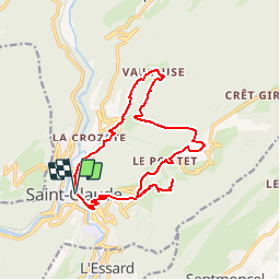
Trail Walking of 16 km to be discovered at Bourgogne-Franche-Comté, Jura, Saint-Claude. This trail is proposed by tracegps.

Description

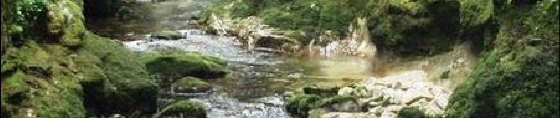
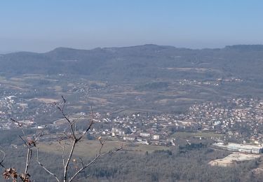
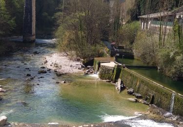
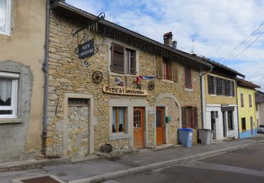
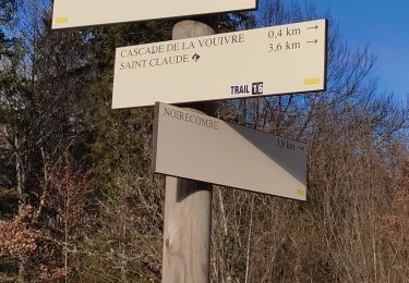
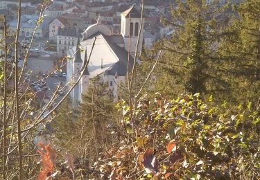
Autour de St Claude. Randonnée en boucle au départ de St-Claude. Cet itinéraire passe par plusieurs points remarquables : la cascade des Combes, les gorges de l'Abime, le trou de l'Abime, le cirque du Vaucluse, le crêt pourri et la cascade de la queue de cheval. Découvrez la suite sur le site de la Communauté des Crapahuteurs.

Elevation profile

Photos

Positioning

Country:
France
Region :
Bourgogne-Franche-Comté
Department/Province :
Jura
Municipality :
Saint-Claude
Location:
Unknown
Start:(UTM)
720282 ; 5141152 (31T) N.

Trails nearby

Trail Walking Septmoncel les Molunes - circuit des chamois Septmoncel  - Photo
Walking
zoe.vienne

Walking

Difficult
(1)
Septmoncel les Molunes, Bourgogne-Franche-Comté, Jura, France
16.3 km | 31 km-effort
5h 51min
Yes
Trail Running Saint-Claude - UTTJ 2015-1 - Photo
Running
bourel.jacques

Running

Very difficult
(1)
Saint-Claude, Bourgogne-Franche-Comté, Jura, France
56 km | 100 km-effort
20h 4min
No
Trail Walking Septmoncel les Molunes - Les Molunes - mairie  - Photo
Walking
jacno

Walking

Medium
(1)
Septmoncel les Molunes, Bourgogne-Franche-Comté, Jura, France
6.3 km | 8.4 km-effort
1h 54min
Yes
Trail Walking Villard-Saint-Sauveur - Pont de l'Isle - cascade queue de cheval  - Photo
Walking
Jackoyo

Walking

Easy
Villard-Saint-Sauveur, Bourgogne-Franche-Comté, Jura, France
7.6 km | 12.5 km-effort
2h 10min
Yes
Trail Walking Saint-Claude - Belvd. Pontoux depuis Rue des Perrieres à St-Claude 39200 - Photo
Walking
Gafanhao

Walking

Medium
Saint-Claude, Bourgogne-Franche-Comté, Jura, France
14 km | 21 km-effort
3h 30min
Yes
Trail Walking Saint-Claude - St Claude Cascade de la Vouivre  - Photo
Walking
Jackoyo

Walking

Easy
Saint-Claude, Bourgogne-Franche-Comté, Jura, France
7 km | 9.9 km-effort
1h 52min
Yes
Trail On foot Coteaux du Lizon - Sentier des savoir-faire - Photo
On foot
PRO

On foot

Easy
Coteaux du Lizon, Bourgogne-Franche-Comté, Jura, France
3.1 km | 3.9 km-effort
52min
Yes
Trail Walking Saint-Claude - De St-Claude à Vaucluse - Photo
Walking
Gafanhao

Walking

Medium
Saint-Claude, Bourgogne-Franche-Comté, Jura, France
12.6 km | 18.7 km-effort
2h 55min
Yes
Trail Walking Saint-Claude - queue de l'âne et queue de cheval - Photo
Walking
Jackoyo

Walking

Medium
Saint-Claude, Bourgogne-Franche-Comté, Jura, France
8.7 km | 14.4 km-effort
2h 44min
Yes


Close
My subscriptions