Trail Walking Laruns - Lac d'Isabe 1925m et Pic de Sesques 2606m par les gorges du Bitet - Photo

Lac d'Isabe 1925m et Pic de Sesques 2606m par les gorges du Bitet

 tracegps
tracegps

User

© OpenStreetMap contributors
Length
Length
12.9 km
Max alt
Max alt
2586 m
Uphill gradient
Uphill gradient
1615 m
Km-Effort
Km-Effort  
34 km
Min alt
Min alt
960 m
Downhill gradient
Downhill gradient
1615 m
Boucle
Boucle
Yes
Creation date :
2014-12-10 00:00:00.0
Updated on :
2014-12-10 00:00:00.0

(0 Reviews)

Walking
Walking
7h30
Difficulty : Difficult

Scan this QR Code to open this trail in the SityTrail application

FREE GPS app for hiking

Logo SityTrail SityTrail

IGN / Geographical institutes

Download SityTrail from the App Store Download SityTrail from Google Play

Logo SityTrail SityTrail World

The world is yours!

Download SityTrail from the App Store Download SityTrail from Google Play Download SityTrail on Huawei AppGallery

About

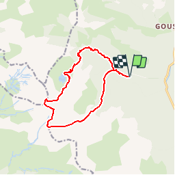
Trail Walking of 12.9 km to be discovered at New Aquitaine, Pyrénées-Atlantiques, Laruns. This trail is proposed by tracegps.

Description

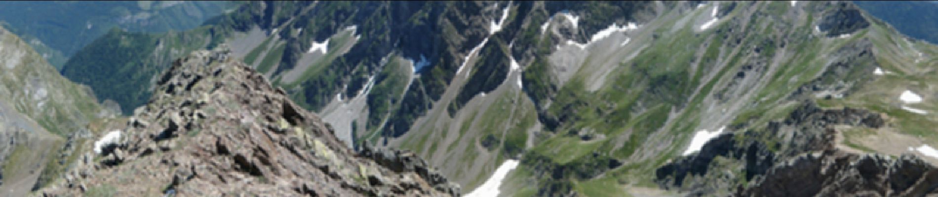
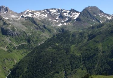
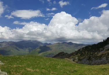
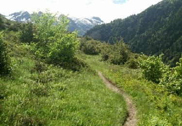
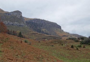
Lac d'Isabe 1925m et Pic de Sesques 2606m par les gorges du Bitet depuis le pont (930m) Dans un amphithéâtre d'une austère beauté, le lac d'Isabe mérite à lui seul le déplacement. Au-delà, à 2h de marches, le Pic de Sesques constitue un remarquable belvédère, d'accès facile, mais imposant 1700m de montée depuis la voiture. Si cette dure ascension vous décourage (surtout en pleine chaleur), vous pouvez envisager la descente des Gorges du Bidet, par le vallon de Sesques. D’autres indications, photos et panoramiques sur le site « Les Pyrénées vues par Mariano ».

Elevation profile

Photos

Positioning

Country:
France
Region :
New Aquitaine
Department/Province :
Pyrénées-Atlantiques
Municipality :
Laruns
Location:
Unknown
Start:(UTM)
706766 ; 4756303 (30T) N.

Trails nearby

Trail Walking Laruns - chemin des fenetres - Photo
Walking
mongo

Walking

Easy
(1)
Laruns, New Aquitaine, Pyrénées-Atlantiques, France
8 km | 14.1 km-effort
3h 0min
No
Trail Walking Laruns - COLLECTE GR108
Walking
GUIDE
marmotte65

Walking

Medium
Laruns, New Aquitaine, Pyrénées-Atlantiques, France
6.6 km | 11 km-effort
2h 29min
No
Trail On foot Laruns - Voie d'OssauB - Photo
On foot
PRO

On foot

Medium
Laruns, New Aquitaine, Pyrénées-Atlantiques, France
14.1 km | 24 km-effort
5h 32min
No
Trail On foot Laruns - Vallon du Soussouéou - Photo
On foot
PRO

On foot

Medium
Laruns, New Aquitaine, Pyrénées-Atlantiques, France
13.7 km | 26 km-effort
5h 51min
Yes
Trail Other activity Laruns - TDP N°12 GABAS   EAUX BONNES - Photo
Other activity
jeff2

Other activity

Very easy
Laruns, New Aquitaine, Pyrénées-Atlantiques, France
24 km | 43 km-effort
7h 38min
No
Trail Walking Laruns - Vallon du Soussouéou - Photo
Walking
DuMarsan

Walking

Medium
(1)
Laruns, New Aquitaine, Pyrénées-Atlantiques, France
15.1 km | 28 km-effort
6h 37min
Yes
Trail Walking Laruns - Pic de la Gentiane depuis Goust - Photo
Walking
tracegps

Walking

Difficult
Laruns, New Aquitaine, Pyrénées-Atlantiques, France
13.4 km | 26 km-effort
6h 0min
Yes
Trail On foot Laruns - Collecte GR 108 2eme tronçon
On foot
GUIDE
marmotte65

On foot

Easy
Laruns, New Aquitaine, Pyrénées-Atlantiques, France
5.3 km | 10 km-effort
2h 16min
No
Trail On foot Laruns - Collecte GR108 1er troncon
On foot
GUIDE
marmotte65

On foot

Easy
Laruns, New Aquitaine, Pyrénées-Atlantiques, France
5.7 km | 9.6 km-effort
2h 10min
No


Close
My subscriptions