Trail Walking Hombleux - Circuit de la Croix Saint Claude - Hombleux - Photo

Circuit de la Croix Saint Claude - Hombleux

 tracegps
tracegps

User

© OpenStreetMap contributors
Length
Length
15.7 km
Max alt
Max alt
77 m
Uphill gradient
Uphill gradient
79 m
Km-Effort
Km-Effort  
16.7 km
Min alt
Min alt
56 m
Downhill gradient
Downhill gradient
79 m
Boucle
Boucle
Yes
Creation date :
2014-12-10 00:00:00.0
Updated on :
2014-12-10 00:00:00.0

(0 Reviews)

Walking
Walking
4h00
Difficulty : Difficult

Scan this QR Code to open this trail in the SityTrail application

FREE GPS app for hiking

Logo SityTrail SityTrail

IGN / Geographical institutes

Download SityTrail from the App Store Download SityTrail from Google Play

Logo SityTrail SityTrail World

The world is yours!

Download SityTrail from the App Store Download SityTrail from Google Play Download SityTrail on Huawei AppGallery

About

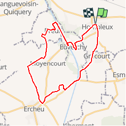
Trail Walking of 15.7 km to be discovered at Hauts-de-France, Somme, Hombleux. This trail is proposed by tracegps.

Description

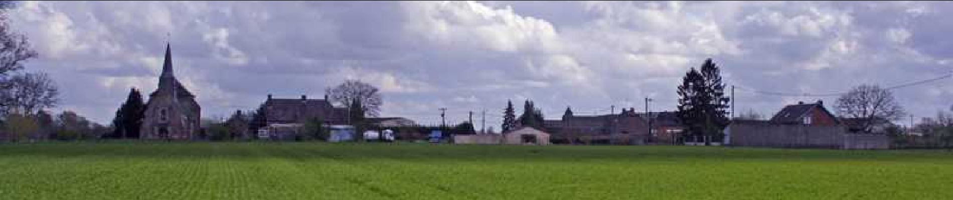
Circuit proposé par la Communauté de Communes du Pays Neslois. Le départ du parking de la mairie d’Hombleux. Nombreuses sont les visites possibles : l’église Saint Médard (restaurée après 1918), à Hombleux, abrite un carillon de 16 cloches que l’on peut écouter, l’église Saint Matthieu dont le chœur date du XVIème siècle et la nef du XIXème (restaurée après 1918), la ferme Lannoy qui fut autrefois un couvent. Cette randonnée vous permettra également d’admirer le château de Moyencourt flanqué de 7 tours ainsi que la grotte artificielle de Buverchy que vous pouvez visiter. Retrouvez cette randonnée sur le site de la Communauté de Communes du Pays Neslois.

Elevation profile

Photos

Positioning

Country:
France
Region :
Hauts-de-France
Department/Province :
Somme
Municipality :
Hombleux
Location:
Hombleux
Start:(UTM)
498932 ; 5509753 (31U) N.

Trails nearby

Trail Walking Sancourt - Source Magloire - Photo
Walking
José800

Walking

Medium
Sancourt, Hauts-de-France, Somme, France
14.2 km | 15.4 km-effort
3h 11min
No
Trail Walking Voyennes - La Courtemanche - Voyennes - Photo
Walking
tracegps

Walking

Medium
(1)
Voyennes, Hauts-de-France, Somme, France
10.1 km | 11 km-effort
2h 40min
Yes
Trail Walking Voyennes - Circuit de la Courtemanche  -  Voyennes - Photo
Walking
tracegps

Walking

Medium
Voyennes, Hauts-de-France, Somme, France
11.9 km | 12.9 km-effort
3h 0min
Yes
Trail Walking Nesle - Circuit de la fontaine Saint Quentin - Nesle - Photo
Walking
tracegps

Walking

Medium
Nesle, Hauts-de-France, Somme, France
12.5 km | 13.8 km-effort
3h 10min
Yes
Trail Walking Sancourt - Source Magloire - Photo
Walking
José800

Walking

Difficult
Sancourt, Hauts-de-France, Somme, France
12.8 km | 13.8 km-effort
3h 8min
Yes
Trail On foot Rouy-le-Petit - La Courtemanche - Photo
On foot
PRO

On foot

Easy
Rouy-le-Petit, Hauts-de-France, Somme, France
9.9 km | 10.8 km-effort
2h 27min
Yes
Trail Walking Hombleux - Hombleux 80 - Photo
Walking
José800

Walking

Difficult
Hombleux, Hauts-de-France, Somme, France
14.6 km | 15.6 km-effort
4h 18min
Yes
Trail On foot Hombleux - La Croix St Claude Hombleux 80 - Photo
On foot
José800

On foot

Easy
Hombleux, Hauts-de-France, Somme, France
11.9 km | 12.7 km-effort
2h 52min
Yes
Trail Walking Voyennes - Voyennes  - Photo
Walking
jpblimond

Walking

Medium
Voyennes, Hauts-de-France, Somme, France
18.1 km | 19.6 km-effort
4h 11min
Yes


Close
My subscriptions