


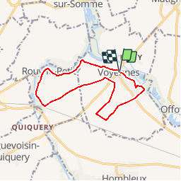

11.5 km | 12.4 km-effort


User


FREE GPS app for hiking
 SityTrail
IGN / Geographical institutes
SityTrail World
The world is yours!
Trail Walking of 11.9 km to be discovered at Hauts-de-France, Somme, Voyennes. This trail is proposed by tracegps.
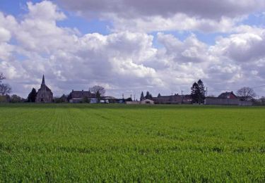
Circuit proposé par la Communauté de Communes du Pays Neslois. Le départ a lieu de la place de Voyennes, face à la salle des fêtes. Cette randonnée permet d’admirer les villages de Rouy-le-Petit et Voyennes. A Rouy-le-Petit, nous vous recommandons : le bis pont (au Sud du territoire), la stèle du Sergent Soudry ; tué en septembre 1918 lors des dernières offensives Allemandes sur la rivière Ingon ; l’arboretum, l’église de Saint-Eloi reconstruite après 1918 par l'architecte Dutoit ainsi que le lavoir restauré. En remontant sur Voyennes, en plaine, vous pourrez peut-être rencontrer des chevreuils, lièvres et perdreaux, si vous êtes attentifs et silencieux. Vous pourrez visiter l’église Saint-Etienne, reconstruite après la dernière guerre. Retrouvez cette randonnée sur le site de la Communauté de Communes du Pays Neslois.


Walking
Walking

Walking

Walking

Walking

Walking
Walking

Walking
Walking