


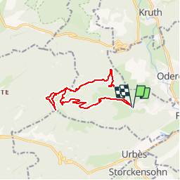


15 km | 24 km-effort

User


FREE GPS app for hiking
 SityTrail
IGN / Geographical institutes
SityTrail World
The world is yours!
Trail Walking of 11.8 km to be discovered at Grand Est, Haut-Rhin, Fellering. This trail is proposed by tracegps.
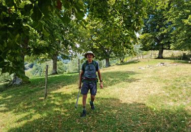
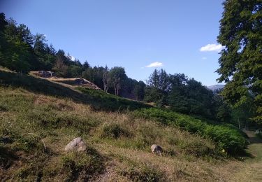
Magnifique balade vers un superbe sommet des hautes Vosges du Sud offrant un extraordinaire panorama sommital, le Drumont est un sommet dégarni typique des Hautes-Vosges. Il constitue l’un des plus remarquables ballons vosgiens. Dominant les vallées de Thann du côté oriental (Alsace) et de Bussang du côté occidental (Lorraine), le Drumont possède une ferme-auberge réputée, à 300 mètres en contrebas du sommet. Dans le fond de la vallée de la Thur, vous distinguerez les nombreux villages, tels Oderen, Fellering, Wesserling, Thann etc… Départ près de l'auberge à la Langmatt (rue de Rammersbach) par le chemin balisé disque jaune qui mène par l'ancienne ferme du Lochberg au col sous le Hasenkopf. Prendre le GR 531 rectangle bleu vers l'auberge du Drumont et le col de Bussang. A l'auberge, le triangle bleu, direction Wesserling, mène au col entre la tête des Russiers et le Petit Drumont. Y prendre le sentier menant au sommet du Drumont par le rectangle bleu (Superbe panorama et table d'orientation). Reprendre le sentier rectangle bleu vers le Hasenkopf et au col, descendre vers Vorgott par le sentier triangle rouge pour atteindre Langenbach (abri forestier), triangle jaune vers Langmatt.


Walking

Walking

Walking
Walking

Walking
Walking
Walking
Walking
Walking
Jolie découverte, à faire !!!