Trail Walking Villers-Cotterêts - Réseau d'eau ancien de Villers-Cotteret - Photo

Réseau d'eau ancien de Villers-Cotteret

© OpenStreetMap contributors
Length
Length
5.6 km
Max alt
Max alt
236 m
Uphill gradient
Uphill gradient
126 m
Km-Effort
Km-Effort  
7.2 km
Min alt
Min alt
168 m
Downhill gradient
Downhill gradient
124 m
Boucle
Boucle
Yes
Creation date :
2019-05-06 23:12:51.584
Updated on :
2019-05-06 23:12:51.584

(1 Reviews)

Walking
Walking
1h36
Difficulty : Easy

Scan this QR Code to open this trail in the SityTrail application

FREE GPS app for hiking

Logo SityTrail SityTrail

IGN / Geographical institutes

Download SityTrail from the App Store Download SityTrail from Google Play

Logo SityTrail SityTrail World

The world is yours!

Download SityTrail from the App Store Download SityTrail from Google Play Download SityTrail on Huawei AppGallery

About

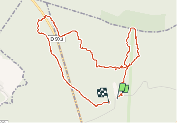
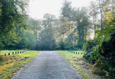
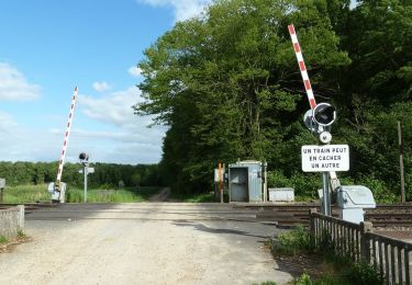
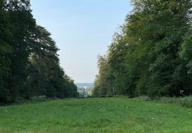
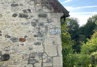
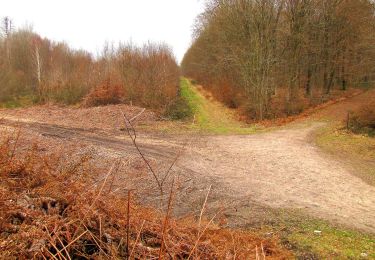
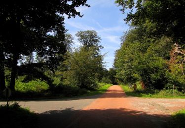
Trail Walking of 5.6 km to be discovered at Hauts-de-France, Aisne, Villers-Cotterêts. This trail is proposed by bianchireg.

Elevation profile

Photos

Positioning

Country:
France
Region :
Hauts-de-France
Department/Province :
Aisne
Municipality :
Villers-Cotterêts
Location:
Unknown
Start:(UTM)
506654 ; 5458024 (31U) N.

Comments

Please log in to post a review or rate the element


Trails nearby

Trail Walking Fleury - en Forêt de Retz_92_05_2022_Rond d'Orléans_Chapeau des Cordeliers_la Laie des étangs de Longpont - Photo
Walking

Walking

Medium
Fleury, Hauts-de-France, Aisne, France
9.2 km | 10.9 km-effort
2h 46min
Yes
Trail On foot Puiseux-en-Retz - Route du Faîte - Photo
On foot
PRO

On foot

Easy
Puiseux-en-Retz, Hauts-de-France, Aisne, France
5.8 km | 7.1 km-effort
1h 37min
No
Trail Walking Largny-sur-Automne - en Forêt de Retz_90_09_2021_la Selve - Photo
Walking

Walking

Medium
Largny-sur-Automne, Hauts-de-France, Aisne, France
6.2 km | 7.8 km-effort
1h 52min
Yes
Trail Walking Villers-Cotterêts - en Forêt de Retz_89_09_2021_les Ventes Racines et le Chablis des Bouleaux - Photo
Walking

Walking

Medium
Villers-Cotterêts, Hauts-de-France, Aisne, France
10.2 km | 12.1 km-effort
3h 14min
Yes
Trail Walking Villers-Cotterêts - Domaine de Coyolles - Photo
Walking
TURLUPIN2010

Walking

Medium
Villers-Cotterêts, Hauts-de-France, Aisne, France
14.3 km | 16.3 km-effort
3h 0min
Yes
Trail Walking Vivières - en Forêt de Retz_88_autour du Regard Saint-Hubert et du Rond de la Reine - Photo
Walking

Walking

Very difficult
Vivières, Hauts-de-France, Aisne, France
12.3 km | 15.5 km-effort
4h 36min
Yes
Trail Walking Villers-Cotterêts - en forêt de Retz_87_la Laie des Masures par la Route Chrétiennette - Photo
Walking

Walking

Very difficult
Villers-Cotterêts, Hauts-de-France, Aisne, France
12 km | 15 km-effort
3h 57min
Yes
Trail On foot Villers-Cotterêts - le GR11A  dans la Forêt de Retz  - Photo
On foot

On foot

Very difficult
Villers-Cotterêts, Hauts-de-France, Aisne, France
27 km | 33 km-effort
Unknown
No
Trail Walking Haramont - en forêt de Retz_79_08_2019_vers Taillefontaine et Retheuil par les lisières - Photo
Walking

Walking

Very difficult
Haramont, Hauts-de-France, Aisne, France
17.1 km | 22 km-effort
5h 25min
Yes


Close
My subscriptions