Trail Mountain bike Pont-Audemer - Pommiers et chaumieres - Photo

Pommiers et chaumieres

© OpenStreetMap contributors
Length
Length
53 km
Max alt
Max alt
132 m
Uphill gradient
Uphill gradient
797 m
Km-Effort
Km-Effort  
63 km
Min alt
Min alt
0 m
Downhill gradient
Downhill gradient
796 m
Boucle
Boucle
Yes
Creation date :
2014-12-10 00:00:00.0
Updated on :
2014-12-10 00:00:00.0

(0 Reviews)

Mountain bike
Mountain bike
3h56
Difficulty : Difficult

Scan this QR Code to open this trail in the SityTrail application

FREE GPS app for hiking

Logo SityTrail SityTrail

IGN / Geographical institutes

Download SityTrail from the App Store Download SityTrail from Google Play

Logo SityTrail SityTrail World

The world is yours!

Download SityTrail from the App Store Download SityTrail from Google Play Download SityTrail on Huawei AppGallery

About

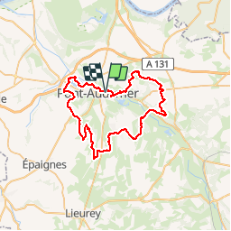
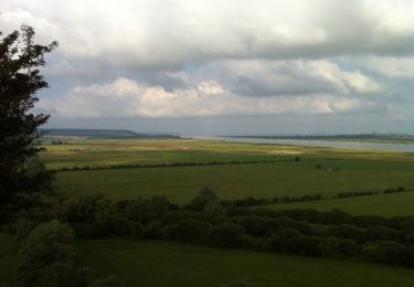
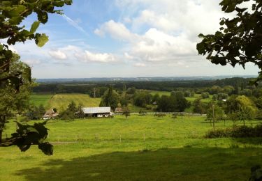
Trail Mountain bike of 53 km to be discovered at Normandy, Eure, Pont-Audemer. This trail is proposed by knight27350.

Description

Boucles au départ de Pont-Audemer

Elevation profile

Positioning

Country:
France
Region :
Normandy
Department/Province :
Eure
Municipality :
Pont-Audemer
Location:
Pont-Audemer
Start:(UTM)
320937 ; 5469428 (31U) N.

Trails nearby

Trail Walking Tourville-sur-Pont-Audemer - Chemin de la Guinguette - Photo
Walking
bub27

Walking

Difficult
(1)
Tourville-sur-Pont-Audemer, Normandy, Eure, France
9.5 km | 13.2 km-effort
2h 47min
Yes
Trail Walking Le Perrey - chemin des Têtards - Photo
Walking
dominiquelouis

Walking

Medium
Le Perrey, Normandy, Eure, France
7.8 km | 9.2 km-effort
2h 21min
Yes
Trail Mountain bike Saint-Symphorien - Chemin du Vent d'Ouest - Saint-Symphorien - Photo
Mountain bike
tracegps

Mountain bike

Easy
Saint-Symphorien, Normandy, Eure, France
8.7 km | 9.8 km-effort
1h 0min
Yes
Trail Walking Saint-Symphorien - Chemin du Vent d'Ouest - Saint-Symphorien - Photo
Walking
tracegps

Walking

Medium
Saint-Symphorien, Normandy, Eure, France
8.7 km | 9.8 km-effort
2h 19min
Yes
Trail Walking Campigny - 20230913-Campigny claude - Photo
Walking
doudet

Walking

Medium
Campigny, Normandy, Eure, France
7.9 km | 10.2 km-effort
2h 26min
Yes
Trail Walking Toutainville - les étangs avec Nolan - Photo
Walking
serisier

Walking

Very easy
Toutainville, Normandy, Eure, France
3.3 km | 3.5 km-effort
58min
Yes
Trail Walking Bouquelon - Bouquelon - Photo
Walking
elcanario

Walking

Very easy
Bouquelon, Normandy, Eure, France
13.2 km | 16.4 km-effort
3h 25min
Yes
Trail Walking Bouquelon - Le phare de la Roque - Bouquelon - Photo
Walking
tracegps

Walking

Medium
Bouquelon, Normandy, Eure, France
19.4 km | 24 km-effort
4h 0min
Yes
Trail Walking Bouquelon - Bouquelon au dessus du Marais Vernier - Photo
Walking
tracegps

Walking

Medium
Bouquelon, Normandy, Eure, France
14.6 km | 17.9 km-effort
2h 49min
Yes


Close
My subscriptions