Trail Walking Saint-Jeure-d'Andaure - En pays d'Andaure - Photo
 tracegps
tracegps

User

© OpenStreetMap contributors
Length
Length
6.8 km
Max alt
Max alt
1123 m
Uphill gradient
Uphill gradient
247 m
Km-Effort
Km-Effort  
10.1 km
Min alt
Min alt
887 m
Downhill gradient
Downhill gradient
243 m
Boucle
Boucle
Yes
Creation date :
2014-12-10 00:00:00.0
Updated on :
2014-12-10 00:00:00.0

(1 Reviews)

Walking
Walking
2h30
Difficulty : Medium

Scan this QR Code to open this trail in the SityTrail application

FREE GPS app for hiking

Logo SityTrail SityTrail

IGN / Geographical institutes

Download SityTrail from the App Store Download SityTrail from Google Play

Logo SityTrail SityTrail World

The world is yours!

Download SityTrail from the App Store Download SityTrail from Google Play Download SityTrail on Huawei AppGallery

About

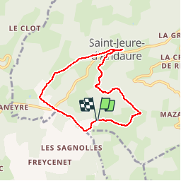
Trail Walking of 6.8 km to be discovered at Auvergne-Rhône-Alpes, Ardèche, Saint-Jeure-d'Andaure. This trail is proposed by tracegps.

Description

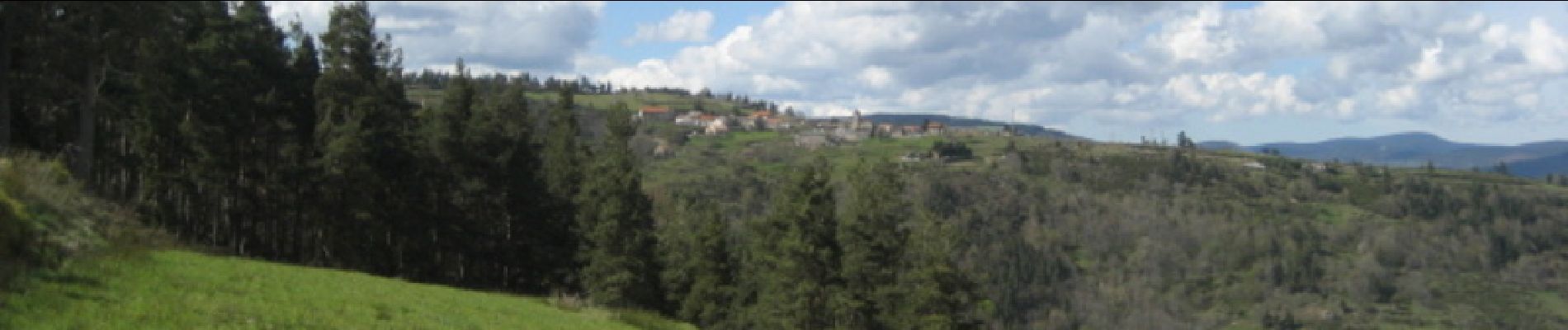
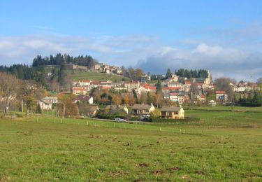
Beau circuit ardéchois, passage au col de Brun. Montée au dessus de St Jeure d'Andaure. Descente au dessous du village. Beaux paysages et belles vues sur la Haute Ardèche si belle au printemps. Calme assuré !

Elevation profile

Photos

Points of interest

Point of interest Saint-Jeure-d'Andaure - Antenne - Photo
tracegps
SAINT-JEURE-D'ANDAURE 
Point of interest Saint-Jeure-d'Andaure - Départ - Photo
tracegps
SAINT-JEURE-D'ANDAURE 

Positioning

Country:
France
Region :
Auvergne-Rhône-Alpes
Department/Province :
Ardèche
Municipality :
Saint-Jeure-d'Andaure
Location:
Unknown
Start:(Dec)
Start:(UTM)
614521 ; 4987792 (31T) N.

Comments

Please log in to post a review or rate the element


Très beau circuit conforme à la présentation. Beaux paysages, durée prévue facilement respectée par un marcheur moyen. Merci pour le partage.


Trails nearby

Trail Walking Saint-Agrève - La chaux par les Sagnoles - Photo
Walking
mallovon

Walking

Medium
(1)
Saint-Agrève, Auvergne-Rhône-Alpes, Ardèche, France
6.4 km | 8.9 km-effort
2h 17min
Yes
Trail Walking Saint-Agrève - Le serre par le col de brun - Photo
Walking
mallovon

Walking

Easy
Saint-Agrève, Auvergne-Rhône-Alpes, Ardèche, France
4.1 km | 5.1 km-effort
1h 20min
Yes
Trail Mountain bike Désaignes - Autour de Combeneyre - Désaignes - Photo
Mountain bike
tracegps

Mountain bike

Medium
Désaignes, Auvergne-Rhône-Alpes, Ardèche, France
13.1 km | 18.3 km-effort
1h 30min
Yes
Trail Walking Désaignes - Autour de Combeneyre - Désaignes - Photo
Walking
tracegps

Walking

Medium
Désaignes, Auvergne-Rhône-Alpes, Ardèche, France
13.1 km | 18.3 km-effort
3h 0min
Yes
Trail Walking Désaignes - La Terrasse - Désaignes - Photo
Walking
tracegps

Walking

Medium
Désaignes, Auvergne-Rhône-Alpes, Ardèche, France
13.3 km | 21 km-effort
4h 0min
Yes
Trail Walking Désaignes - Les Sauvages - Desaignes - Photo
Walking
tracegps

Walking

Medium
Désaignes, Auvergne-Rhône-Alpes, Ardèche, France
12.3 km | 17.1 km-effort
3h 0min
Yes
Trail Walking Labatie-d'Andaure - Le rocher de Peyrolle Labatie d Andaure - Photo
Walking
brigitte07

Walking

Difficult
(1)
Labatie-d'Andaure, Auvergne-Rhône-Alpes, Ardèche, France
7.4 km | 12.1 km-effort
2h 1min
Yes
Trail Walking Devesset - le grail - Photo
Walking
berlan2

Walking

Very easy
Devesset, Auvergne-Rhône-Alpes, Ardèche, France
12 km | 0 m-effort
4h 2min
Yes
Trail Walking Saint-Agrève - La Galoche 2013 - Saint Agrève - Photo
Walking
tracegps

Walking

Medium
Saint-Agrève, Auvergne-Rhône-Alpes, Ardèche, France
19.5 km | 29 km-effort
5h 0min
Yes


Close
My subscriptions