Trail Walking Ancelle - La grande Autane - Champsaur - Photo
 R@ph
R@ph

User GUIDE

© OpenStreetMap contributors
Length
Length
16.8 km
Max alt
Max alt
2750 m
Uphill gradient
Uphill gradient
1155 m
Km-Effort
Km-Effort  
32 km
Min alt
Min alt
1625 m
Downhill gradient
Downhill gradient
1154 m
Boucle
Boucle
Yes
Creation date :
2014-12-10 00:00:00.0
Updated on :
2014-12-10 00:00:00.0

(0 Reviews)

Walking
Walking
4h20
Difficulty : Difficult

Scan this QR Code to open this trail in the SityTrail application

FREE GPS app for hiking

Logo SityTrail SityTrail

IGN / Geographical institutes

Download SityTrail from the App Store Download SityTrail from Google Play

Logo SityTrail SityTrail World

The world is yours!

Download SityTrail from the App Store Download SityTrail from Google Play Download SityTrail on Huawei AppGallery

About

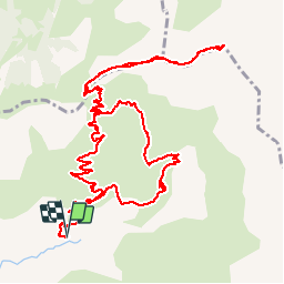
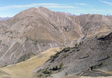
Trail Walking of 16.8 km to be discovered at Provence-Alpes-Côte d'Azur, Hautes-Alpes, Ancelle. This trail is proposed by R@ph.

Description

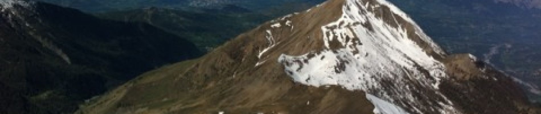
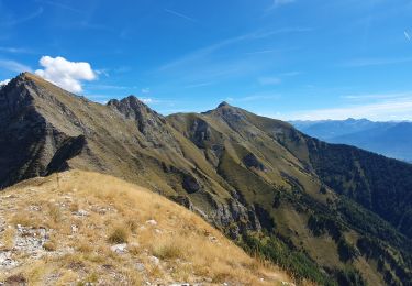
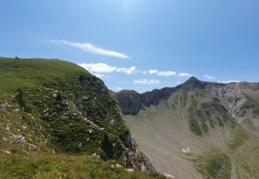
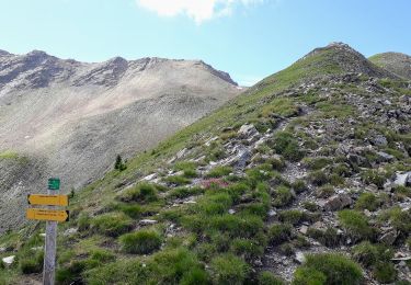
Belle balade vers un des sommet du Champsaur dont la cime est encore enneigée à cette époque. Accès par le col de Combeau, puis en crête par la suite jusqu'au sommet. Quelques petits passages délicats, mais rien de compliqué. En période de neige version raquette ou plus audacieux, en ski de randonnée. Splendide vue du sommet, mais ça vous en doutiez....
Pour le retour dans la descente j'ai emprunté un chemin différent, les distances sur les panneaux sont fausses et le chemin plus long.

Elevation profile

Photos

Positioning

Country:
France
Region :
Provence-Alpes-Côte d'Azur
Department/Province :
Hautes-Alpes
Municipality :
Ancelle
Location:
Unknown
Start:(UTM)
282864 ; 4945253 (32T) N.

Trails nearby

Trail Walking Saint-Jean-Saint-Nicolas - Circuit de Costebelle - Photo
Walking
Dervalmarc

Walking

Very easy
(2)
Saint-Jean-Saint-Nicolas, Provence-Alpes-Côte d'Azur, Hautes-Alpes, France
7.4 km | 12.1 km-effort
2h 16min
Yes
Trail Running Ancelle - Ancelle-Tour du Cuchon - Photo
Running
frederique.marti@laposte.net

Running

Very easy
(2)
Ancelle, Provence-Alpes-Côte d'Azur, Hautes-Alpes, France
15.4 km | 26 km-effort
3h 15min
Yes
Trail Walking Ancelle - col de la coupa et tour de la rouanne - Photo
Walking
chdubois

Walking

Difficult
(1)
Ancelle, Provence-Alpes-Côte d'Azur, Hautes-Alpes, France
16.2 km | 28 km-effort
4h 56min
Yes
Trail Walking Ancelle - L'arche et L'aiguille 01/09/23 - Photo
Walking
GUIDE
R@ph

Walking

Very difficult
Ancelle, Provence-Alpes-Côte d'Azur, Hautes-Alpes, France
8.6 km | 19.6 km-effort
4h 27min
Yes
Trail Walking Ancelle - Le Piolt par la Pourrachiere 21/07/23 - Photo
Walking
GUIDE
R@ph

Walking

Very difficult
Ancelle, Provence-Alpes-Côte d'Azur, Hautes-Alpes, France
13.7 km | 25 km-effort
5h 41min
Yes
Trail Walking Ancelle - Le Piolit par Rouanne Haute 27/09/19 - Photo
Walking
GUIDE
R@ph

Walking

Very difficult
Ancelle, Provence-Alpes-Côte d'Azur, Hautes-Alpes, France
14.2 km | 26 km-effort
5h 15min
Yes
Trail Walking Orcières - Col de Rouannette 22/07/18 - Photo
Walking
GUIDE
R@ph

Walking

Medium
Orcières, Provence-Alpes-Côte d'Azur, Hautes-Alpes, France
9.3 km | 20 km-effort
3h 56min
Yes
Trail Snowshoes Ancelle - Tour de Pourrachière - Photo
Snowshoes
Orage

Snowshoes

Difficult
(1)
Ancelle, Provence-Alpes-Côte d'Azur, Hautes-Alpes, France
14.9 km | 26 km-effort
6h 0min
No
Trail Walking Saint-Jean-Saint-Nicolas - Pont Ricous Pelissier Coste Belle Pont du Fossé - Photo
Walking
Orage

Walking

Easy
(2)
Saint-Jean-Saint-Nicolas, Provence-Alpes-Côte d'Azur, Hautes-Alpes, France
11.3 km | 21 km-effort
1h 57min
Yes


Close
My subscriptions