Trail Walking Sers - Bareges-Hautacam - Photo

Bareges-Hautacam

© OpenStreetMap contributors
Length
Length
22 km
Max alt
Max alt
2590 m
Uphill gradient
Uphill gradient
1311 m
Km-Effort
Km-Effort  
40 km
Min alt
Min alt
1619 m
Downhill gradient
Downhill gradient
1642 m
Boucle
Boucle
No
Creation date :
2014-12-10 00:00:00.0
Updated on :
2014-12-10 00:00:00.0

(0 Reviews)

Walking
Walking
7h29
Difficulty : Medium

Scan this QR Code to open this trail in the SityTrail application

FREE GPS app for hiking

Logo SityTrail SityTrail

IGN / Geographical institutes

Download SityTrail from the App Store Download SityTrail from Google Play

Logo SityTrail SityTrail World

The world is yours!

Download SityTrail from the App Store Download SityTrail from Google Play Download SityTrail on Huawei AppGallery

About

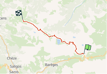
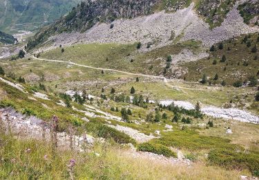
Trail Walking of 22 km to be discovered at Occitania, Hautespyrenees, Sers. This trail is proposed by romananus1er.

Description

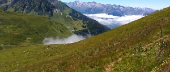
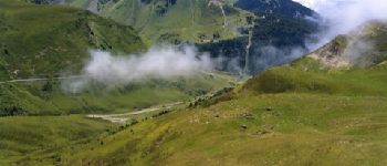
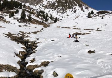
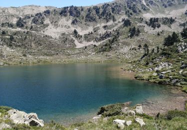
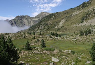
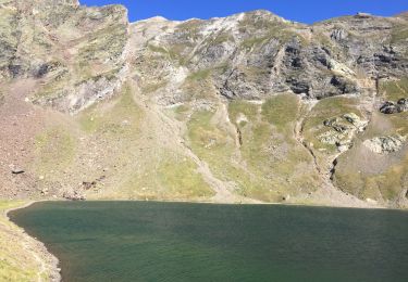
Randonnée au départ de la vallée de Barèges à Hautacam en passant par le Pic Crémat, le Lac Bleu, Le Pic de Bisourtère et le Lac d'Ourec

Elevation profile

Photos

Points of interest

Point of interest Beaucens - Col d'Aoube - Photo
romananus1er
BEAUCENS 
Point of interest Sers - Pic Cremat - Photo
romananus1er
Point of interest Beaucens - Étape pour passer la nuit - Photo
romananus1er

Positioning

Country:
France
Region :
Occitania
Department/Province :
Hautespyrenees
Municipality :
Sers
Location:
Unknown
Start:(UTM)
266309 ; 4755215 (31T) N.

Trails nearby

Trail Walking Barèges - Pic des Trois Conseillers - Photo
Walking
tracegps

Walking

Very difficult
(1)
Barèges, Occitania, Hautespyrenees, France
16 km | 34 km-effort
9h 0min
Yes
Trail Walking Barèges - Pic de Madamète en boucle par les lacs - Photo
Walking
tracegps

Walking

Difficult
(1)
Barèges, Occitania, Hautespyrenees, France
21 km | 40 km-effort
9h 0min
Yes
Trail Walking Barèges - En boucle, Grand Tourmalet- Aygues Cluses-Col de Madamète- Lac  Dets Coubous. - Photo
Walking
2034

Walking

Difficult
(3)
Barèges, Occitania, Hautespyrenees, France
16.7 km | 32 km-effort
6h 26min
Yes
Trail Horseback riding Sers - Plateau d’Aoube par la cabane d’Aoube - Photo
Horseback riding
orsel

Horseback riding

Easy
Sers, Occitania, Hautespyrenees, France
7.4 km | 15.1 km-effort
4h 43min
Yes
Trail Walking Barèges - le circuit des 5 lacs - Photo
Walking
Vero7684

Walking

Difficult
(2)
Barèges, Occitania, Hautespyrenees, France
13.1 km | 24 km-effort
5h 13min
Yes
Trail On foot Barèges - Grande boucle dans la région du Néouvielle - Photo
On foot
PRO

On foot

Medium
Barèges, Occitania, Hautespyrenees, France
16.5 km | 31 km-effort
7h 1min
Yes
Trail Walking Sers - Le lac d’oncet - Photo
Walking
serleb

Walking

Easy
Sers, Occitania, Hautespyrenees, France
6.7 km | 11.3 km-effort
2h 30min
Yes
Trail Walking Bagnères-de-Bigorre - tourmalet G2 heit  - Photo
Walking
LouisROGER

Walking

Very easy
Bagnères-de-Bigorre, Occitania, Hautespyrenees, France
5.5 km | 11.6 km-effort
6h 37min
Yes
Trail Walking Barèges - Lac dets Coubous - Photo
Walking
sereton

Walking

Medium
Barèges, Occitania, Hautespyrenees, France
9.7 km | 18 km-effort
3h 30min
Yes


Close
My subscriptions