Trail Walking Baelen - Porfays - Allée du Grand Fossé - Photo

Porfays - Allée du Grand Fossé

 Fichaumi
Fichaumi

User

© OpenStreetMap contributors
Length
Length
11.2 km
Max alt
Max alt
608 m
Uphill gradient
Uphill gradient
153 m
Km-Effort
Km-Effort  
13.2 km
Min alt
Min alt
530 m
Downhill gradient
Downhill gradient
145 m
Boucle
Boucle
Yes
Creation date :
2014-12-10 00:00:00.0
Updated on :
2014-12-10 00:00:00.0

(0 Reviews)

Walking
Walking
--
Difficulty : Easy

Scan this QR Code to open this trail in the SityTrail application

FREE GPS app for hiking

Logo SityTrail SityTrail

IGN / Geographical institutes

Download SityTrail from the App Store Download SityTrail from Google Play

Logo SityTrail SityTrail World

The world is yours!

Download SityTrail from the App Store Download SityTrail from Google Play Download SityTrail on Huawei AppGallery

About

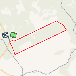
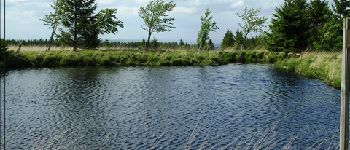
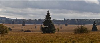
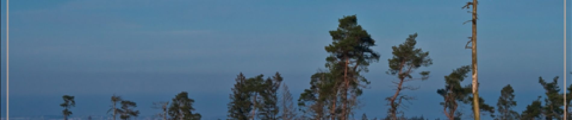
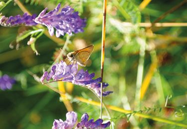
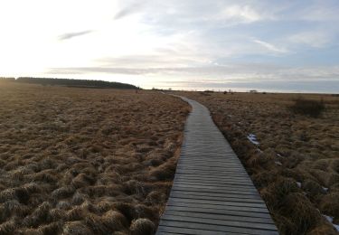
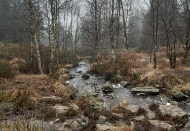
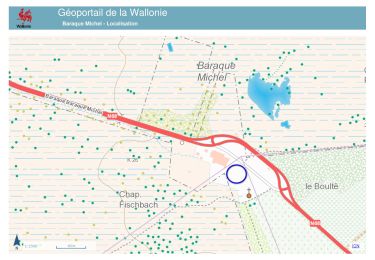
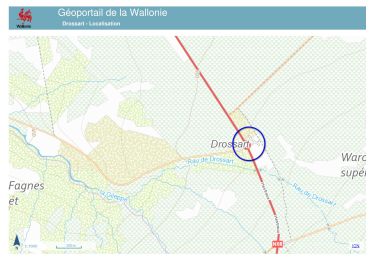
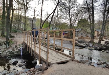
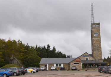
Trail Walking of 11.2 km to be discovered at Wallonia, Liège, Baelen. This trail is proposed by Fichaumi.

Description

Départ parking à l'entrée de la route forestière dite de Porfays.

Elevation profile

Photos

Points of interest

Point of interest Baelen - Banc - Photo
Fichaumi
BAELEN 
Point of interest Baelen - Point de vue - Photo
Fichaumi
BAELEN 
Point of interest Baelen - Banc - Photo
Fichaumi
BAELEN 
Point of interest Baelen - Point de vue - Photo
Fichaumi
BAELEN 
Point of interest Baelen - Observatoire - Photo
Fichaumi
BAELEN 
Point of interest Baelen - Banc - Photo
Fichaumi
BAELEN 
Point of interest Baelen - Point de vue - Photo
Fichaumi
BAELEN 
Point of interest Baelen - Panneau - Photo
Fichaumi
BAELEN 
Point of interest Baelen - Attention - Photo
Fichaumi
BAELEN 

Positioning

Country:
Belgium
Region :
Wallonia
Department/Province :
Liège
Municipality :
Baelen
Location:
Membach
Start:(UTM)
291584 ; 5603317 (32U) N.

Trails nearby

Trail Walking Baelen - Hestreux - Circuit Natura 2000 - Lg 23 - Photo
Walking
GUIDE+

Walking

Easy
(4)
Baelen, Wallonia, Liège, Belgium
8.6 km | 10.3 km-effort
3h 0min
No
Trail Walking Waimes - la grande ronde des fagnes - Photo
Walking
mitimitys

Walking

Easy
(3)
Waimes, Wallonia, Liège, Belgium
8.9 km | 10.5 km-effort
1h 47min
Yes
Trail Walking Waimes - botrange . baraque Michel longeant la fagne wallonne . Retour via croix des fiancés.  pont bleu.  fagne de polleur . station météo Mont rigide  - Photo
Walking
stef789

Walking

Very easy
(3)
Waimes, Wallonia, Liège, Belgium
13.9 km | 16.6 km-effort
3h 5min
Yes
Trail Walking Jalhay - 20231113 - Baraque Michel 6.2 Km - Photo
Walking
GUIDE
pierreh01

Walking

Medium
Jalhay, Wallonia, Liège, Belgium
6.2 km | 7.3 km-effort
1h 35min
Yes
Trail Walking Baelen - 20231030 - Drossart 7.8 Km - Photo
Walking
GUIDE
pierreh01

Walking

Easy
Baelen, Wallonia, Liège, Belgium
7.8 km | 9.4 km-effort
2h 28min
Yes
Trail Walking Waimes - UTDS - Fagne de Polleur/Sart - Photo
Walking
GUIDE
mumu.larandonneuse

Walking

Easy
Waimes, Wallonia, Liège, Belgium
16.8 km | 19.8 km-effort
3h 55min
No
Trail Walking Waimes - 20211011 - Signal Botrange - 6.4 Km - Photo
Walking
GUIDE
pierreh01

Walking

Easy
Waimes, Wallonia, Liège, Belgium
6.1 km | 7.5 km-effort
1h 47min
Yes
Trail Walking Jalhay - 20210607 - Baraque Michel 8.8 Km - Photo
Walking
GUIDE
pierreh01

Walking

Medium
Jalhay, Wallonia, Liège, Belgium
8.6 km | 10.1 km-effort
2h 24min
Yes
Trail Walking Waimes - fagne de Poleur départ Borange - Photo
Walking
fissettemichel

Walking

Easy
(2)
Waimes, Wallonia, Liège, Belgium
9.1 km | 10.8 km-effort
2h 0min
Yes


Close
My subscriptions