Trail Walking Sixt-Fer-à-Cheval - Lac de Gers - Photo
© OpenStreetMap contributors
Length
Length
12.8 km
Max alt
Max alt
2477 m
Uphill gradient
Uphill gradient
726 m
Km-Effort
Km-Effort  
25 km
Min alt
Min alt
1529 m
Downhill gradient
Downhill gradient
1621 m
Boucle
Boucle
No
Creation date :
2014-12-10 00:00:00.0
Updated on :
2014-12-10 00:00:00.0

(0 Reviews)

Walking
Walking
--
Difficulty : Medium

Scan this QR Code to open this trail in the SityTrail application

FREE GPS app for hiking

Logo SityTrail SityTrail

IGN / Geographical institutes

Download SityTrail from the App Store Download SityTrail from Google Play

Logo SityTrail SityTrail World

The world is yours!

Download SityTrail from the App Store Download SityTrail from Google Play Download SityTrail on Huawei AppGallery

About

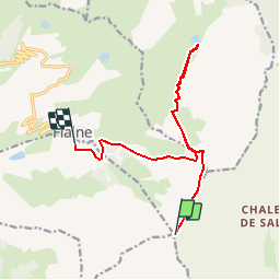
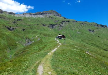
Trail Walking of 12.8 km to be discovered at Auvergne-Rhône-Alpes, Upper Savoy, Sixt-Fer-à-Cheval. This trail is proposed by castellas83.

Description

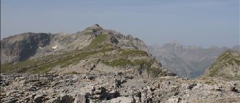
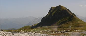
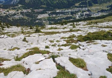
Monter avec le telepherique DMC jusqu'aux Grandes Platières.
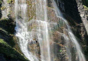
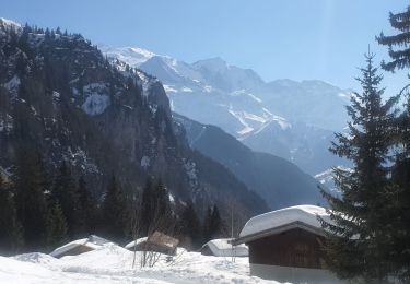
Vue sur le Mont Blanc sublime
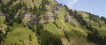
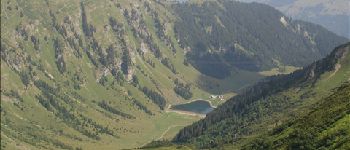
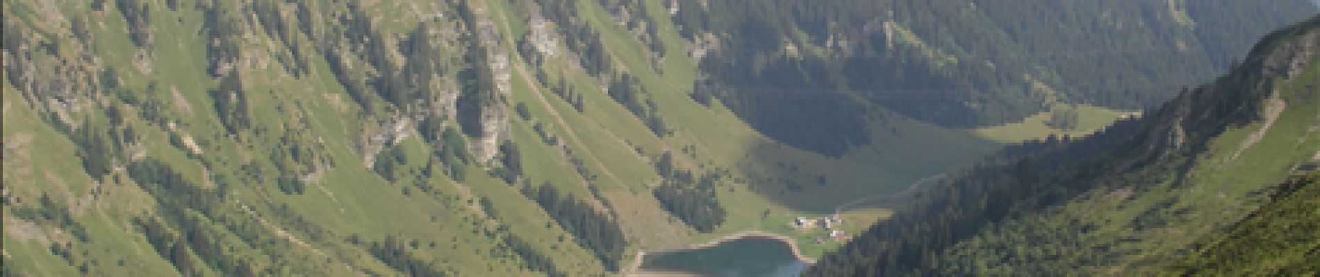
Descente longue et raide sur le lac (cadre très agréable) et dans les cailloux (remontée pareille). Descente sur Flaine pas très agréable

Elevation profile

Photos

Points of interest

Point of interest Sixt-Fer-à-Cheval - Les Grandes Platières - Photo
castellas83
SIXT-FER-À-CHEVAL 
Point of interest Arâches-la-Frasse - Belle surprise : un chamois - Photo
castellas83
ARÂCHES-LA-FRASSE 
Point of interest Arâches-la-Frasse - Tête Pelouse - Photo
castellas83
ARÂCHES-LA-FRASSE 
Point of interest Samoëns - lac de Gers - Photo
castellas83
SAMOËNS 
Point of interest Samoëns - Vue sur le lac de Gers - Photo
castellas83

Positioning

Country:
France
Region :
Auvergne-Rhône-Alpes
Department/Province :
Upper Savoy
Municipality :
Sixt-Fer-à-Cheval
Location:
Unknown
Start:(UTM)
323644 ; 5094825 (32T) N.

Trails nearby

Trail Walking Passy - Tour des Ayères - Passy Plaine-Joux - Photo
Walking
tracegps

Walking

Medium
(6)
Passy, Auvergne-Rhône-Alpes, Upper Savoy, France
9 km | 14.3 km-effort
2h 30min
Yes
Trail Walking Passy - Plaine Joux Barmus Ayères Lac Vert  - Photo
Walking
GUIDE
Kargil

Walking

Very easy
(1)
Passy, Auvergne-Rhône-Alpes, Upper Savoy, France
7.6 km | 12.2 km-effort
2h 18min
Yes
Trail Walking Sixt-Fer-à-Cheval - Lac d'Anterne - Photo
Walking
i20

Walking

Medium
(1)
Sixt-Fer-à-Cheval, Auvergne-Rhône-Alpes, Upper Savoy, France
19.8 km | 37 km-effort
5h 9min
Yes
Trail Walking Passy - Plaine Joux-Passage du derochoir-Col de Portette-Platé - Photo
Walking
GUIDE
Kargil

Walking

Difficult
Passy, Auvergne-Rhône-Alpes, Upper Savoy, France
14.4 km | 30 km-effort
6h 42min
Yes
Trail Walking Sixt-Fer-à-Cheval - SIXT PASSY RESERVE: CHALETS DE SALES 2 - Photo
Walking
djeepee74

Walking

Medium
Sixt-Fer-à-Cheval, Auvergne-Rhône-Alpes, Upper Savoy, France
11.5 km | 21 km-effort
4h 50min
Yes
Trail Walking Magland - belvédère d Aulp - Photo
Walking
GEGERANDO17

Walking

Difficult
Magland, Auvergne-Rhône-Alpes, Upper Savoy, France
7.7 km | 14.1 km-effort
4h 2min
Yes
Trail Walking Passy - SIXT PASSY RESERVE: PLAINE JOUX- LAC DE PORMENAZ - REFUGE DE MOEDE ANTERNE - retour par la piste - Photo
Walking
djeepee74

Walking

Difficult
Passy, Auvergne-Rhône-Alpes, Upper Savoy, France
16.7 km | 28 km-effort
5h 34min
Yes
Trail Snowshoes Passy - 05-03-2022 Plaine Joux - Chalet du Souay - Photo
Snowshoes
GUIDE
Kargil

Snowshoes

Easy
Passy, Auvergne-Rhône-Alpes, Upper Savoy, France
9.2 km | 15.2 km-effort
2h 41min
Yes
Trail Walking Passy - CHAMONIX ... par les Ayères.  - Photo
Walking
GerardBouche

Walking

Medium
Passy, Auvergne-Rhône-Alpes, Upper Savoy, France
8.8 km | 14.5 km-effort
2h 48min
Yes


Close
My subscriptions