Trail Walking Ronchamp - Ronchamp Le Rhien - Photo
 ballet
ballet

User

© OpenStreetMap contributors
Length
Length
15.4 km
Max alt
Max alt
769 m
Uphill gradient
Uphill gradient
502 m
Km-Effort
Km-Effort  
22 km
Min alt
Min alt
367 m
Downhill gradient
Downhill gradient
501 m
Boucle
Boucle
Yes
Creation date :
2014-12-10 00:00:00.0
Updated on :
2014-12-10 00:00:00.0

(0 Reviews)

Walking
Walking
3h00
Difficulty : Medium

Scan this QR Code to open this trail in the SityTrail application

FREE GPS app for hiking

Logo SityTrail SityTrail

IGN / Geographical institutes

Download SityTrail from the App Store Download SityTrail from Google Play

Logo SityTrail SityTrail World

The world is yours!

Download SityTrail from the App Store Download SityTrail from Google Play Download SityTrail on Huawei AppGallery

About

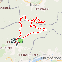
Trail Walking of 15.4 km to be discovered at Bourgogne-Franche-Comté, Haute-Saône, Ronchamp. This trail is proposed by ballet.

Description

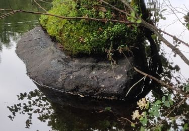
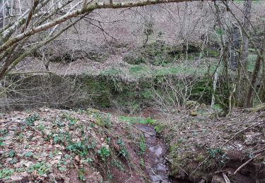
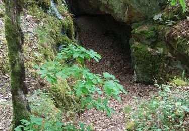
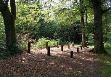
Promenade très ombragée dans les vosges-saônoises ou la forêt est omnie présente

Elevation profile

Positioning

Country:
France
Region :
Bourgogne-Franche-Comté
Department/Province :
Haute-Saône
Municipality :
Ronchamp
Location:
Unknown
Start:(UTM)
322745 ; 5287508 (32T) N.

Trails nearby

Trail Walking Ronchamp - le tour par la chapelle Ronchamp - Photo
Walking
ebihr4

Walking

Easy
(1)
Ronchamp, Bourgogne-Franche-Comté, Haute-Saône, France
4.2 km | 5.8 km-effort
1h 16min
Yes
Trail Mountain bike Mélisey - 1000 2tangs 54km 935ml - Photo
Mountain bike
qlqin

Mountain bike

Difficult
(1)
Mélisey, Bourgogne-Franche-Comté, Haute-Saône, France
53 km | 68 km-effort
4h 20min
Yes
Trail Walking Ronchamp - Ronchamp - Chapelle ND du Haut - sentier de l'Etançon (puits de mines) - Photo
Walking
Bart2015

Walking

Difficult
Ronchamp, Bourgogne-Franche-Comté, Haute-Saône, France
10.3 km | 13.6 km-effort
3h 5min
Yes
Trail Walking Champagney - Canal souterrain de la Haute-Saône - Photo
Walking
Bart2015

Walking

Difficult
Champagney, Bourgogne-Franche-Comté, Haute-Saône, France
10.1 km | 13.4 km-effort
3h 3min
Yes
Trail Walking Mélisey - melissey - Photo
Walking
tessy74

Walking

Medium
Mélisey, Bourgogne-Franche-Comté, Haute-Saône, France
9.4 km | 11.7 km-effort
3h 52min
Yes
Trail Walking Champagney - Champagney - canal de la Haute-Saône - tunnel - Photo
Walking
Bart2015

Walking

Medium
Champagney, Bourgogne-Franche-Comté, Haute-Saône, France
5.5 km | 7.5 km-effort
1h 10min
Yes
Trail Walking Mélisey - Melisey 1000 Étangs - Photo
Walking
Christophechipeaux

Walking

Medium
(1)
Mélisey, Bourgogne-Franche-Comté, Haute-Saône, France
19 km | 24 km-effort
3h 19min
Yes
Trail Walking Saint-Barthélemy - St Barthélémy - les mines du Mont de Vannes - Photo
Walking
Bart2015

Walking

Easy
Saint-Barthélemy, Bourgogne-Franche-Comté, Haute-Saône, France
4.1 km | 6.1 km-effort
1h 17min
Yes
Trail Walking Champagney - parcours sportif des Épaisses à Champagney - Photo
Walking
Sugg

Walking

Easy
Champagney, Bourgogne-Franche-Comté, Haute-Saône, France
1.7 km | 2 km-effort
36min
Yes


Close
My subscriptions