


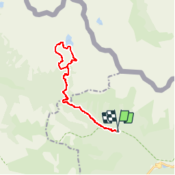


13.3 km | 20 km-effort


User


FREE GPS app for hiking
 SityTrail
IGN / Geographical institutes
SityTrail World
The world is yours!
Trail Walking of 16.6 km to be discovered at Provence-Alpes-Côte d'Azur, Maritime Alps, Saint-Martin-Vésubie. This trail is proposed by patsure.
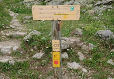
Passage hors sentier difficile.


Walking
Walking

Walking

On foot
On foot

On foot

On foot

Walking
Walking
Super appli pour faire des randos.
Très très bien !