Trail Walking Bouxwiller - Forêt Uttwiller / Bouxwiller - Photo

Forêt Uttwiller / Bouxwiller

 baggera
baggera

User

© OpenStreetMap contributors
Length
Length
3.4 km
Max alt
Max alt
268 m
Uphill gradient
Uphill gradient
46 m
Km-Effort
Km-Effort  
4.1 km
Min alt
Min alt
228 m
Downhill gradient
Downhill gradient
56 m
Boucle
Boucle
Yes
Creation date :
2014-12-10 00:00:00.0
Updated on :
2014-12-10 00:00:00.0

(0 Reviews)

Walking
Walking
57m
Difficulty : Very easy

Scan this QR Code to open this trail in the SityTrail application

FREE GPS app for hiking

Logo SityTrail SityTrail

IGN / Geographical institutes

Download SityTrail from the App Store Download SityTrail from Google Play

Logo SityTrail SityTrail World

The world is yours!

Download SityTrail from the App Store Download SityTrail from Google Play Download SityTrail on Huawei AppGallery

About

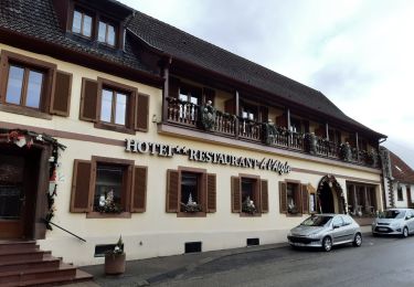
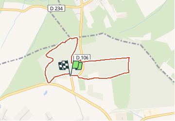
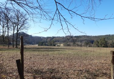
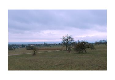
Trail Walking of 3.4 km to be discovered at Grand Est, Bas-Rhin, Bouxwiller. This trail is proposed by baggera.

Description

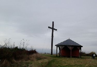
Signaletique club Vosgien : rond jaune, puis cerle jaune après avoir retraversé la route.
         

Elevation profile

Positioning

Country:
France
Region :
Grand Est
Department/Province :
Bas-Rhin
Municipality :
Bouxwiller
Location:
Unknown
Start:(UTM)
388876 ; 5410535 (32U) N.

Trails nearby

Trail Walking Ingwiller - boucle Ingwiller /Lichtemberg - Photo
Walking
LUTZMarc

Walking

Medium
Ingwiller, Grand Est, Bas-Rhin, France
20 km | 27 km-effort
5h 9min
Yes
Trail On foot Bouxwiller - Sentier Géologique / Sentier des Chortens - Photo
On foot
PRO

On foot

Easy
Bouxwiller, Grand Est, Bas-Rhin, France
5.8 km | 7.6 km-effort
1h 42min
Yes
Trail Walking Bouxwiller - Boucle Imbsheim Blastberg - Photo
Walking
zazie

Walking

Easy
Bouxwiller, Grand Est, Bas-Rhin, France
7.4 km | 9.3 km-effort
1h 51min
Yes
Trail Walking Bouxwiller - Boucle Imbsheim Blastberg - Photo
Walking
zazie

Walking

Easy
Bouxwiller, Grand Est, Bas-Rhin, France
7.4 km | 9.3 km-effort
1h 51min
Yes
Trail Walking Bouxwiller - sentier geologique du Batsberg - Photo
Walking
fbertrand

Walking

Medium
Bouxwiller, Grand Est, Bas-Rhin, France
6 km | 7.8 km-effort
2h 31min
Yes
Trail Walking Bouxwiller - De Bouxwiller à Saverne - Photo
Walking
tracegps

Walking

Difficult
Bouxwiller, Grand Est, Bas-Rhin, France
21 km | 28 km-effort
5h 0min
No
Trail Horseback riding Ingwiller - Chemin Chateaux 03 Ingwiller ErnolsheimLesSaverne - Photo
Horseback riding
GUIDE+

Horseback riding

Difficult
Ingwiller, Grand Est, Bas-Rhin, France
28 km | 38 km-effort
5h 3min
No
Trail Horseback riding Ingwiller - Circuit Alsace Moselle Ingwiller Soucht - Photo
Horseback riding
GUIDE+

Horseback riding

Difficult
Ingwiller, Grand Est, Bas-Rhin, France
26 km | 35 km-effort
4h 39min
No
Trail Walking Ingwiller - 67 Ingwiller - Photo
Walking
LUTZMarc

Walking

Medium
Ingwiller, Grand Est, Bas-Rhin, France
55 km | 70 km-effort
5h 6min
No


Close
My subscriptions