Trail Walking Mont Lozère et Goulet - Sources du Tarn - Photo
 sphinkie
sphinkie

User

© OpenStreetMap contributors
Length
Length
18.2 km
Max alt
Max alt
1577 m
Uphill gradient
Uphill gradient
371 m
Km-Effort
Km-Effort  
23 km
Min alt
Min alt
1348 m
Downhill gradient
Downhill gradient
369 m
Boucle
Boucle
Yes
Creation date :
2014-12-10 00:00:00.0
Updated on :
2014-12-10 00:00:00.0

(0 Reviews)

Walking
Walking
4h57
Difficulty : Easy

Scan this QR Code to open this trail in the SityTrail application

FREE GPS app for hiking

Logo SityTrail SityTrail

IGN / Geographical institutes

Download SityTrail from the App Store Download SityTrail from Google Play

Logo SityTrail SityTrail World

The world is yours!

Download SityTrail from the App Store Download SityTrail from Google Play Download SityTrail on Huawei AppGallery

About

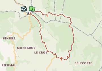
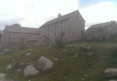
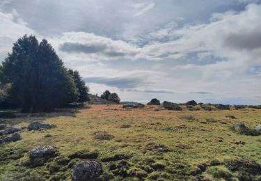
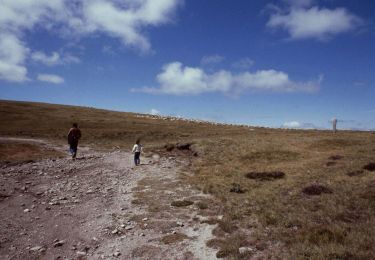
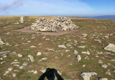
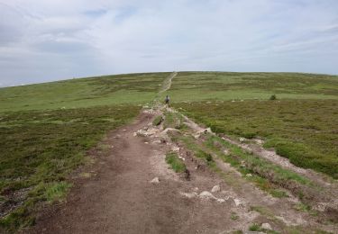
Trail Walking of 18.2 km to be discovered at Occitania, Lozère, Mont Lozère et Goulet. This trail is proposed by sphinkie.

Description

6h:30 | 18.1km A/R

6h:30 | 18.1km A/R
Longueur - 18.1km
Points - 715
Créé - 2012-08-03 09:30:37
Vitesse Max - 127km/h
Altitude Min - 1404m
Altitude Max - 1628m

Elevation profile

Positioning

Country:
France
Region :
Occitania
Department/Province :
Lozère
Municipality :
Mont Lozère et Goulet
Location:
Mas-d'Orcières
Start:(UTM)
561236 ; 4919242 (31T) N.

Trails nearby

Trail Walking Pont de Montvert - Sud Mont Lozère - Finiels/ sommet / station du Bleymard en boucle - Photo
Walking
GUIDE
nadinebondoux

Walking

Difficult
Pont de Montvert - Sud Mont Lozère, Occitania, Lozère, France
20 km | 30 km-effort
5h 38min
Yes
Trail Walking Pont de Montvert - Sud Mont Lozère - Cévennes Mas Camargues Pont du Tarn - Photo
Walking
HO49

Walking

Easy
(1)
Pont de Montvert - Sud Mont Lozère, Occitania, Lozère, France
7.4 km | 8.6 km-effort
2h 7min
Yes
Trail Walking Mont Lozère et Goulet - sources du tarn - Photo
Walking
olivier78000

Walking

Medium
(1)
Mont Lozère et Goulet, Occitania, Lozère, France
13.3 km | 17.3 km-effort
3h 50min
No
Trail Electric bike Cubières - ETANG DE BARANDON PAR LA STATION DE SKI - Photo
Electric bike
asclier0

Electric bike

Medium
Cubières, Occitania, Lozère, France
31 km | 36 km-effort
2h 11min
Yes
Trail On foot Pont de Montvert - Sud Mont Lozère - Sentier de Mas Camargues - Photo
On foot
PRO

On foot

Easy
Pont de Montvert - Sud Mont Lozère, Occitania, Lozère, France
3.1 km | 3.9 km-effort
52min
Yes
Trail On foot Pont de Montvert - Sud Mont Lozère - chemin de Malevrère - Photo
On foot
PRO

On foot

Easy
Pont de Montvert - Sud Mont Lozère, Occitania, Lozère, France
3.1 km | 4.4 km-effort
1h 0min
No
Trail Walking Mont Lozère et Goulet - Le Finiels - Photo
Walking
richardsimopons

Walking

Difficult
Mont Lozère et Goulet, Occitania, Lozère, France
9 km | 12.3 km-effort
2h 33min
Yes
Trail Walking Mont Lozère et Goulet - 210617 - Mont Lozère  - Photo
Walking
randodan

Walking

Easy
Mont Lozère et Goulet, Occitania, Lozère, France
7.1 km | 9.3 km-effort
1h 22min
Yes
Trail Equestrian Mont Lozère et Goulet - Le Chalet du Mont Lozère - Auriac  - Photo
Equestrian
alfreson

Equestrian

Medium
Mont Lozère et Goulet, Occitania, Lozère, France
24 km | 30 km-effort
4h 49min
No


Close
My subscriptions