Trail Walking Wambrechies - wambrechies quesnois - Photo

wambrechies quesnois

© OpenStreetMap contributors
Length
Length
10.7 km
Max alt
Max alt
20 m
Uphill gradient
Uphill gradient
47 m
Km-Effort
Km-Effort  
11.4 km
Min alt
Min alt
8 m
Downhill gradient
Downhill gradient
48 m
Boucle
Boucle
Yes
Creation date :
2014-12-10 00:00:00.0
Updated on :
2014-12-10 00:00:00.0

(1 Reviews)

Walking
Walking
2h31
Difficulty : Easy

Scan this QR Code to open this trail in the SityTrail application

FREE GPS app for hiking

Logo SityTrail SityTrail

IGN / Geographical institutes

Download SityTrail from the App Store Download SityTrail from Google Play

Logo SityTrail SityTrail World

The world is yours!

Download SityTrail from the App Store Download SityTrail from Google Play Download SityTrail on Huawei AppGallery

About

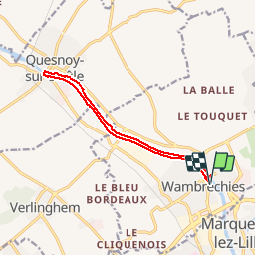
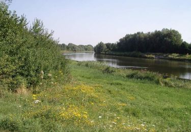
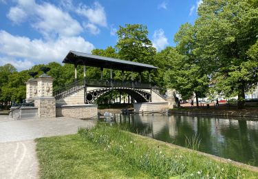
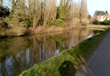
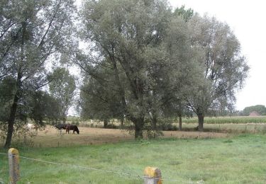
Trail Walking of 10.7 km to be discovered at Hauts-de-France, Nord, Wambrechies. This trail is proposed by Bernard.voyageur.

Description

du parking Robersart à Wambrechies au Quesnoy sur Deûle et retour

Elevation profile

Positioning

Country:
France
Region :
Hauts-de-France
Department/Province :
Nord
Municipality :
Wambrechies
Location:
Unknown
Start:(UTM)
503845 ; 5614987 (31U) N.

Comments

Please log in to post a review or rate the element


Jolis parcours mélangeant canal et parc. Merci pour ce partage


Trails nearby

Trail Cycle Wambrechies - La Deule canalisée - Wambrechies - Photo
Cycle
tracegps

Cycle

Medium
(2)
Wambrechies, Hauts-de-France, Nord, France
40 km | 43 km-effort
2h 30min
Yes
Trail Walking Quesnoy-sur-Deûle - Circuit du grand Perne - Quesnoy-sur-Deule - Photo
Walking
tracegps

Walking

Medium
(2)
Quesnoy-sur-Deûle, Hauts-de-France, Nord, France
10.6 km | 11.1 km-effort
2h 40min
Yes
Trail Walking Wambrechies - Circuit du Genièvre - Wambrechies - Photo
Walking
tracegps

Walking

Medium
(2)
Wambrechies, Hauts-de-France, Nord, France
13.3 km | 14.2 km-effort
3h 15min
Yes
Trail Mountain bike Lambersart - Deûle et ses campagnes - Photo
Mountain bike
nicowear

Mountain bike

Easy
(2)
Lambersart, Hauts-de-France, Nord, France
24 km | 25 km-effort
1h 25min
Yes
Trail Walking Lille - Lille 9,5 km - Photo
Walking
GUIDE
rvapeldo

Walking

Easy
Lille, Hauts-de-France, Nord, France
10.3 km | 11.3 km-effort
4h 24min
Yes
Trail Walking Lille - Lille Citadelle parcs remparts centre 12,5  km - Photo
Walking
GUIDE
rvapeldo

Walking

Easy
Lille, Hauts-de-France, Nord, France
13.2 km | 14.5 km-effort
4h 53min
Yes
Trail Walking Bondues - Bondue 18/02/17 - Photo
Walking
roclem421

Walking

Easy
Bondues, Hauts-de-France, Nord, France
12.2 km | 13.1 km-effort
2h 53min
Yes
Trail Walking Verlinghem - Le chemin des Templiers - Verlinghem - Photo
Walking
tracegps

Walking

Easy
(1)
Verlinghem, Hauts-de-France, Nord, France
5.8 km | 6.3 km-effort
1h 30min
Yes
Trail Walking Marcq-en-Barœul - Circuit des trois villes  -  Marcq-en-Baroeul - Photo
Walking
tracegps

Walking

Medium
Marcq-en-Barœul, Hauts-de-France, Nord, France
13.2 km | 14.4 km-effort
3h 15min
Yes


Close
My subscriptions