Trail Walking Ancizan - Lac d'Arou - Payolle - Photo

Lac d'Arou - Payolle

 tracegps
tracegps

User

© OpenStreetMap contributors
Length
Length
9.8 km
Max alt
Max alt
1868 m
Uphill gradient
Uphill gradient
385 m
Km-Effort
Km-Effort  
14.9 km
Min alt
Min alt
1547 m
Downhill gradient
Downhill gradient
385 m
Boucle
Boucle
Yes
Creation date :
2014-12-10 00:00:00.0
Updated on :
2014-12-10 00:00:00.0

(4 Reviews)

Walking
Walking
3h30
Difficulty : Medium

Scan this QR Code to open this trail in the SityTrail application

FREE GPS app for hiking

Logo SityTrail SityTrail

IGN / Geographical institutes

Download SityTrail from the App Store Download SityTrail from Google Play

Logo SityTrail SityTrail World

The world is yours!

Download SityTrail from the App Store Download SityTrail from Google Play Download SityTrail on Huawei AppGallery

About

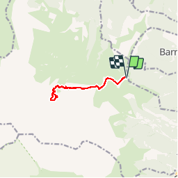
Trail Walking of 9.8 km to be discovered at Occitania, Hautespyrenees, Ancizan. This trail is proposed by tracegps.

Description

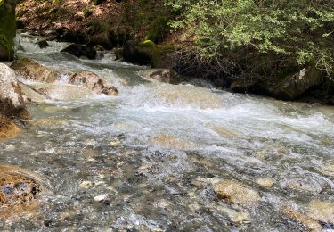
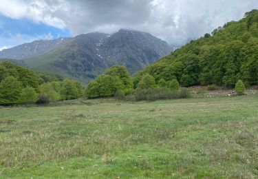
Départ depuis la Hourquette d'Ancizan. On suit un chemin à flanc de montagne pour aboutir au lac d'Arou. Zone pastorale. Le lac est situé au pied du cirque de Monfaucon dominé par le pic du même nom, celui de Bassia et l'Arbizon. Se promener un peu au dessus du lac en direction du fond du cirque pour observer les nombreuses marmottes.

Elevation profile

Photos

Positioning

Country:
France
Region :
Occitania
Department/Province :
Hautespyrenees
Municipality :
Ancizan
Location:
Unknown
Start:(UTM)
280028 ; 4753244 (31T) N.

Comments

Please log in to post a review or rate the element


parcours assez facile.


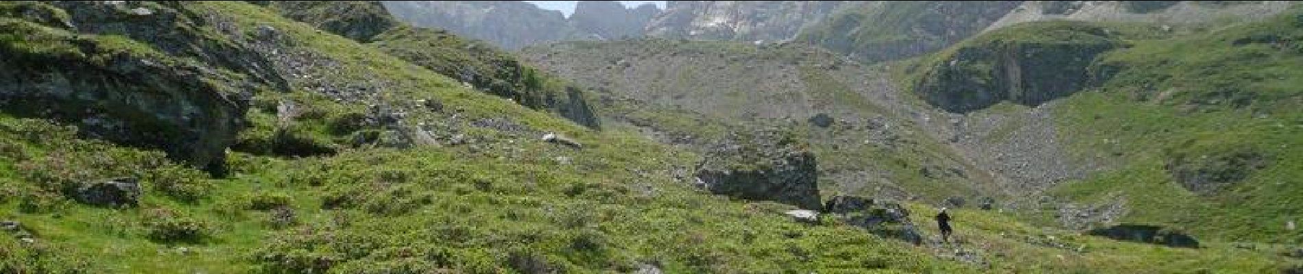
pour monter au pieds des falaises passer par la droite. A noter la présence d'un groupe d'izards dans le cirque.


bon


Trails nearby

Trail On foot Campan - Boucle d'Espiadet - Photo
On foot
PRO

On foot

Easy
Campan, Occitania, Hautespyrenees, France
4.2 km | 6.3 km-effort
1h 25min
No
Trail Walking Ancizan - Soum de Coste Oueillère - Photo
Walking
GUIDE
lhomme.ph

Walking

Difficult
(1)
Ancizan, Occitania, Hautespyrenees, France
9.6 km | 23 km-effort
4h 26min
Yes
Trail Snowshoes Campan - raquet 1 - Photo
Snowshoes
eliott3

Snowshoes

Easy
(1)
Campan, Occitania, Hautespyrenees, France
4.9 km | 7.2 km-effort
2h 10min
Yes
Trail Walking Campan - payolle - Photo
Walking
yfouldrin

Walking

Very easy
(1)
Campan, Occitania, Hautespyrenees, France
6.5 km | 8.2 km-effort
1h 52min
Yes
Trail Walking Ancizan - CAMPAN/PAYOLLE le sarrouat les huîtres et les Esclozes
Walking
GUIDE
marmotte65

Walking

Medium
Ancizan, Occitania, Hautespyrenees, France
8 km | 11.1 km-effort
2h 31min
Yes
Trail Walking Ancizan - Les Granges esclozes - Photo
Walking
fred47

Walking

Easy
Ancizan, Occitania, Hautespyrenees, France
30 km | 36 km-effort
2h 49min
No
Trail Mountain bike Arreau - Col d’Aspin - Photo
Mountain bike
fred47

Mountain bike

Difficult
Arreau, Occitania, Hautespyrenees, France
14.6 km | 23 km-effort
3h 23min
Yes
Trail Walking Campan - Fred et lolo  - Photo
Walking
fred47

Walking

Easy
Campan, Occitania, Hautespyrenees, France
4.2 km | 5.6 km-effort
2h 2min
Yes
Trail Snowshoes Ancizan - Payolle Marche raquettes - Photo
Snowshoes
Forsans

Snowshoes

Medium
Ancizan, Occitania, Hautespyrenees, France
11.4 km | 15.6 km-effort
3h 3min
No


Close
My subscriptions