Trail Mountain bike Saint-Martin-d'Uriage - VTT aux Seiglières - Uriage Les Bains - Photo

VTT aux Seiglières - Uriage Les Bains

 tracegps
tracegps

User

© OpenStreetMap contributors
Length
Length
23 km
Max alt
Max alt
1163 m
Uphill gradient
Uphill gradient
972 m
Km-Effort
Km-Effort  
36 km
Min alt
Min alt
408 m
Downhill gradient
Downhill gradient
969 m
Boucle
Boucle
Yes
Creation date :
2014-12-10 00:00:00.0
Updated on :
2014-12-10 00:00:00.0

(0 Reviews)

Mountain bike
Mountain bike
3h15
Difficulty : Difficult

Scan this QR Code to open this trail in the SityTrail application

FREE GPS app for hiking

Logo SityTrail SityTrail

IGN / Geographical institutes

Download SityTrail from the App Store Download SityTrail from Google Play

Logo SityTrail SityTrail World

The world is yours!

Download SityTrail from the App Store Download SityTrail from Google Play Download SityTrail on Huawei AppGallery

About

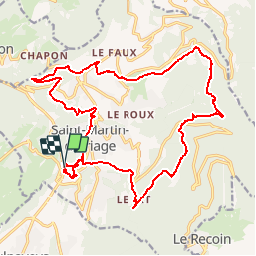
Trail Mountain bike of 23 km to be discovered at Auvergne-Rhône-Alpes, Isère, Saint-Martin-d'Uriage. This trail is proposed by tracegps.

Description

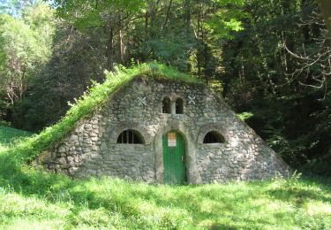
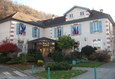
Circuit 25k 950m de dénivelée. Départ: Uriage, St Martin d'Uriage, Le Rossin, ferme la Rivoire, Champ Roti, St Nizier d'Uriage, La Ronziére, Pinet, Croix du Pinet, Etang des Marais Chaud, Les Seigliéres, Refuge du Marais, Uriage.

Elevation profile

Photos

Positioning

Country:
France
Region :
Auvergne-Rhône-Alpes
Department/Province :
Isère
Municipality :
Saint-Martin-d'Uriage
Location:
Unknown
Start:(UTM)
722452 ; 5002862 (31T) N.

Trails nearby

Trail Walking Chamrousse - Boucle Roche Béranger - lacs Robert - Chamrousse - Photo
Walking
tracegps

Walking

Medium
(1)
Chamrousse, Auvergne-Rhône-Alpes, Isère, France
11.4 km | 20 km-effort
4h 30min
Yes
Trail On foot Saint-Martin-d'Uriage - Circuit des Curistes - Photo
On foot
PRO

On foot

Easy
Saint-Martin-d'Uriage, Auvergne-Rhône-Alpes, Isère, France
5.9 km | 7.8 km-effort
1h 46min
Yes
Trail On foot Saint-Martin-d'Uriage - Circuit des Crêtes - Photo
On foot
PRO

On foot

Easy
Saint-Martin-d'Uriage, Auvergne-Rhône-Alpes, Isère, France
9.5 km | 13.6 km-effort
3h 5min
Yes
Trail On foot Saint-Martin-d'Uriage - Circuit du Bit - Photo
On foot
PRO

On foot

Easy
Saint-Martin-d'Uriage, Auvergne-Rhône-Alpes, Isère, France
9.1 km | 16.3 km-effort
3h 41min
Yes
Trail On foot Saint-Martin-d'Uriage - Balcon de Combeloup - Photo
On foot
PRO

On foot

Easy
Saint-Martin-d'Uriage, Auvergne-Rhône-Alpes, Isère, France
9.4 km | 15.1 km-effort
3h 25min
Yes
Trail On foot Gières - De Gières au col du Gourlu - Photo
On foot
PRO

On foot

Easy
Gières, Auvergne-Rhône-Alpes, Isère, France
6.2 km | 10.5 km-effort
2h 22min
No
Trail Walking Chamrousse - lacs Robert  - Photo
Walking
marshall44

Walking

Medium
(1)
Chamrousse, Auvergne-Rhône-Alpes, Isère, France
9.2 km | 21 km-effort
5h 0min
Yes
Trail Walking Vaulnaveys-le-Haut - col de la botte - Photo
Walking
Youcef Atallah

Walking

Very difficult
Vaulnaveys-le-Haut, Auvergne-Rhône-Alpes, Isère, France
11 km | 19.4 km-effort
3h 3min
No
Trail Nordic walking Jarrie - Mon chabou -haut jarret  - Photo
Nordic walking
Youcef Atallah

Nordic walking

Very easy
Jarrie, Auvergne-Rhône-Alpes, Isère, France
10.2 km | 14.6 km-effort
2h 21min
Yes


Close
My subscriptions