


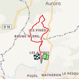

9.8 km | 12 km-effort


User


FREE GPS app for hiking
 SityTrail
IGN / Geographical institutes
SityTrail World
The world is yours!
Trail Walking of 6 km to be discovered at Provence-Alpes-Côte d'Azur, Bouches-du-Rhône, Pélissanne. This trail is proposed by jm_benard.
Balade de Pelissanne vers Auron
Walking

Other activity

Mountain bike

Walking
Other activity

Walking
Walking

Mountain bike
Walking
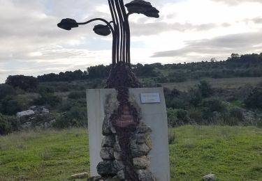
Une jolie petite balade à faire en famille avec en prime un beau panorama sur Pélissane et ses environs