Trail Walking Méthamis - grotte beaumaniere methamis - Photo

grotte beaumaniere methamis

© OpenStreetMap contributors
Length
Length
1.2 km
Max alt
Max alt
353 m
Uphill gradient
Uphill gradient
14 m
Km-Effort
Km-Effort  
1.6 km
Min alt
Min alt
263 m
Downhill gradient
Downhill gradient
82 m
Boucle
Boucle
No
Creation date :
2014-12-10 00:00:00.0
Updated on :
2014-12-10 00:00:00.0

(1 Reviews)

Walking
Walking
21m
Difficulty : Easy

Scan this QR Code to open this trail in the SityTrail application

FREE GPS app for hiking

Logo SityTrail SityTrail

IGN / Geographical institutes

Download SityTrail from the App Store Download SityTrail from Google Play

Logo SityTrail SityTrail World

The world is yours!

Download SityTrail from the App Store Download SityTrail from Google Play Download SityTrail on Huawei AppGallery

About

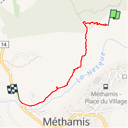
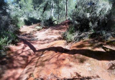
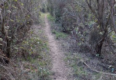
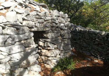
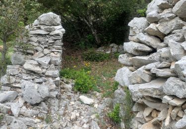
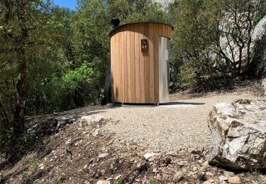
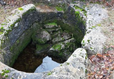
Trail Walking of 1.2 km to be discovered at Provence-Alpes-Côte d'Azur, Vaucluse, Méthamis. This trail is proposed by d.jeanjean.

Description

départ avant le pont sur la Nesque  sur la route a gauche

Elevation profile

Positioning

Country:
France
Region :
Provence-Alpes-Côte d'Azur
Department/Province :
Vaucluse
Municipality :
Méthamis
Location:
Unknown
Start:(UTM)
678363 ; 4876437 (31T) N.

Comments

Please log in to post a review or rate the element


Trails nearby

Trail Walking Villes-sur-Auzon - villes sur auzon - Photo
Walking
Vero7684

Walking

Difficult
(1)
Villes-sur-Auzon, Provence-Alpes-Côte d'Azur, Vaucluse, France
22 km | 31 km-effort
6h 18min
Yes
Trail Walking Villes-sur-Auzon - LES ESCAMPEAUX - Photo
Walking
FLORENSAC

Walking

Medium
(1)
Villes-sur-Auzon, Provence-Alpes-Côte d'Azur, Vaucluse, France
14.9 km | 21 km-effort
4h 50min
Yes
Trail Walking Méthamis - De Méthamis au four à chaux par la Gorge de la Nesque - Photo
Walking
tracegps

Walking

Medium
(1)
Méthamis, Provence-Alpes-Côte d'Azur, Vaucluse, France
12.7 km | 16.9 km-effort
4h 30min
Yes
Trail Walking Mormoiron - Boucle des ocres du ravin des Sitos - Photo
Walking
rigol05

Walking

Medium
Mormoiron, Provence-Alpes-Côte d'Azur, Vaucluse, France
7.5 km | 10.4 km-effort
2h 15min
Yes
Trail Walking Mazan - Boucle NdA - Photo
Walking
supercolas

Walking

Medium
Mazan, Provence-Alpes-Côte d'Azur, Vaucluse, France
11.6 km | 16.8 km-effort
3h 4min
Yes
Trail Walking Blauvac - Passichaud Bergerie Pas du loup - Photo
Walking
supercolas

Walking

Easy
Blauvac, Provence-Alpes-Côte d'Azur, Vaucluse, France
7.5 km | 10.4 km-effort
2h 17min
Yes
Trail Walking Murs - Col de murs - Photo
Walking
Lionel DAVIN

Walking

Difficult
Murs, Provence-Alpes-Côte d'Azur, Vaucluse, France
13.4 km | 17.7 km-effort
2h 25min
Yes
Trail Walking Villes-sur-Auzon - Contreforts du ventoux  - Photo
Walking
Lionel DAVIN

Walking

Difficult
Villes-sur-Auzon, Provence-Alpes-Côte d'Azur, Vaucluse, France
13.3 km | 18.9 km-effort
2h 43min
Yes
Trail Walking Villes-sur-Auzon - Villes sur auzon /Bergerie de PIE GROS/LA LAUZE - Photo
Walking
FLORENSAC

Walking

Medium
Villes-sur-Auzon, Provence-Alpes-Côte d'Azur, Vaucluse, France
14.3 km | 20 km-effort
5h 17min
Yes


Close
My subscriptions