Trail Cycle Échauffour - EchauSolignyEvroult - Photo

EchauSolignyEvroult

© OpenStreetMap contributors
Length
Length
73 km
Max alt
Max alt
333 m
Uphill gradient
Uphill gradient
937 m
Km-Effort
Km-Effort  
85 km
Min alt
Min alt
166 m
Downhill gradient
Downhill gradient
929 m
Boucle
Boucle
Yes
Creation date :
2014-12-10 00:00:00.0
Updated on :
2014-12-10 00:00:00.0

(0 Reviews)

Cycle
Cycle
3h00
Difficulty : Easy

Scan this QR Code to open this trail in the SityTrail application

FREE GPS app for hiking

Logo SityTrail SityTrail

IGN / Geographical institutes

Download SityTrail from the App Store Download SityTrail from Google Play

Logo SityTrail SityTrail World

The world is yours!

Download SityTrail from the App Store Download SityTrail from Google Play Download SityTrail on Huawei AppGallery

About

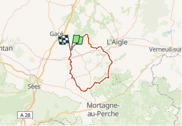
Trail Cycle of 73 km to be discovered at Normandy, Orne, Échauffour. This trail is proposed by sylvain75.

Description

Echauffour - Soligny - Aube - St Evroult.
Tracé sur petite route excepté une portion de 5 kms un peu plus fréquenté. Pas de difficultés majeures.

Elevation profile

Positioning

Country:
France
Region :
Normandy
Department/Province :
Orne
Municipality :
Échauffour
Location:
Unknown
Start:(UTM)
307217 ; 5400850 (31U) N.

Trails nearby

Trail Car La Genevraie - 2023-03-01 maheru Vdu P - Photo
Car
patrick2m

Car

La Genevraie, Normandy, Orne, France
43 km | 49 km-effort
2h 30min
No
Trail 4x4 Orgères - orgere 1 2021 - Photo
4x4
didier76

4x4

Very easy
Orgères, Normandy, Orne, France
38 km | 48 km-effort
3h 15min
Yes
Trail Other activity Échauffour - Basse Normandie - Ligne 402 - Sainte-Gauburge - Mesnil-Mauger - Photo
Other activity
mich54

Other activity

Very easy
Échauffour, Normandy, Orne, France
61 km | 66 km-effort
5min
No
Trail Other activity Échauffour - Haute Normandie - Ligne 400 - Echauffour - Bernay (Section de Echauffour à la limite Eure/Orne) 1 - Photo
Other activity
mich54

Other activity

Very easy
Échauffour, Normandy, Orne, France
18.7 km | 21 km-effort
5min
No
Trail Cycle Échauffour - Autour de Gacé - Photo
Cycle
sylvain75

Cycle

Medium
Échauffour, Normandy, Orne, France
69 km | 80 km-effort
4h 38min
Yes
Trail Walking Cisai-Saint-Aubin - Cisai St Aubin (boucle) - Photo
Walking
neitag61

Walking

Easy
Cisai-Saint-Aubin, Normandy, Orne, France
5.1 km | 6.8 km-effort
1h 40min
Yes
Trail 4x4 Orgères - orgeres  - Photo
4x4
didier76

4x4

Very easy
Orgères, Normandy, Orne, France
44 km | 53 km-effort
3h 7min
Yes
Trail sport Orgères - THN22J1 -200kg ou pilote confirme - Photo
sport
Beaudet Franck

sport

Very easy
Orgères, Normandy, Orne, France
141 km | 170 km-effort
Unknown
Yes
Trail 4x4 Orgères - orgere 2 2021 - Photo
4x4
didier76

4x4

Very easy
Orgères, Normandy, Orne, France
51 km | 63 km-effort
4h 18min
Yes


Close
My subscriptions