


5.6 km | 12.2 km-effort


User


FREE GPS app for hiking
 SityTrail
IGN / Geographical institutes
SityTrail World
The world is yours!
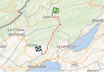
Trail Other activity of 20 km to be discovered at Bern, Bernese Jura administrative district, Saint-Imier. This trail is proposed by Romrando.
Source:geocities.com/romrando - 24.7.05
Gorge sauvage, Chasseral puis Chaumont par la ligne de crête. Magnifique randonnée aux multiples ambiances et aux points de vue continuels sur les Alpes et le Val de Ruz.
Itinéraire : De Neuchâtel par le train (par Bienne ou La Chaux-de-Fonds) rejoindre la gare de St-Imier dans le vallon du même nom.
Passer sous la gare par un petit tunnel puis par une allée pavée gagner le fond du vallon. Contourner un bâtiment-usine par la droite. Le chemin est dès lors bien balisé et vers l''Est gagner la lisière de la forêt (variante indiquée en cas de tir). On rejoint le fond de la Combe Grède et sa réserve naturelle.
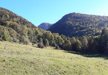
Un premier parcours forestier vous mène au coeur de la réserve au pied de grand à-pics rocheux. La gorge devient sauvage, le sentier se redresse pour franchir quelques ressauts rocheux (échelles). Une suite de lacets serrés vous permet de franchir un grand ressaut dans un magnifique décor. On est ainsi propulsé hors de la gorge, sur une prairie paisible à la croisée de plusieurs chemins (P. 1''277m).
Sur la droite par une petite combe, presque sans transition, on gagne les paturages jurassiens dénudés. Par le chemin des crêtes on atteint alors l''hôtel du Chasseral. (Hôtel-Restaurant ouvert toute l''année en principe / Tel 032 / 751.24.51 ).
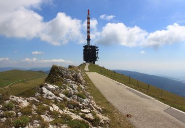
Variante : du pt 1277 m partir par le vallon direction NE puis ENE et gagner la "Métairie de Morat". Partir alors SW pour gagner le Petit Chasseral, franchir une combe et par la route gagner le sommet du Chasseral et son immense relais radio.
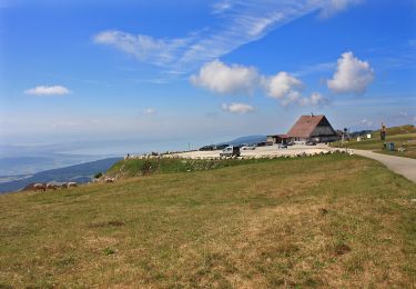
Coup d''oeil infini, mais changement d''ambiance (les beaux jours il y a foule de voitures). De là on ne va plus guère quitter le fil de la crête. On double la "Métairie de l''Ile" (restauration) puis le restaurant de campagne de "Chuffort". La crête prend une direction SSW. Peu après "La Dame" un court parcours sur route vous mène à un parking. Tout de suite à gauche ne pas manquer de reprende le chemin des crêtes . Celui-ci évite par quelques détours combien agréable la petite route goudronnée. On rejoint ainsi la maison des "Trois Cheminées" puis à travers champs, plus loin, la "Métairie d''Hauterive" et enfin par la forêt, la station du funiculaire de Chaumont. Par ce dernier puis par le bus no 7, on rejoint facilement la gare CFF. (Pour une descente à pied, il faut compter encore environ 1h 30)
On foot
On foot
On foot
Walking

Other activity

Walking
Walking
Walking
Other activity