Trail Running Ammelne - tafraout - Photo
 laet
laet

User

© OpenStreetMap contributors
Length
Length
14.2 km
Max alt
Max alt
1215 m
Uphill gradient
Uphill gradient
545 m
Km-Effort
Km-Effort  
21 km
Min alt
Min alt
901 m
Downhill gradient
Downhill gradient
547 m
Boucle
Boucle
Yes
Creation date :
2019-05-26 16:16:14.148
Updated on :
2019-05-26 16:16:15.85

(0 Reviews)

Running
Running
1h30
Difficulty : Medium

Scan this QR Code to open this trail in the SityTrail application

FREE GPS app for hiking

Logo SityTrail SityTrail

IGN / Geographical institutes

Download SityTrail from the App Store Download SityTrail from Google Play

Logo SityTrail SityTrail World

The world is yours!

Download SityTrail from the App Store Download SityTrail from Google Play Download SityTrail on Huawei AppGallery

About

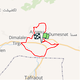
Trail Running of 14.2 km to be discovered at Souss-Massa, cercle de Tafraout, Ammelne. This trail is proposed by laet.

Elevation profile

Positioning

Country:
Morocco
Region :
Souss-Massa
Department/Province :
cercle de Tafraout
Municipality :
Ammelne
Location:
Unknown
Start:(UTM)
503329 ; 3291501 (29R) N.

Trails nearby

Trail Moto cross Tafraout - CIRCULAR_TAFRAOUTE - Photo
Moto cross
jpipacific

Moto cross

Easy
Tafraout, Souss-Massa, Pachalik de Tafraout, Morocco
119 km | 151 km-effort
5h 0min
No
Trail Car Ammelne - 16 fév liaison Tafraout-Amtudi - Photo
Car
michcoq

Car

Very easy
Ammelne, Souss-Massa, cercle de Tafraout, Morocco
108 km | 130 km-effort
Unknown
No
Trail Walking Tafraout - Tafraoute  - Photo
Walking
carole5983

Walking

Very easy
Tafraout, Souss-Massa, Pachalik de Tafraout, Morocco
2.4 km | 3 km-effort
1h 37min
Yes


Close
My subscriptions