Trail Cycle Sainte-Colombe-de-la-Commanderie - Ste Colmbe Ceret Ste Colombe - Photo
 mosse
mosse

User

© OpenStreetMap contributors
Length
Length
43 km
Max alt
Max alt
394 m
Uphill gradient
Uphill gradient
765 m
Km-Effort
Km-Effort  
54 km
Min alt
Min alt
108 m
Downhill gradient
Downhill gradient
780 m
Boucle
Boucle
No
Creation date :
2014-12-10 00:00:00.0
Updated on :
2014-12-10 00:00:00.0

(0 Reviews)

Cycle
Cycle
2h54
Difficulty : Medium

Scan this QR Code to open this trail in the SityTrail application

FREE GPS app for hiking

Logo SityTrail SityTrail

IGN / Geographical institutes

Download SityTrail from the App Store Download SityTrail from Google Play

Logo SityTrail SityTrail World

The world is yours!

Download SityTrail from the App Store Download SityTrail from Google Play Download SityTrail on Huawei AppGallery

About

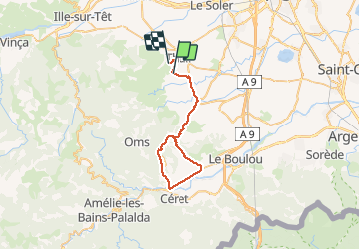
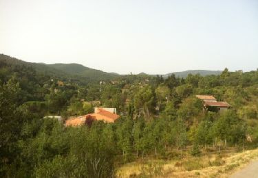
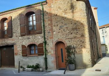
Trail Cycle of 43 km to be discovered at Occitania, Pyrénées-Orientales, Sainte-Colombe-de-la-Commanderie. This trail is proposed by mosse.

Description

Ste Colombe Terrats Fourques Llauro Vives St Jean Pla de Corts Ceret Llauro Ste Colombe
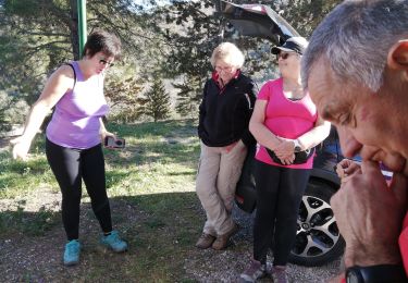
Elevation profile

Positioning

Country:
France
Region :
Occitania
Department/Province :
Pyrénées-Orientales
Municipality :
Sainte-Colombe-de-la-Commanderie
Location:
Unknown
Start:(UTM)
479323 ; 4717950 (31T) N.

Trails nearby

Trail Walking Llupia - 66 LLUPIA - FOURQUES - TERRATS promenade dans les ASPRES et son vignoble  - Photo
Walking
jeff66

Walking

Medium
(1)
Llupia, Occitania, Pyrénées-Orientales, France
15 km | 18.2 km-effort
2h 36min
Yes
Trail Walking Castelnou - CASTELNOU 66 -  CAMELAS - ermitage San Marti de La Roca - Photo
Walking
jeff66

Walking

Difficult
(1)
Castelnou, Occitania, Pyrénées-Orientales, France
10.8 km | 16.7 km-effort
2h 19min
Yes
Trail Walking Thuir - Thuir à Castelnou - Photo
Walking
timousse

Walking

Medium
(1)
Thuir, Occitania, Pyrénées-Orientales, France
14.1 km | 20 km-effort
4h 13min
Yes
Trail Walking Fourques - Fourques  - Photo
Walking
Fildesir

Walking

Very easy
(1)
Fourques, Occitania, Pyrénées-Orientales, France
14.2 km | 16.4 km-effort
5h 17min
Yes
Trail Walking Castelnou - Thuir  - Photo
Walking
Jean-François BALANGER

Walking

Very easy
(1)
Castelnou, Occitania, Pyrénées-Orientales, France
9.3 km | 12.1 km-effort
4h 4min
No
Trail Walking Castelnou - castel nous  - Photo
Walking
Jean-François BALANGER

Walking

Very easy
(1)
Castelnou, Occitania, Pyrénées-Orientales, France
11.9 km | 16.7 km-effort
4h 0min
Yes
Trail Walking Sainte-Colombe-de-la-Commanderie - THUIR 66 - Castelnou - Ste Colombe de la C. - Photo
Walking
jeff66

Walking

Medium
(2)
Sainte-Colombe-de-la-Commanderie, Occitania, Pyrénées-Orientales, France
14.8 km | 21 km-effort
2h 56min
Yes
Trail Walking Montauriol - Montauriol : les points de vue. - Photo
Walking
prehault

Walking

Easy
(4)
Montauriol, Occitania, Pyrénées-Orientales, France
4 km | 5.3 km-effort
1h 8min
Yes
Trail Walking Fourques - fourques sentier des histoires  - Photo
Walking
66Gribouille83

Walking

Medium
Fourques, Occitania, Pyrénées-Orientales, France
9.1 km | 10.9 km-effort
2h 47min
Yes


Close
My subscriptions