Trail Other activity Kerns - Stöckalp Älggi - Photo

Stöckalp Älggi

© OpenStreetMap contributors
Length
Length
6 km
Max alt
Max alt
1861 m
Uphill gradient
Uphill gradient
784 m
Km-Effort
Km-Effort  
14.5 km
Min alt
Min alt
1077 m
Downhill gradient
Downhill gradient
214 m
Boucle
Boucle
No
Creation date :
2014-12-11 00:00:00.0
Updated on :
2014-12-11 00:00:00.0

(0 Reviews)

Other activity
Other activity
--
Difficulty : Unknown

Scan this QR Code to open this trail in the SityTrail application

FREE GPS app for hiking

Logo SityTrail SityTrail

IGN / Geographical institutes

Download SityTrail from the App Store Download SityTrail from Google Play

Logo SityTrail SityTrail World

The world is yours!

Download SityTrail from the App Store Download SityTrail from Google Play Download SityTrail on Huawei AppGallery

About

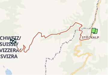
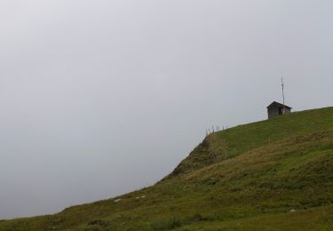
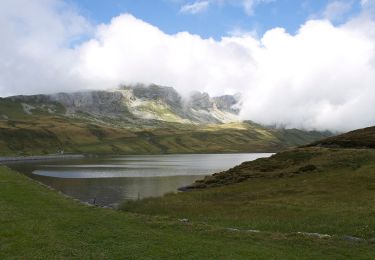
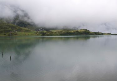
Trail Other activity of 6 km to be discovered at Obwalden, Unknown, Kerns. This trail is proposed by bayardpaul.

Description

La 07:41 20:16
Ol 08:06 20:05
Lu 09:07 19:05
Sa 09:43 18:20
Me 10:06 17:49

Elevation profile

Positioning

Country:
Switzerland
Region :
Obwalden
Department/Province :
Unknown
Municipality :
Kerns
Location:
Unknown
Start:(UTM)
444964 ; 5183449 (32T) N.

Trails nearby

Trail On foot  - Melchsee-Frutt - Tannenalp - Photo
On foot
PRO

On foot

Easy
, Obwalden, , Switzerland
4.3 km | 6.2 km-effort
1h 23min
No
Trail On foot Kerns - Vier-Seen-Wanderung - Photo
On foot
PRO

On foot

Easy
Kerns, Obwalden, Unknown, Switzerland
11.6 km | 18.8 km-effort
4h 17min
No
Trail On foot Kerns - HöWa - Photo
On foot
PRO

On foot

Easy
Kerns, Obwalden, Unknown, Switzerland
10.9 km | 17.8 km-effort
4h 2min
No
Trail Walking  - sf10_e6b_schlechtwetter - Photo
Walking
GUIDE+

Walking

Very easy
, Obwalden, , Switzerland
23 km | 32 km-effort
7h 23min
No
Trail Walking  - sf10_e6b - Photo
Walking
GUIDE+

Walking

Very easy
, Obwalden, , Switzerland
12.4 km | 21 km-effort
5h 5min
No
Trail Walking Innertkirchen - y10_engstlen_taelli - Photo
Walking
GUIDE+

Walking

Very easy
Innertkirchen, Bern, Interlaken-Oberhasli administrative district, Switzerland
7.2 km | 12.5 km-effort
2h 54min
No
Trail Walking  - Mittelpunkt Schweiz - Photo
Walking
GUIDE+

Walking

Very easy
, Obwalden, , Switzerland
20 km | 37 km-effort
Unknown
No
Trail Walking  - vv_melchsee_round - Photo
Walking
GUIDE+

Walking

Very easy
, Obwalden, , Switzerland
17.3 km | 31 km-effort
5h 41min
Yes
Trail Other activity  - Frutt - Tannensee - Bonistock - Photo
Other activity
steger12

Other activity

Very easy
, Obwalden, , Switzerland
9.7 km | 14.1 km-effort
Unknown
Yes


Close
My subscriptions