


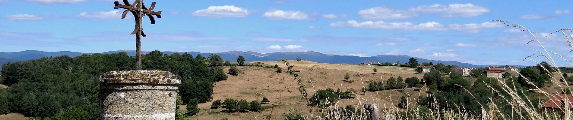
Domaize_Croix_Fourchoux

jagarnier
User GUIDE
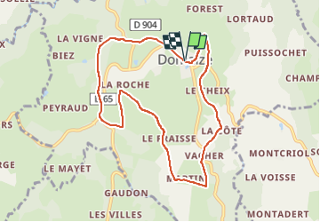

Length
8.8 km

Max alt
652 m

Uphill gradient
211 m
Km-Effort
11.6 km

Min alt
460 m

Downhill gradient
210 m
Boucle
Yes
Creation date :
2018-07-16 10:32:59.214
Updated on :
2022-08-28 15:56:07.894
2h30
Difficulty : Easy

FREE GPS app for hiking
 SityTrail
IGN / Geographical institutes
SityTrail Plus
The world is yours!
About
Trail Walking of 8.8 km to be discovered at Auvergne-Rhône-Alpes, Puy-de-Dôme, Domaize. This trail is proposed by jagarnier.
Photos

Positioning
Country:
France
Region :
Auvergne-Rhône-Alpes
Department/Province :
Puy-de-Dôme
Municipality :
Domaize
Location:
Unknown
Start:(Dec)
Start:(UTM)
541672 ; 5059523 (31T) N.
Comments