Trail Electric bike Penne-d'Agenais - Montflanquin - Photo
 lviallet
lviallet

User

© OpenStreetMap contributors
Length
Length
49 km
Max alt
Max alt
195 m
Uphill gradient
Uphill gradient
621 m
Km-Effort
Km-Effort  
57 km
Min alt
Min alt
51 m
Downhill gradient
Downhill gradient
621 m
Boucle
Boucle
Yes
Creation date :
2019-02-05 19:33:58.679
Updated on :
2019-02-07 17:30:22.616

(0 Reviews)

Electric bike
Electric bike
--
Difficulty : Very easy

Scan this QR Code to open this trail in the SityTrail application

FREE GPS app for hiking

Logo SityTrail SityTrail

IGN / Geographical institutes

Download SityTrail from the App Store Download SityTrail from Google Play

Logo SityTrail SityTrail World

The world is yours!

Download SityTrail from the App Store Download SityTrail from Google Play Download SityTrail on Huawei AppGallery

About

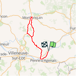
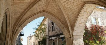
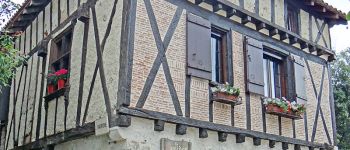
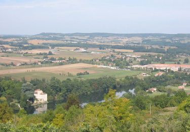
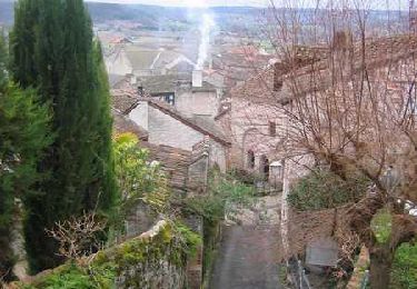
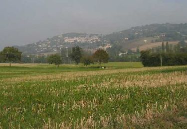
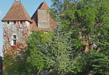
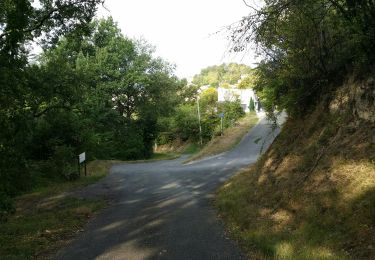
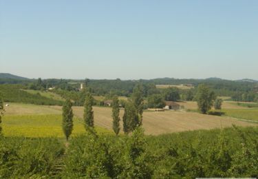
Trail Electric bike of 49 km to be discovered at New Aquitaine, Lot-et-Garonne, Penne-d'Agenais. This trail is proposed by lviallet.

Elevation profile

Photos

Points of interest

Point of interest Monflanquin - Monflanquin - Photo
lviallet
MONFLANQUIN 
Point of interest Pujols - Pujols-le-Haut - Photo
lviallet
Point of interest Penne-d'Agenais - Penne d'Agenais - Photo
lviallet
PENNE-D'AGENAIS 

Positioning

Country:
France
Region :
New Aquitaine
Department/Province :
Lot-et-Garonne
Municipality :
Penne-d'Agenais
Location:
Unknown
Start:(UTM)
328488 ; 4920835 (31T) N.

Trails nearby

Trail Walking Penne-d'Agenais - Penne-d'Agenais, vers le château de Noaillac - Pays de la vallée du Lot - Photo
Walking
tracegps

Walking

Difficult
(2)
Penne-d'Agenais, New Aquitaine, Lot-et-Garonne, France
13 km | 17.8 km-effort
3h 30min
Yes
Trail Mountain bike Penne-d'Agenais - Penne-d'Agenais, sur le plateau Saint-Michel - Pays de la vallée du Lot - Photo
Mountain bike
tracegps

Mountain bike

Difficult
(1)
Penne-d'Agenais, New Aquitaine, Lot-et-Garonne, France
10.5 km | 14.5 km-effort
1h 19min
Yes
Trail Walking Penne-d'Agenais - Magnac, balade autour du Pech de la Citerne - Pays de la vallée du Lot - Photo
Walking
tracegps

Walking

Medium
(1)
Penne-d'Agenais, New Aquitaine, Lot-et-Garonne, France
6.7 km | 8.8 km-effort
2h 0min
Yes
Trail On foot Penne-d'Agenais - Penne-d’Agenais, vers le château de Noaillac - 13,2km - Photo
On foot
PRO

On foot

Easy
Penne-d'Agenais, New Aquitaine, Lot-et-Garonne, France
13.1 km | 17.8 km-effort
4h 2min
Yes
Trail On foot Penne-d'Agenais - Penne-d’Agenais, sur le plateau Saint-Michel -10,7km - Photo
On foot
PRO

On foot

Easy
Penne-d'Agenais, New Aquitaine, Lot-et-Garonne, France
10 km | 13.9 km-effort
3h 8min
Yes
Trail Walking Penne-d'Agenais - La randonnée de Penne d'agenais- Lot et Garonne  - Photo
Walking
alainjoseph6

Walking

Medium
Penne-d'Agenais, New Aquitaine, Lot-et-Garonne, France
7.2 km | 9.8 km-effort
2h 20min
Yes
Trail Mountain bike Penne-d'Agenais - 8142359 track 1522706785 672 - Photo
Mountain bike
sebcar

Mountain bike

Medium
(1)
Penne-d'Agenais, New Aquitaine, Lot-et-Garonne, France
36 km | 45 km-effort
Unknown
Yes
Trail On foot Penne-d'Agenais - Magnac, balade autour du Pech de la Citerne - 7km - Photo
On foot
PRO

On foot

Easy
Penne-d'Agenais, New Aquitaine, Lot-et-Garonne, France
6.8 km | 8.9 km-effort
2h 0min
Yes
Trail Walking Trentels - La balade du coteau de Trentels - Pays de la vallée du Lot - Photo
Walking
tracegps

Walking

Easy
Trentels, New Aquitaine, Lot-et-Garonne, France
6.6 km | 8.8 km-effort
1h 49min
Yes


Close
My subscriptions