A Track-9512-F-S1-F-MNT
Lucienfilippi
User
Length
7.3 km
Max alt
474 m
Uphill gradient
120 m
Km-Effort
8.9 km
Min alt
394 m
Downhill gradient
120 m
Boucle
Yes
Creation date :
2019-02-15 11:02:34.203
Updated on :
2020-07-14 12:48:03.079
1h56
Difficulty : Medium
FREE GPS app for hiking
About
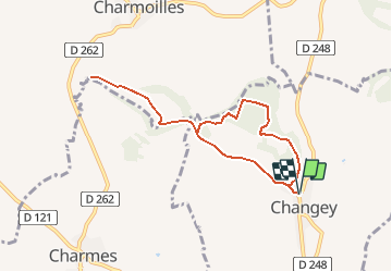
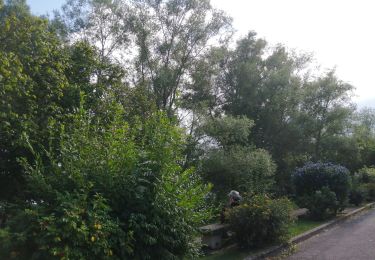
Trail Walking of 7.3 km to be discovered at Grand Est, Haute-Marne, Changey. This trail is proposed by Lucienfilippi.
Description
Belle petite rando bien facile, sans difficulté
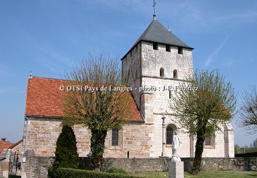
au départ de l'église de Changey près de Langres,
pelouses sèches,
il y avait jusqu'à l'an 2000 un pélerinage annuelle jusquu'à ND du Mt Vengé
Positioning
Country:
France
Region :
Grand Est
Department/Province :
Haute-Marne
Municipality :
Changey
Location:
Unknown
Start:(Dec)
Start:(UTM)
678154 ; 5310863 (31T) N.
Comments
Trails nearby
Les Forts - Neuilly - l'Evêque
Cycle
Difficult
Neuilly-l'Évêque,
Grand Est,
Haute-Marne,
France
51 km | 61 km-effort
4h 15min
Yes
Notre Dame du Mont Vengé - Changey
Mountain bike
Easy
Changey,
Grand Est,
Haute-Marne,
France
7.3 km | 8.9 km-effort
30min
Yes
Notre Dame du Mont Vengé - Changey
Walking
Easy
Changey,
Grand Est,
Haute-Marne,
France
7.3 km | 8.9 km-effort
1h 30min
Yes
La Montagnotte
Mountain bike
Very difficult
Champigny-lès-Langres,
Grand Est,
Haute-Marne,
France
18.5 km | 23 km-effort
2h 30min
Yes
La Montagnotte
Walking
Difficult
Champigny-lès-Langres,
Grand Est,
Haute-Marne,
France
18.5 km | 23 km-effort
5h 0min
Yes
charmes
Walking
Very easy
(1)
Changey,
Grand Est,
Haute-Marne,
France
6.1 km | 7.2 km-effort
1h 12min
Yes
Boucle Champigny Peigney par la Liez
Walking
Champigny-lès-Langres,
Grand Est,
Haute-Marne,
France
13.7 km | 15.7 km-effort
2h 23min
Yes
La montagne de Jorquenay
Walking
Champigny-lès-Langres,
Grand Est,
Haute-Marne,
France
8.1 km | 10 km-effort
1h 20min
Yes
Tour de la Liez depuis champigny
Mountain bike
Champigny-lès-Langres,
Grand Est,
Haute-Marne,
France
25 km | 28 km-effort
1h 43min
Yes
un peu déçue sans grand intérêt