Trail Walking Vieux-Moulin - en forêt de Compiègne_26_la Grotte des Ramoneurs_Tournantes de la Queue de Saint-Etienne et sur la Côte de Roilaye - Photo

en forêt de Compiègne_26_la Grotte des Ramoneurs_Tournantes de la Queue de Saint-Etienne et sur la Côte de Roilaye

mes randos en forêt

© OpenStreetMap contributors
Length
Length
16.1 km
Max alt
Max alt
142 m
Uphill gradient
Uphill gradient
188 m
Km-Effort
Km-Effort  
18.6 km
Min alt
Min alt
64 m
Downhill gradient
Downhill gradient
188 m
Boucle
Boucle
Yes
Creation date :
2019-04-12 06:24:00.0
Updated on :
2019-05-08 13:32:23.747

(0 Reviews)

Walking
Walking
5h28
Difficulty : Difficult

Scan this QR Code to open this trail in the SityTrail application

FREE GPS app for hiking

Logo SityTrail SityTrail

IGN / Geographical institutes

Download SityTrail from the App Store Download SityTrail from Google Play

Logo SityTrail SityTrail World

The world is yours!

Download SityTrail from the App Store Download SityTrail from Google Play Download SityTrail on Huawei AppGallery

About

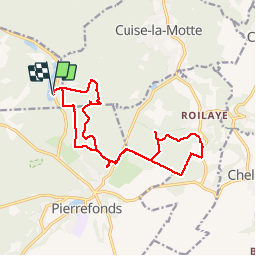
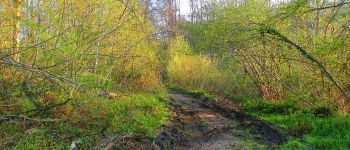
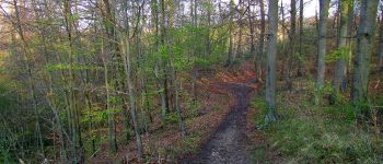
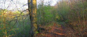
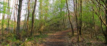
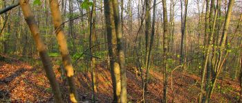
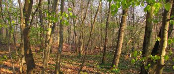
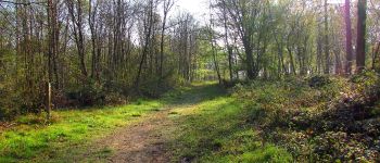
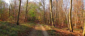
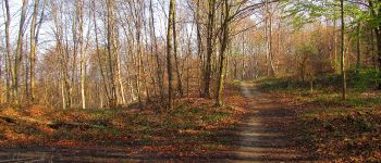
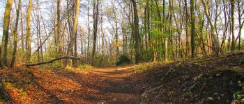
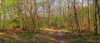
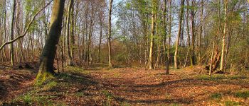
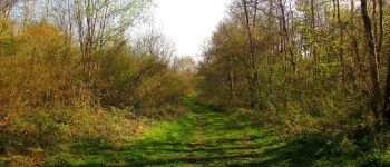
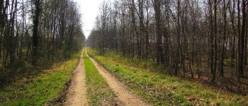
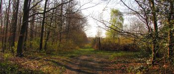
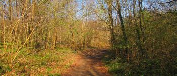
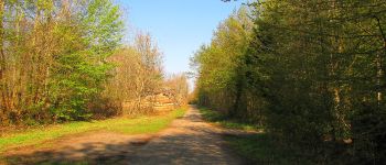
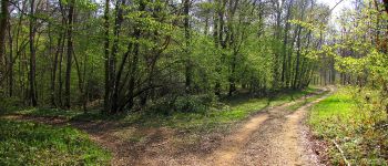
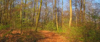
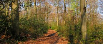
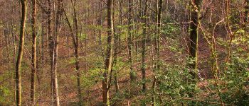
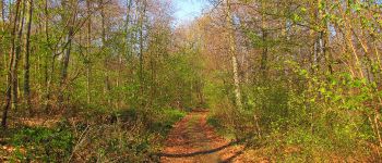
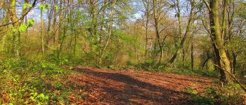
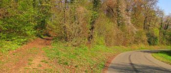
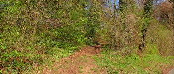
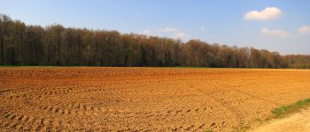
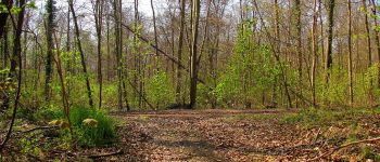
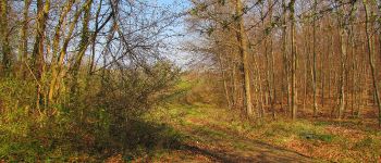
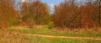
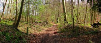
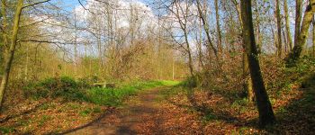
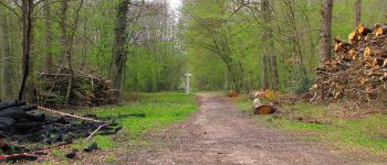
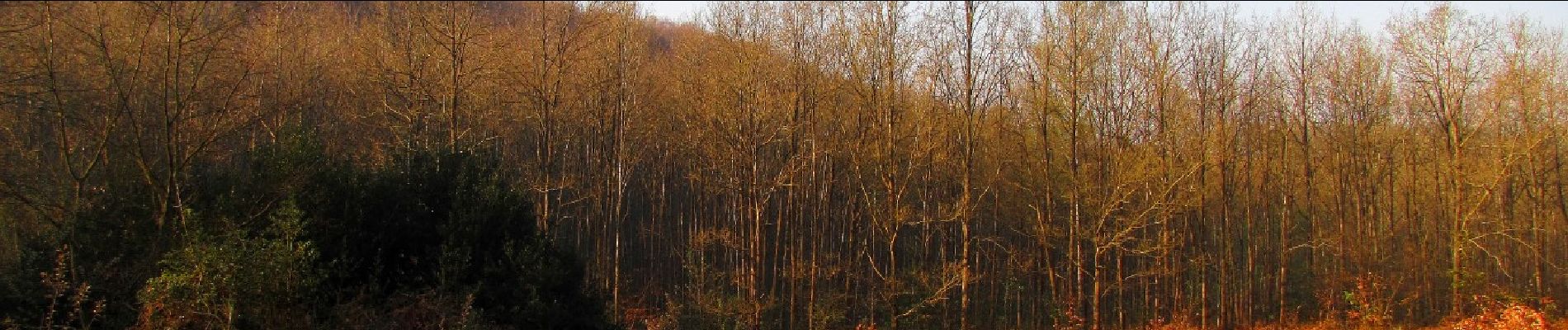
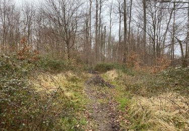
Trail Walking of 16.1 km to be discovered at Hauts-de-France, Oise, Vieux-Moulin. This trail is proposed by en forêt de Compiègne.

Description

voir aussi mes blogs:
http://foret-de-retz.over-blog.com/
http://foret-de-compiegne.over-blog.com/

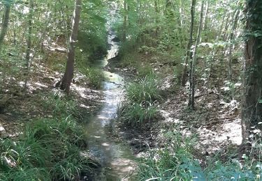
objectifs: trouver enfin cette Grotte des Ramoneurs (3 ième tentative) et faire 2 tournantes de la forêt de Compiègne (il y en a 23).
objectifs atteints!
La Grotte des Ramoneurs sera largement commentée dans le blog de la forêt de Compiègne avec des indications très précises pour la trouver.

batterie de recharge pour iphone indispensable.

Au départ des étangs de Saint-Pierre , passer le carrefour de la Gorge du Han et suivre la Route de Chelles jusqu'à l'intersection avec la Tournante de la Queue de Saint-Etienne. La suivre sur la gauche. En passant à l'altitude 118 sur les cartes IGN, rentrer en forêt sur la droite: la Grotte des Ramoneurs se situe aux coordonnées Lambert  2 étendu: X= 646683 et Y= 2486174 (plus de détails sur le blog). Revenir sur la tournante et la suivre jusqu'au bout: carrefour du Rond de Sapin. Continuer sur le Chemin de Batigny jusqu'à la D335. sur la gauche. Continuer qq mètres sur cette route puis sur la droite retrouver le GR12 (chaussée Brunehaut). Prendre à gauche le Chemin de Pierrefonds puis encore à gauche le chemin rural des Vaches. Le suivre jusqu'au bout puis prendre à droite la Tournante sur la Côte de Roilaye. Allez jusqu'au bout (D335).  Tourner à droite sur cette route puis à droite dans un chemin de terre (les Eperchets) . Prendre à gauche le premier chemin qui longe le champ pour retrouver la Chaussée Brunehaut. La suivre en tournant à droite  jusqu'à la D335. Après avoir chercher un chemin qui n'existe pas, suivre le chemin de Batigny jusqu'à l'intersection avec la Route de la Mariolle (Route François 1er).  Tourner à droite sur la Route Tournante sous le Mont Saint-Mard et aller jusqu'au carrefour de la Gorge du Han. Suivre à droite pour revenir au point de départ.

Elevation profile

Photos

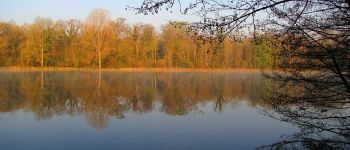
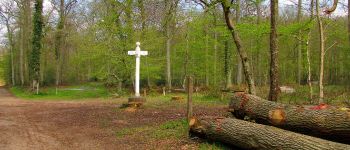
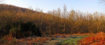
170 photos in total. Please click on a photo to see them all in the gallery.

Points of interest

Point of interest Vieux-Moulin - départ et Arrivée aux étangs de Saint-Pierre - Photo
JeanLucA4
Point of interest Vieux-Moulin - Point 23 - Photo
JeanLucA4
VIEUX-MOULIN 
Point of interest Cuise-la-Motte - Point 2 - Photo
JeanLucA4
CUISE-LA-MOTTE 
Point of interest Cuise-la-Motte - Point 3 - Photo
JeanLucA4
CUISE-LA-MOTTE 
Point of interest Cuise-la-Motte - Point 4 - Photo
JeanLucA4
CUISE-LA-MOTTE 
Point of interest Cuise-la-Motte - Point 5 - Photo
JeanLucA4
CUISE-LA-MOTTE 
Point of interest Cuise-la-Motte - Point 6 - Photo
JeanLucA4
CUISE-LA-MOTTE 
Point of interest Pierrefonds - Point 7 - Photo
JeanLucA4
PIERREFONDS 
Point of interest Cuise-la-Motte - Point 8 - Photo
JeanLucA4
CUISE-LA-MOTTE 
Point of interest Pierrefonds - Point 9 - Photo
JeanLucA4
PIERREFONDS 
Point of interest Pierrefonds - Point 10 - Photo
JeanLucA4
PIERREFONDS 
Point of interest Pierrefonds - Point 11 - Photo
JeanLucA4
PIERREFONDS 
Point of interest Pierrefonds - Point 12 - Photo
JeanLucA4
PIERREFONDS 
Point of interest Pierrefonds - Point 13 - Photo
JeanLucA4
PIERREFONDS 
Point of interest Pierrefonds - Point 14 - Photo
JeanLucA4
PIERREFONDS 
Point of interest Pierrefonds - Point 15 - Photo
JeanLucA4
PIERREFONDS 
Point of interest Pierrefonds - Point 16 - Photo
JeanLucA4
PIERREFONDS 
Point of interest Saint-Étienne-Roilaye - Point 17 - Photo
JeanLucA4
SAINT-ÉTIENNE-ROILAYE 
Point of interest Saint-Étienne-Roilaye - Point 18 - Photo
JeanLucA4
SAINT-ÉTIENNE-ROILAYE 
Point of interest Saint-Étienne-Roilaye - Point 19 - Photo
JeanLucA4
SAINT-ÉTIENNE-ROILAYE 
Point of interest Saint-Étienne-Roilaye - Point 20 - Photo
JeanLucA4
SAINT-ÉTIENNE-ROILAYE 
Point of interest Saint-Étienne-Roilaye - Point 21 - Photo
JeanLucA4
SAINT-ÉTIENNE-ROILAYE 
Point of interest Saint-Étienne-Roilaye - Point 22 - Photo
JeanLucA4
SAINT-ÉTIENNE-ROILAYE 
Point of interest Saint-Étienne-Roilaye - Point 23 - Photo
JeanLucA4
SAINT-ÉTIENNE-ROILAYE 
Point of interest Saint-Étienne-Roilaye - Point 24 - Photo
JeanLucA4
SAINT-ÉTIENNE-ROILAYE 
Point of interest Saint-Étienne-Roilaye - Point 25 - Photo
JeanLucA4
SAINT-ÉTIENNE-ROILAYE 
Point of interest Saint-Étienne-Roilaye - Point 26 - Photo
JeanLucA4
SAINT-ÉTIENNE-ROILAYE 
Point of interest Saint-Étienne-Roilaye - Point 28 - Photo
JeanLucA4
SAINT-ÉTIENNE-ROILAYE 
Point of interest Saint-Étienne-Roilaye - Point 29 - Photo
JeanLucA4
SAINT-ÉTIENNE-ROILAYE 
Point of interest Saint-Étienne-Roilaye - Point 30 - Photo
JeanLucA4
SAINT-ÉTIENNE-ROILAYE 
Point of interest Saint-Étienne-Roilaye - Point 32 - Photo
JeanLucA4
SAINT-ÉTIENNE-ROILAYE 
Point of interest Saint-Étienne-Roilaye - Point 33 - Photo
JeanLucA4
SAINT-ÉTIENNE-ROILAYE 
Point of interest Pierrefonds - Point 34 - Photo
JeanLucA4
PIERREFONDS 
Point of interest Pierrefonds - Point 35 - Photo
JeanLucA4
PIERREFONDS 
Point of interest Pierrefonds - Point 36 - Photo
JeanLucA4
PIERREFONDS 
Point of interest Pierrefonds - Point 37 - Photo
JeanLucA4
PIERREFONDS 

Positioning

Country:
France
Region :
Hauts-de-France
Department/Province :
Oise
Municipality :
Vieux-Moulin
Location:
Unknown
Start:(UTM)
497585 ; 5468938 (31U) N.

Trails nearby

Trail On foot Pierrefonds - Le Voliard - Photo
On foot
PRO

On foot

Easy
(1)
Pierrefonds, Hauts-de-France, Oise, France
5.2 km | 6.4 km-effort
1h 27min
No
Trail On foot Saint-Jean-aux-Bois - Promenade du Chêne de Saint-Jean - Photo
On foot
PRO

On foot

Easy
Saint-Jean-aux-Bois, Hauts-de-France, Oise, France
5.7 km | 6.5 km-effort
1h 28min
No
Trail Walking Pierrefonds - Rando couscous ATPC ARVAL 4/2/2024 - Photo
Walking
pascha

Walking

Medium
(1)
Pierrefonds, Hauts-de-France, Oise, France
9.6 km | 11.9 km-effort
2h 42min
Yes
Trail Walking Saint-Jean-aux-Bois - SAINT JEAN AUX BOIS, le village et les bois - Photo
Walking
jeannine grandjean

Walking

Easy
Saint-Jean-aux-Bois, Hauts-de-France, Oise, France
4.6 km | 5.2 km-effort
1h 11min
Yes
Trail Walking Vieux-Moulin - Rando douce Vieux moulin 14/8/2022 - Photo
Walking
pascha

Walking

Medium
(1)
Vieux-Moulin, Hauts-de-France, Oise, France
8.7 km | 10.1 km-effort
2h 14min
Yes
Trail Walking Vieux-Moulin - Gorges du Han - ATPC ARVAL - Photo
Walking
pascha

Walking

Very easy
(1)
Vieux-Moulin, Hauts-de-France, Oise, France
13.2 km | 16 km-effort
2h 42min
Yes
Trail Walking Saint-Jean-aux-Bois - Saint Jean au Bois 13,4 km - Photo
Walking
GUIDE
rvapeldo

Walking

Easy
Saint-Jean-aux-Bois, Hauts-de-France, Oise, France
13.4 km | 16.3 km-effort
3h 51min
Yes
Trail Walking Compiègne - en forêt de Compiègne_47_autour des Beaux Monts - Photo
Walking

Walking

Medium
Compiègne, Hauts-de-France, Oise, France
4.8 km | 6.4 km-effort
1h 27min
No
Trail On foot Trosly-Breuil - Le Mont-Collet - Photo
On foot
PRO

On foot

Easy
Trosly-Breuil, Hauts-de-France, Oise, France
4.9 km | 6.6 km-effort
1h 29min
Yes


Close
My subscriptions