Trail Walking Longpont - en forêt de Retz_77_Longpont_Puiseux en Retz_AR - Photo

en forêt de Retz_77_Longpont_Puiseux en Retz_AR

forêts de France

© OpenStreetMap contributors
Length
Length
22 km
Max alt
Max alt
234 m
Uphill gradient
Uphill gradient
417 m
Km-Effort
Km-Effort  
27 km
Min alt
Min alt
86 m
Downhill gradient
Downhill gradient
416 m
Boucle
Boucle
Yes
Creation date :
2019-04-15 06:13:20.0
Updated on :
2020-11-08 13:39:58.805

(0 Reviews)

Walking
Walking
6h04
Difficulty : Difficult

Scan this QR Code to open this trail in the SityTrail application

FREE GPS app for hiking

Logo SityTrail SityTrail

IGN / Geographical institutes

Download SityTrail from the App Store Download SityTrail from Google Play

Logo SityTrail SityTrail World

The world is yours!

Download SityTrail from the App Store Download SityTrail from Google Play Download SityTrail on Huawei AppGallery

About

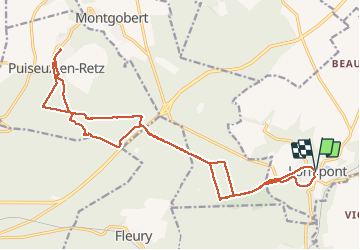
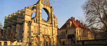
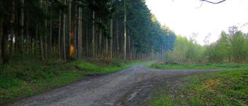
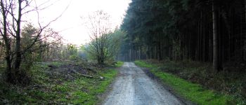
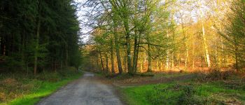
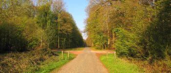
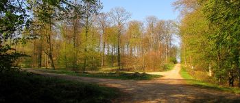
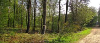
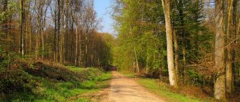
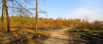
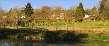
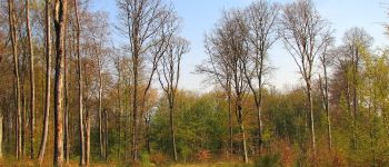
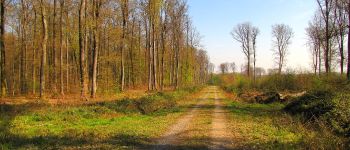
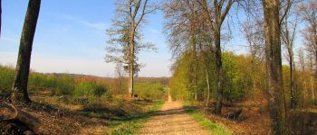
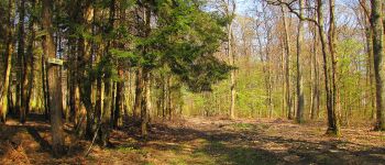
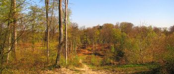
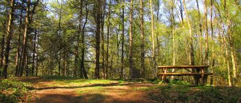
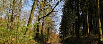
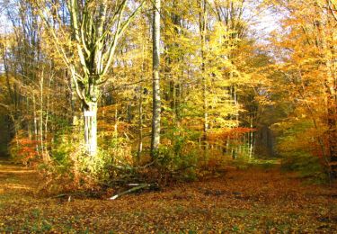
Trail Walking of 22 km to be discovered at Hauts-de-France, Aisne, Longpont. This trail is proposed by en forêt de Retz.

Description

04/ 2019
voir aussi:

batterie  de recharge pour iphone indispensable.
warning: le carrefour des Myrtilles est mal situé sur les cartes IGN.  Voir http://foret-de-retz.over-blog.com/2018/06/le-carrefour-des-myrtilles.html.
Le GR11A, qui  le traverse, pour aller au carrefour des Fonds Houchart n'existe plus. J'ai essayé et j'ai arrêté.  Ronces et végétation très dense (gaulis).

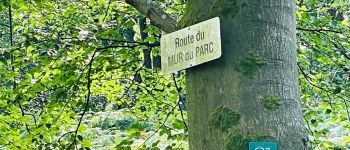
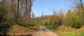
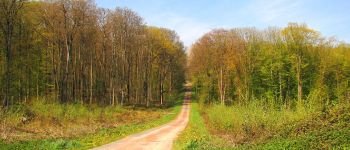
Au départ de Longpont, rejoindre le GR11A "aux trois maisons". Le suivre jusqu'à l'entrée du chemin de Longpont. Tourner à gauche dans ce chemin et continuer jusqu'au carrefour Allain. Tourner à droite dans la Route de Vauvaudran et continuer jusqu'au carrefour du Hibou. Prendre à gauche la Route de Chavigny et la suivre jusqu'au carrefour de Chavigny. Sur la droite, prendre la laie des Monthieux et continuer jusqu'au biopont. Le traverser. Prendre un sentier à droite et rejoindre la Route du Mur du Parc. La suivre à gauche jusqu'au carrefour des Têtes Salmon.
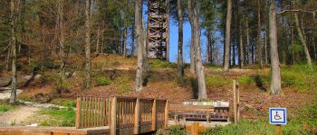
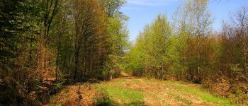
Quelques centaines de mètres après sur la Route du Mur du Parc, suivre à droite un très bon chemin (pas de nom?) pour rejoindre le carrefour des Six Routes. Suivre ce chemin jusqu'à Puiseux en Retz.  Visiter le village (photos).  Sortir de Puiseux en Retz  en prenant un chemin qui passe devant le cimetière et continuer jusqu'au carrefour de Puiseux. Suivre la laie des Quatre Chapons jusqu'au carrefour des Quatre Chapons. Prendre à gauche la Route de Cabaret jusqu'au carrefour des Six Routes.  Tourner à droite dans la laie de Puiseux  pour aller jusqu'au prochain carrefour (erreur de nom, ce n'est pas le carrefour des Myrtilles). Rejoindre sur la droite le carrefour des Terres Glaises. puis continuer pour aller à la Tour Mangin. Redescendre vers la Route du Faîte et la suivre à gauche jusqu'au carrefour du Saut du Cerf. Prendre la laie de la Mare Pavée et tourner à droite dans un chemin (il y en a plusieurs qui sont parallèles, à cause d'anciennes coupes de bois) pour rejoindre le biopont. Le traverser, récupérer la laie des Monthieux et la suivre jusqu'au carrefour de Chavigny. Prendre à droite la Route Droite et continuer jusqu'au carrefour de Vieville. Suivre à gauche le chemin de Longpont jusqu'à la D2. La prendre à droite pour revenir à Longpont.

Elevation profile

Photos

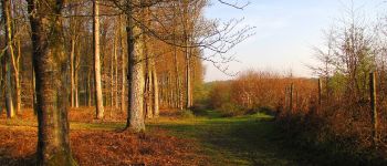
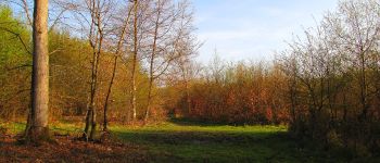
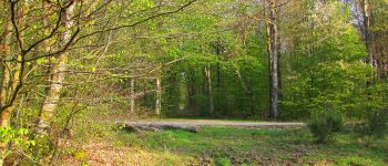
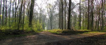
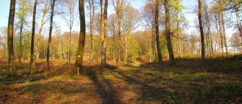
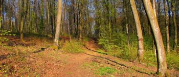
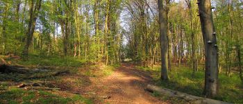
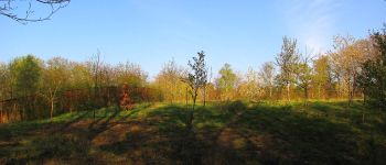
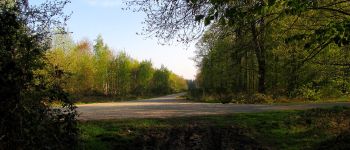
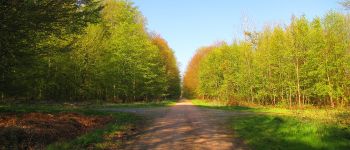
160 photos in total. Please click on a photo to see them all in the gallery.

Points of interest

Point of interest Longpont - départ et arrivée - Photo
JeanLucA4
Point of interest Montgobert - Point 1 - Photo
JeanLucA4
MONTGOBERT 
Point of interest Montgobert - Point 2 - Photo
JeanLucA4
MONTGOBERT 
Point of interest Montgobert - Point 3 - Photo
JeanLucA4
MONTGOBERT 
Point of interest Montgobert - Point 4 - Photo
JeanLucA4
MONTGOBERT 
Point of interest Montgobert - Point 5 - Photo
JeanLucA4
MONTGOBERT 
Point of interest Montgobert - Point 6 - Photo
JeanLucA4
MONTGOBERT 
Point of interest Montgobert - Point 7 - Photo
JeanLucA4
MONTGOBERT 
Point of interest Montgobert - Point 8 - Photo
JeanLucA4
MONTGOBERT 
Point of interest Fleury - Point 9 - Photo
JeanLucA4
FLEURY 
Point of interest Fleury - Point 10 - Photo
JeanLucA4
FLEURY 
Point of interest Fleury - Point 11 - Photo
JeanLucA4
FLEURY 
Point of interest Fleury - Point 12 - Photo
JeanLucA4
FLEURY 
Point of interest Fleury - Point 13 - Photo
JeanLucA4
FLEURY 
Point of interest Puiseux-en-Retz - Point 14 - Photo
JeanLucA4
PUISEUX-EN-RETZ 
Point of interest Puiseux-en-Retz - Point 15 - Photo
JeanLucA4
PUISEUX-EN-RETZ 
Point of interest Puiseux-en-Retz - Point 16 - Photo
JeanLucA4
PUISEUX-EN-RETZ 
Point of interest Puiseux-en-Retz - Point 17 - Photo
JeanLucA4
PUISEUX-EN-RETZ 
Point of interest Puiseux-en-Retz - Point 18 - Photo
JeanLucA4
PUISEUX-EN-RETZ 
Point of interest Puiseux-en-Retz - Point 19 - Photo
JeanLucA4
PUISEUX-EN-RETZ 
Point of interest Puiseux-en-Retz - Point 20 - Photo
JeanLucA4
PUISEUX-EN-RETZ 
Point of interest Puiseux-en-Retz - Point 21 - Photo
JeanLucA4
PUISEUX-EN-RETZ 
Point of interest Puiseux-en-Retz - Point 22 - Photo
JeanLucA4
PUISEUX-EN-RETZ 
Point of interest Puiseux-en-Retz - Point 23 - Photo
JeanLucA4
PUISEUX-EN-RETZ 
Point of interest Puiseux-en-Retz - Point 24 - Photo
JeanLucA4
PUISEUX-EN-RETZ 
Point of interest Puiseux-en-Retz - Point 25 - Photo
JeanLucA4
PUISEUX-EN-RETZ 
Point of interest Puiseux-en-Retz - Point 26 - Photo
JeanLucA4
PUISEUX-EN-RETZ 
Point of interest Puiseux-en-Retz - Point 27 - Photo
JeanLucA4
PUISEUX-EN-RETZ 
Point of interest Puiseux-en-Retz - Point 28 - Photo
JeanLucA4
PUISEUX-EN-RETZ 
Point of interest Villers-Cotterêts - Point 29 - Photo
JeanLucA4
VILLERS-COTTERÊTS 
Point of interest Puiseux-en-Retz - Point 30 - Photo
JeanLucA4
PUISEUX-EN-RETZ 
Point of interest Montgobert - Point 31 - Photo
JeanLucA4
MONTGOBERT 
Point of interest Montgobert - Point 32 - Photo
JeanLucA4
MONTGOBERT 

Positioning

Country:
France
Region :
Hauts-de-France
Department/Province :
Aisne
Municipality :
Longpont
Location:
Unknown
Start:(UTM)
515986 ; 5457872 (31U) N.

Trails nearby

Trail Walking Longpont - en forêt de Retz_19_Longpont_carrefour de Vauvaudran_AR - Photo
Walking

Walking

Medium
(1)
Longpont, Hauts-de-France, Aisne, France
17.5 km | 21 km-effort
4h 10min
Yes
Trail Walking Corcy - FLEURY .AISNE  - Photo
Walking
TURLUPIN2010

Walking

Medium
Corcy, Hauts-de-France, Aisne, France
5.7 km | 7.9 km-effort
1h 25min
Yes
Trail Walking Corcy - en forêt de Retz_91_04_2022_la Laie de la Belle Epine - Photo
Walking

Walking

Difficult
Corcy, Hauts-de-France, Aisne, France
10.6 km | 13.3 km-effort
3h 32min
Yes
Trail On foot Puiseux-en-Retz - Route du Faîte - Photo
On foot
PRO

On foot

Easy
Puiseux-en-Retz, Hauts-de-France, Aisne, France
5.8 km | 7.1 km-effort
1h 37min
No
Trail On foot Longpont - en forêt de Retz_22_Longpont_Rond d'Orléans_AR - Photo
On foot

On foot

Medium
Longpont, Hauts-de-France, Aisne, France
14.6 km | 17.5 km-effort
Unknown
Yes
Trail Walking Montgobert - en forêt de Retz_83_les Champs Mentard_le Fond d'Argent - Photo
Walking

Walking

Medium
Montgobert, Hauts-de-France, Aisne, France
13.6 km | 16.2 km-effort
3h 46min
Yes
Trail Walking Montgobert - en forêt de Retz_75_promenade familiale tout temps - Photo
Walking

Walking

Very easy
Montgobert, Hauts-de-France, Aisne, France
3.9 km | 4.7 km-effort
1h 25min
Yes
Trail Walking Longpont - en forêt de Retz_73_ballade (5) en toute saison - Photo
Walking

Walking

Easy
Longpont, Hauts-de-France, Aisne, France
9.1 km | 10.8 km-effort
2h 6min
Yes
Trail Walking Longpont - en forêt de Retz_70_ballade (4) en toute saison - Photo
Walking

Walking

Very easy
Longpont, Hauts-de-France, Aisne, France
8.5 km | 10.1 km-effort
1h 44min
Yes


Close
My subscriptions