Trail Walking Champey - champey - Photo
 Fillatre
Fillatre

User

© OpenStreetMap contributors
Length
Length
12.6 km
Max alt
Max alt
532 m
Uphill gradient
Uphill gradient
290 m
Km-Effort
Km-Effort  
16.5 km
Min alt
Min alt
352 m
Downhill gradient
Downhill gradient
290 m
Boucle
Boucle
Yes
Creation date :
2019-04-23 11:46:14.83
Updated on :
2019-04-23 15:58:57.469

(1 Reviews)

Walking
Walking
3h37
Difficulty : Difficult

Scan this QR Code to open this trail in the SityTrail application

FREE GPS app for hiking

Logo SityTrail SityTrail

IGN / Geographical institutes

Download SityTrail from the App Store Download SityTrail from Google Play

Logo SityTrail SityTrail World

The world is yours!

Download SityTrail from the App Store Download SityTrail from Google Play Download SityTrail on Huawei AppGallery

About

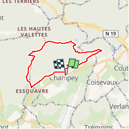
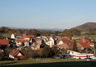
Trail Walking of 12.6 km to be discovered at Bourgogne-Franche-Comté, Haute-Saône, Champey. This trail is proposed by Fillatre.

Description

wxwx

Elevation profile

Positioning

Country:
France
Region :
Bourgogne-Franche-Comté
Department/Province :
Haute-Saône
Municipality :
Champey
Location:
Unknown
Start:(UTM)
325760 ; 5272890 (32T) N.

Comments

Please log in to post a review or rate the element


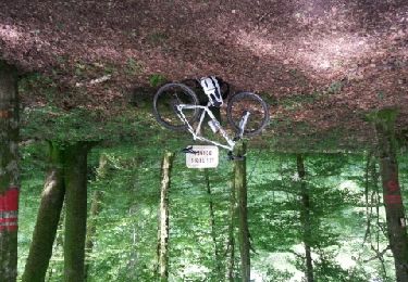
Joli tracé sans difficulté Lorsque le chemin de termine vers plusieurs captages d'eau, il faut monter à droite dans la végétation pour rejoindre un chemin 500m plus haut


Trails nearby

Trail Walking Trémoins - TREMOINS - Photo
Walking
Marchebuissonniere

Walking

Medium
(1)
Trémoins, Bourgogne-Franche-Comté, Haute-Saône, France
8.3 km | 10.5 km-effort
3h 22min
Yes
Trail Mountain bike Semondans - les  valettes - Photo
Mountain bike
Raphaël K

Mountain bike

Very difficult
Semondans, Bourgogne-Franche-Comté, Doubs, France
34 km | 44 km-effort
2h 11min
Yes
Trail Mountain bike Semondans - menhir de Brevilliers  - Photo
Mountain bike
Raphaël K

Mountain bike

Very difficult
Semondans, Bourgogne-Franche-Comté, Doubs, France
41 km | 50 km-effort
3h 3min
Yes
Trail Walking Champey - grotte de la Baume - Photo
Walking
Raymond Bacholle

Walking

Easy
Champey, Bourgogne-Franche-Comté, Haute-Saône, France
21 km | 27 km-effort
4h 45min
Yes
Trail Walking Héricourt - Héricourt - fort Mont Vaudois - poudriére puis batterie d'Urcerey - Echenans - Photo
Walking
Bart2015

Walking

Medium
Héricourt, Bourgogne-Franche-Comté, Haute-Saône, France
16.4 km | 23 km-effort
3h 16min
Yes
Trail Mountain bike Couthenans - La raie du cul depuis Couthenans - Photo
Mountain bike
demipoil

Mountain bike

Medium
Couthenans, Bourgogne-Franche-Comté, Haute-Saône, France
22 km | 30 km-effort
2h 11min
Yes
Trail Mountain bike Semondans - mont vaudois  - Photo
Mountain bike
Raphaël K

Mountain bike

Medium
Semondans, Bourgogne-Franche-Comté, Doubs, France
29 km | 37 km-effort
1h 47min
Yes
Trail Mountain bike Semondans - val de bonnal - Photo
Mountain bike
Raphaël K

Mountain bike

Very difficult
Semondans, Bourgogne-Franche-Comté, Doubs, France
43 km | 56 km-effort
3h 29min
No
Trail Mountain bike Semondans - mont vaudois - Photo
Mountain bike
Raphaël K

Mountain bike

Very difficult
Semondans, Bourgogne-Franche-Comté, Doubs, France
35 km | 46 km-effort
2h 48min
Yes


Close
My subscriptions