


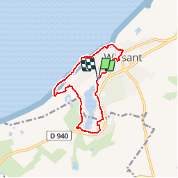


16.1 km | 18.7 km-effort


User


FREE GPS app for hiking
 SityTrail
IGN / Geographical institutes
SityTrail World
The world is yours!
Trail Walking of 5.5 km to be discovered at Hauts-de-France, Pas-de-Calais, Wissant. This trail is proposed by terminio.
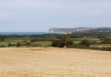
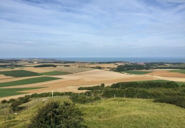
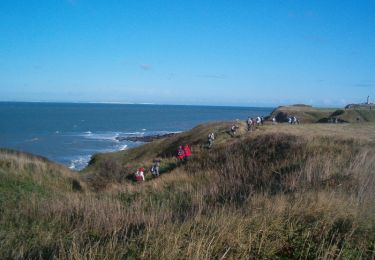
randonnée agréable avec de belles vues.


On foot
Walking

Walking

Walking
Walking

Walking

Walking

Walking

Walking