Trail Walking Saint-Agnan-en-Vercors - Tiolache - Photo
© OpenStreetMap contributors
Length
Length
12.8 km
Max alt
Max alt
1626 m
Uphill gradient
Uphill gradient
375 m
Km-Effort
Km-Effort  
17.8 km
Min alt
Min alt
1367 m
Downhill gradient
Downhill gradient
372 m
Boucle
Boucle
Yes
Creation date :
2019-05-15 08:45:07.79
Updated on :
2019-05-15 14:58:52.787

(0 Reviews)

Walking
Walking
5h10
Difficulty : Very easy

Scan this QR Code to open this trail in the SityTrail application

FREE GPS app for hiking

Logo SityTrail SityTrail

IGN / Geographical institutes

Download SityTrail from the App Store Download SityTrail from Google Play

Logo SityTrail SityTrail World

The world is yours!

Download SityTrail from the App Store Download SityTrail from Google Play Download SityTrail on Huawei AppGallery

About

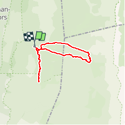
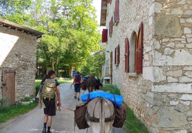
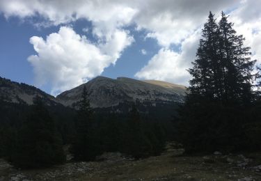
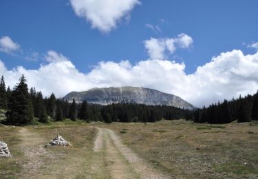
Trail Walking of 12.8 km to be discovered at Auvergne-Rhône-Alpes, Drôme, Saint-Agnan-en-Vercors. This trail is proposed by germainjy.

Description

je n'arrive plus a charger les cartes IGN. Le nouveau sity train plante. Inutilisable . Quel dommage d'avoir remplace un programme qui fonctionnait par un programme merdique.

Elevation profile

Positioning

Country:
France
Region :
Auvergne-Rhône-Alpes
Department/Province :
Drôme
Municipality :
Saint-Agnan-en-Vercors
Location:
Unknown
Start:(UTM)
694316 ; 4976829 (31T) N.

Trails nearby

Trail Walking Saint-Agnan-en-Vercors - Vercors - La Coche Grand Veymont Queyrie - Photo
Walking
Alfredy

Walking

Very easy
(1)
Saint-Agnan-en-Vercors, Auvergne-Rhône-Alpes, Drôme, France
24 km | 33 km-effort
7h 22min
Yes
Trail Walking Saint-Agnan-en-Vercors - 26 tiolache - Photo
Walking
himba26100

Walking

Easy
Saint-Agnan-en-Vercors, Auvergne-Rhône-Alpes, Drôme, France
14.4 km | 21 km-effort
6h 13min
Yes
Trail Walking Saint-Agnan-en-Vercors - 26 st Agnan champ gros de la vache - Photo
Walking
himba26100

Walking

Medium
Saint-Agnan-en-Vercors, Auvergne-Rhône-Alpes, Drôme, France
16.9 km | 27 km-effort
6h 51min
Yes
Trail Walking Saint-Agnan-en-Vercors - trop Alexis - Photo
Walking
jphugon

Walking

Very difficult
Saint-Agnan-en-Vercors, Auvergne-Rhône-Alpes, Drôme, France
16.3 km | 28 km-effort
7h 59min
Yes
Trail Walking Saint-Agnan-en-Vercors - Malaval  - Photo
Walking
ajd26

Walking

Very difficult
Saint-Agnan-en-Vercors, Auvergne-Rhône-Alpes, Drôme, France
14.6 km | 24 km-effort
5h 49min
Yes
Trail Walking Vassieux-en-Vercors - Vassieux en Vercors- La Chapelle en Vercors- Rando Âne (2 et 3 ème jour) -  - Photo
Walking
crocau

Walking

Easy
Vassieux-en-Vercors, Auvergne-Rhône-Alpes, Drôme, France
15.4 km | 19.3 km-effort
5h 11min
No
Trail Walking La Chapelle-en-Vercors - La Chapelle en Vercors - Vassieux (Première étape balade ânes) - Photo
Walking
crocau

Walking

Easy
La Chapelle-en-Vercors, Auvergne-Rhône-Alpes, Drôme, France
11.3 km | 15.1 km-effort
3h 53min
No
Trail Walking Saint-Agnan-en-Vercors - Grand Veymont par pré râteau  - Photo
Walking
alinetpierre

Walking

Difficult
Saint-Agnan-en-Vercors, Auvergne-Rhône-Alpes, Drôme, France
19 km | 32 km-effort
5h 56min
Yes
Trail Walking Saint-Agnan-en-Vercors - Aiguillette ou Petit Veymont par la Coche - Grande Cabane - Photo
Walking
Philindy26

Walking

Difficult
Saint-Agnan-en-Vercors, Auvergne-Rhône-Alpes, Drôme, France
19.3 km | 27 km-effort
5h 30min
Yes


Close
My subscriptions