Trail Other activity Reigoldswil - Reigoldswil - Wasserfallen - Vogelberg - Photo

Reigoldswil - Wasserfallen - Vogelberg

 aebher
aebher

User

© OpenStreetMap contributors
Length
Length
8.8 km
Max alt
Max alt
1141 m
Uphill gradient
Uphill gradient
628 m
Km-Effort
Km-Effort  
17.2 km
Min alt
Min alt
539 m
Downhill gradient
Downhill gradient
625 m
Boucle
Boucle
Yes
Creation date :
2014-12-11 00:00:00.0
Updated on :
2014-12-11 00:00:00.0

(0 Reviews)

Other activity
Other activity
--
Difficulty : Unknown

Scan this QR Code to open this trail in the SityTrail application

FREE GPS app for hiking

Logo SityTrail SityTrail

IGN / Geographical institutes

Download SityTrail from the App Store Download SityTrail from Google Play

Logo SityTrail SityTrail World

The world is yours!

Download SityTrail from the App Store Download SityTrail from Google Play Download SityTrail on Huawei AppGallery

About

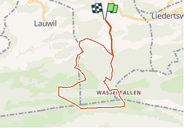
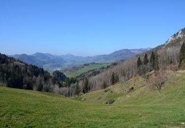
Trail Other activity of 8.8 km to be discovered at Basel-Landschaft, Bezirk Waldenburg. This trail is proposed by aebher.

Description

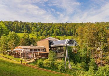
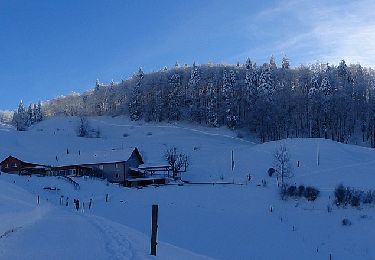
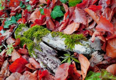
Abwechslungsreiche Wanderung für alle Jahreszeiten. Reigoldswil (Parkplatz bei der Talstation)- Aufstieg dem Bach entlang - Schelmenloch - Bürtenflue - Wasserfallen - Vogelberg - Bürten - Reigoldswil. Einkehrmöglichkeiten  in Wasserfallen und Vogelberg.

Elevation profile

Positioning

Country:
Switzerland
Region :
Basel-Landschaft
Department/Province :
Bezirk Waldenburg
Municipality :
Reigoldswil
Location:
Unknown
Start:(UTM)
401591 ; 5249412 (32T) N.

Trails nearby

Trail On foot  - Gondelbahn - Wasserfallen - Photo
On foot
PRO

On foot

Easy
, Basel-Landschaft, Bezirk Waldenburg, Switzerland
4 km | 7.6 km-effort
1h 43min
No
Trail On foot Mümliswil-Ramiswil - Wasserfallen Rochus Kapelle - Mümliswil - Photo
On foot
PRO

On foot

Easy
Mümliswil-Ramiswil, Solothurn, Bezirk Thal, Switzerland
4.2 km | 5.9 km-effort
1h 20min
No
Trail On foot Oberdorf (BL) - Rebenweg - Photo
On foot
PRO

On foot

Easy
Oberdorf (BL), Basel-Landschaft, Bezirk Waldenburg, Switzerland
4.6 km | 7.3 km-effort
1h 40min
No
Trail On foot Langenbruck - Helfenberg - Mümliswil - Photo
On foot
PRO

On foot

Easy
Langenbruck, Basel-Landschaft, Bezirk Waldenburg, Switzerland
3.9 km | 5.3 km-effort
1h 11min
No
Trail On foot Mümliswil-Ramiswil - Breitenhöchi - Langenbruck - Photo
On foot
PRO

On foot

Easy
Mümliswil-Ramiswil, Solothurn, Bezirk Thal, Switzerland
3.6 km | 6.1 km-effort
1h 22min
No
Trail On foot Lauwil - Bogental - Vogelberg - Photo
On foot
PRO

On foot

Easy
Lauwil, Basel-Landschaft, Bezirk Waldenburg, Switzerland
3.7 km | 7.4 km-effort
1h 40min
No
Trail On foot Mümliswil-Ramiswil - Sool - Mümliswil - Photo
On foot
PRO

On foot

Easy
Mümliswil-Ramiswil, Solothurn, Bezirk Thal, Switzerland
3.9 km | 5.5 km-effort
1h 15min
No
Trail On foot Lauwil - Passwang - Bogental - Photo
On foot
PRO

On foot

Easy
Lauwil, Basel-Landschaft, Bezirk Waldenburg, Switzerland
3.6 km | 7.7 km-effort
1h 45min
No
Trail Other activity Waldenburg - ST_fede_bs10 - Photo
Other activity
GUIDE+

Other activity

Very easy
Waldenburg, Basel-Landschaft, Bezirk Waldenburg, Switzerland
11.4 km | 18 km-effort
3h 58min
No


Close
My subscriptions